Show Selection:
|
#898595 (Received by flhurricane at: 4:35 PM 16.Aug.2017)
TCDAT3
Hurricane Gert Discussion Number 16
NWS National Hurricane Center Miami FL AL082017
500 PM AST Wed Aug 16 2017
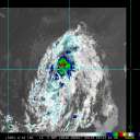
Cloud tops with temperatures colder than -65 deg C have wrapped
almost entirely around Gert`s center, although eye temperatures
have been fluctuating all day. Dvorak intensity estimates vary
widely, from T4.5 from TAFB to around T5.5 from the UW-CIMSS ADT,
and since a warm eye has been unable to persist for an extended
period of time, the initial intensity is raised conservatively to
85 kt. This makes Gert the first category 2 hurricane of the
season. The window of opportunity for additional strengthening
appears to be closing. Gert will be moving over the colder waters
north of the Gulf Stream in about 12-18 hours, and southwesterly
shear will be increasing to well over 30 kt in about 12 hours.
Therefore, a fast weakening trend is forecast to begin on Thursday,
with Gert becoming a tropical storm by 36 hours. The FSU
phase-space diagrams indicate that Gert should be extratropical
just after 36 hours, and the GFS, ECMWF, and UKMET all have the
cyclone being absorbed by a larger extratropical low over the north
Atlantic by day 4.
Acceleration continues with the initial motion now 055/27 kt. With
Gert firmly embedded within the mid-latitude westerlies, the
hurricane`s forward speed should increase for the next 24 hours,
followed by some deceleration as the cyclone begins to interact
with a large cut-off low moving east of Atlantic Canada. Most of
the track guidance is a little faster on this cycle, although the
ECMWF is significantly slower. The new NHC forecast is nudged a
little faster from 12-48 hours, but not too fast given the latest
ECMWF solution. The post-tropical portion of the track, intensity,
and wind radii forecasts incorporate guidance from NOAA`s Ocean
Prediction Center.
Swells from Gert are affecting portions of the mid-Atlantic coast of
the United States, and are expected to spread northward to New
England and Atlantic Canada during the next day or two. These
swells are likely to produce dangerous surf and rip current
conditions. Please consult products from your local weather forecast
office for more information.
FORECAST POSITIONS AND MAX WINDS
INIT 16/2100Z 38.7N 62.4W 85 KT 100 MPH
12H 17/0600Z 40.7N 56.9W 85 KT 100 MPH
24H 17/1800Z 44.3N 48.2W 70 KT 80 MPH
36H 18/0600Z 48.3N 40.4W 55 KT 65 MPH
48H 18/1800Z 51.6N 35.7W 45 KT 50 MPH...POST-TROP/EXTRATROP
72H 19/1800Z 54.3N 32.6W 40 KT 45 MPH...POST-TROP/EXTRATROP
96H 20/1800Z...ABSORBED BY A LARGER EXTRATROPICAL LOW
$$
Forecaster Berg |


