Show Selection:
|
#899350 (Received by flhurricane at: 4:59 AM 24.Aug.2017)
TCDAT4
Tropical Storm Harvey Discussion Number 15
NWS National Hurricane Center Miami FL AL092017
400 AM CDT Thu Aug 24 2017
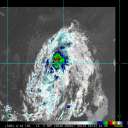
NOAA and Air Force Hurricane Hunter planes have been sampling
Harvey during the past few hours. Both aircraft indicate that
Harvey is becoming better organized and the central pressure is
falling. An average of the flight-level winds and the SFMR yield an
initial intensity of 40 kt. There are some unconfirmed reports of
stronger winds at flight-level to the northeast of the center,
but I am waiting for the plane to go back to that area for
confirmation.
It appears that the environment has finally become favorable
and all of the guidance calls for intensification. In fact, the
Rapid Intensification Index is up to 45 percent. The current NHC
forecast is a little lower than the model consensus to maintain
continuity from the previous advisory. If the current intensity
trend continues, the winds will have to be adjusted upward
in the next advisory.
The initial motion is toward the north or 360 degrees at 9 kt.
However, this is a combination of motion and reformation under the
convection. Harvey is already on the western edge of the
subtropical ridge extending from the Atlantic westward across the
Gulf of Mexico. This pattern will steer the cyclone on a general
northwest to north-northwest track for the next 2 to 3 days. Once
Harvey makes landfall in Texas, most of the global models predict
that the steering currents will collapse and Harvey will begin to
meander over Texas and perhaps will move back into the northwestern
Gulf of Mexico.
Key Messages:
1. Harvey is likely to bring multiple hazards, including heavy
rainfall, storm surge, and possible hurricane conditions to portions
of the Texas coast beginning on Friday.
2. Heavy rainfall is likely to spread across portions of eastern
Texas, Louisiana, and the lower Mississippi Valley from Friday
through early next week and could cause life-threatening flooding.
Please refer to products from your local National Weather Service
office and the NOAA Weather Prediction Center for more information
on the flooding hazard.
3. A Storm Surge Warning is now effect from Port Mansfield to
San Luis Pass, Texas, indicating the possibility of life-threatening
inundation from rising water moving inland from the coast during the
next 36 hours. For a depiction of areas at risk, see the Storm
Surge Watch/Warning Graphic at hurricanes.gov.
4. The Potential Storm Surge Flooding Map is available on the NHC
website. This product depicts a reasonable worst-case scenario -
the amount of inundation that has a 10 percent chance of being
exceeded at each individual location. Because the Flooding Map is
based on inputs that extend out only to about 72 hours, it best
represents the flooding potential in those locations within the
watch area.
FORECAST POSITIONS AND MAX WINDS
INIT 24/0900Z 23.2N 92.8W 40 KT 45 MPH
12H 24/1800Z 24.0N 93.6W 50 KT 60 MPH
24H 25/0600Z 25.1N 94.8W 60 KT 70 MPH
36H 25/1800Z 26.3N 95.8W 70 KT 80 MPH
48H 26/0600Z 27.5N 97.0W 75 KT 85 MPH
72H 27/0600Z 28.5N 97.8W 40 KT 45 MPH...INLAND
96H 28/0600Z 28.5N 97.8W 35 KT 40 MPH...INLAND
120H 29/0600Z 27.6N 97.0W 35 KT 40 MPH...INLAND
$$
Forecaster Avila |


