Show Selection:
|
#901630 (Received by flhurricane at: 4:42 AM 06.Sep.2017)
TCDAT2
Tropical Storm Jose Discussion Number 4
NWS National Hurricane Center Miami FL AL122017
500 AM AST Wed Sep 06 2017
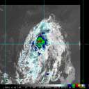
Satellite images indicate that Jose`s banding features are becoming
better established, and the center is now located near the middle of
the central dense overcast. An average of the Dvorak estimates from
TAFB/SAB and ADT values from CIMSS at the University of Wisconsin at
0600 UTC supported an intensity of 45 kt, but since the storm
continues to organize, the initial wind speed is nudged upward to 50
kt at this time.
Satellite fixes suggest that Jose is moving westward at 11 kt. A
slightly faster westward to west-northwestward motion is expected
during the next 2 to 3 days while Jose moves in the flow on the
south and southwest sides of a subtropical high. After that time, a
slower northwestward motion is forecast when Jose moves into a
weakness in the ridge. Although the models agree on the overall
scenario, there is a considerable amount of spread in the 4 to 5 day
period on when and where Jose makes the northwest turn. The NHC
official track forecast is shifted slightly to the left of the
previous one to come into better agreement with the latest consensus
aids.
Additional steady strengthening seems likely during the next few
days since Jose is expected to remain in favorable environmental
conditions. In fact, the SHIPS model shows a 28 percent chance of
Jose rapidly intensifying during the next 24 hours. Therefore, the
NHC intensity forecast lies near the high end of the model guidance,
bringing Jose to hurricane strength by tonight and to near major
hurricane strength in 72 hours. Thereafter, an increase in vertical
wind shear and drier air should end the strengthening trend and
cause some weakening. This intensity forecast is largely an update
of the previous one, and it is in good agreement with the HCCA
model.
FORECAST POSITIONS AND MAX WINDS
INIT 06/0900Z 12.5N 42.8W 50 KT 60 MPH
12H 06/1800Z 13.0N 45.0W 60 KT 70 MPH
24H 07/0600Z 13.7N 48.0W 70 KT 80 MPH
36H 07/1800Z 14.3N 50.9W 80 KT 90 MPH
48H 08/0600Z 14.9N 53.7W 90 KT 105 MPH
72H 09/0600Z 16.7N 57.8W 95 KT 110 MPH
96H 10/0600Z 19.4N 60.5W 90 KT 105 MPH
120H 11/0600Z 22.7N 63.6W 80 KT 90 MPH
$$
Forecaster Cangialosi |


