Show Selection:
|
#901667 (Received by flhurricane at: 10:38 AM 06.Sep.2017)
TCDAT3
Tropical Storm Katia Discussion Number 4
NWS National Hurricane Center Miami FL AL132017
1000 AM CDT Wed Sep 06 2017
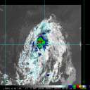
Satellite and microwave data indicate that the cloud pattern
associated with Katia is gradually becoming better organized with
abundant convection near the center and improving outflow. An
average of subjective numbers from TAFB and SAB as well as
objective Dvorak T-numbers from CIMMS yield an initial intensity of
40 kt, or perhaps a little bit higher. An Air Force plane will
check Katia later today, and we will have a better estimate of the
structure of the cyclone.
Currently, the upper-level wind pattern is not very conducive for
strengthening, but most of the global models as well as the SHIPS
guidance indicate that the environment will become favorable with
weaker shear. On this basis, the NHC forecast calls for Katia to
become a hurricane before it approaches the coast of the state of
Veracruz.
Katia is embedded within weak steering currents, and the cyclone
will most likely meander in the southwestern Gulf of Mexico
for the next day or two. After that time global models develop a
ridge over the northern Gulf of Mexico and this flow pattern will
steer Katia southwestward toward the state of Veracruz. The NHC
forecast is basically on top of the multi-model consensus and is
not very different from the previous NHC track.
Given the upward intensity trend and the forecast track toward
the coast, a hurricane watch could be required for a portion of
the coast of the state of Veracruz later today. This system is
forecast to bring very heavy rains primarily to the state of
Veracruz during the next few days.
FORECAST POSITIONS AND MAX WINDS
INIT 06/1500Z 21.7N 95.9W 40 KT 45 MPH
12H 07/0000Z 21.4N 95.4W 50 KT 60 MPH
24H 07/1200Z 21.0N 95.0W 55 KT 65 MPH
36H 08/0000Z 21.0N 95.2W 60 KT 70 MPH
48H 08/1200Z 20.7N 95.4W 65 KT 75 MPH
72H 09/1200Z 19.5N 97.0W 25 KT 30 MPH...POST-TROP/INLAND
96H 10/1200Z...DISSIPATED
$$
Forecaster Avila |


