Show Selection:
|
#904373 (Received by flhurricane at: 4:58 AM 24.Sep.2017)
TCDAT5
Hurricane Maria Discussion Number 33
NWS National Hurricane Center Miami FL AL152017
500 AM EDT Sun Sep 24 2017
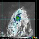
A NOAA Hurricane Hunter aircraft investigating Maria has reported
700-mb flight-level winds of 107 kt in the southeastern eyewall,
with surface wind estimates from the Stepped Frequency Microwave
Radiometer between 75-80 kt. The plane also reported that the
central pressure has risen to 948 mb inside a 30 n mi wide eye.
Based on these data, the initial intensity is nudged downward to
95 kt, and it is possible that this is a bit generous.
The initial motion is 355/8, with Maria currently being steered by
the flow between the Atlantic subtropical ridge and a cut-off
low/trough over the eastern Gulf of Mexico and the southeastern
United States. A general motion toward the north or north-
northwest should continue for the next 3 days or so, with some
decrease in forward speed as a mid-latitude westerly ridge moves
through the New England states to the north of the hurricane. After
72 h, the westerlies move south and erode the subtropical ridge,
which should allow Maria to recurve to the northeast. The track
guidance supports this scenario, although there is some
disagreement on the timing and the location of the recurvature.
The new forecast track lies a little to the north and west of the
previous track in best agreement with the HFIP Corrected consensus
model. However, the 72 and 96 h points lie a little to the east of
the forecasts of the GFS and ECMWF models. Regardless of where the
recurvature occurs, Maria is a large cyclone and the associated
tropical storm force winds could eventually reach a portion of the
North Carolina coast.
Fluctuations in intensity appear likely during the next 24-36 h as
Maria remains over warm water and in an environment of light or
moderate shear. After that time, the hurricane is likely to
encounter the colder water left by Hurricane Jose, which should
cause a weakening trend. The new intensity forecast follows the
overall trend of the guidance and, except for a downward nudge at
12 and 24 h, is similar to the previous forecast.
KEY MESSAGES:
1. Maria`s forecast track continues to be northward, paralleling the
U.S. east coast, and it is likely that some direct impacts will
occur along portions of the coast next week. Interests along the
coast of the Carolinas and the Mid-Atlantic should monitor the
progress of Maria, as tropical storm or hurricane watches may be
needed for part of this area later today.
2. Swells from Maria are increasing along the coast of the
southeastern United States and are expected to reach the
Mid-Atlantic coast today. These swells will likely cause dangerous
surf and rip currents at the beach through much of next week. For
more information, please monitor information from your local
National Weather Service office at www.weather.gov.
FORECAST POSITIONS AND MAX WINDS
INIT 24/0900Z 27.9N 72.7W 95 KT 110 MPH
12H 24/1800Z 28.9N 72.8W 95 KT 110 MPH
24H 25/0600Z 30.1N 73.0W 95 KT 110 MPH
36H 25/1800Z 31.2N 73.1W 90 KT 105 MPH
48H 26/0600Z 32.1N 73.2W 85 KT 100 MPH
72H 27/0600Z 34.0N 73.5W 75 KT 85 MPH
96H 28/0600Z 35.0N 72.5W 70 KT 80 MPH
120H 29/0600Z 36.0N 69.0W 65 KT 75 MPH
$$
Forecaster Beven |


