Show Selection:
|
#932223 (Received by flhurricane at: 11:00 PM 09.Jul.2018)
TCDAT3
Tropical Storm Chris Discussion Number 14
NWS National Hurricane Center Miami FL AL032018
1100 PM EDT Mon Jul 09 2018
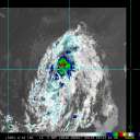
Reports from a NOAA Hurricane Hunter aircraft indicate that Chris
has changed little in strength during the past several hours. The
aircraft has reported maximum flight-level of 63 kt at 700 mb to
the southwest of the center, along with a somewhat-uncertain maximum
SFMR surface wind estimate of 61 kt. The latest reported central
pressure is 995 mb. Based on these, the initial intensity will be
held at a possibly generous 60 kt. The aircraft also reported that
a partial eyewall of 20-30 n mi diameter has formed, but has not yet
been able to close off.
Chris has moved little since the last advisory, as it remains
trapped in a break in the subtropical ridge. A large mid-latitude
trough is forming over eastern Canada and the northeastern
United States, and as this system develops southward it should
break down the ridge and steer Chris to the northeast after about
12 h, with an increasing forward speed expected thereafter as the
tropical cyclone enters the mid-latitude westerlies. Chris should
pass east of the Canadian Maritimes in about 72 h, then pass near or
over southeastern Newfoundland between 72-96 h. The track guidance
generally agrees with this scenario, although some spread remains
in the forecast forward speed. The new forecast track is an update
of the previous forecast and lies near the various consensus models.
The sea surface temperature at NOAA buoy 41002, located 45 n mi
southwest of the center of Chris, has dropped to near 25C, and it is
possible that the temperatures are colder under the center. This
ocean cooling, due to upwelling caused by the slow motion of the
storm, has likely slowed the intensification of Chris despite an
otherwise favorable environment and storm structure. Significant
intensification now appears unlikely until the cyclone actually
starts moving. Based on this and the forecast track, the new
intensity forecast will delay Chris` intensification into a
hurricane until the 18-24 h point. After that, Chris should
strengthen until it moves north of the Gulf Stream and starts to
merge with a frontal system. Extratropical transition is expected
to be complete by 72 h, with the extratropical low gradually
decaying as it moves across the north Atlantic. The new intensity
forecast follows the overall trend of the intensity guidance except
during the first 12 h.
FORECAST POSITIONS AND MAX WINDS
INIT 10/0300Z 32.3N 74.3W 60 KT 70 MPH
12H 10/1200Z 32.6N 73.9W 60 KT 70 MPH
24H 11/0000Z 33.5N 72.7W 70 KT 80 MPH
36H 11/1200Z 35.1N 70.4W 80 KT 90 MPH
48H 12/0000Z 37.7N 66.6W 80 KT 90 MPH
72H 13/0000Z 44.0N 59.0W 60 KT 70 MPH...POST-TROP/EXTRATROP
96H 14/0000Z 49.0N 47.0W 45 KT 50 MPH...POST-TROP/EXTRATROP
120H 15/0000Z 52.0N 31.0W 35 KT 40 MPH...POST-TROP/EXTRATROP
$$
Forecaster Beven |


