Show Selection:
|
#932270 (Received by flhurricane at: 10:54 AM 10.Jul.2018)
TCDAT3
Tropical Storm Chris Discussion Number 16
NWS National Hurricane Center Miami FL AL032018
1100 AM EDT Tue Jul 10 2018
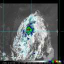
During the past 6 hours, Chris has developed a well-defined eye in
both satellite and radar imagery at times, with a diameter that has
varied in size from 30 nmi to the present 20 nmi. The overall
convective pattern has also become more symmetrical with
well-established outflow present in all quadrants. Satellite
intensity estimates are T3.5/55 kt from TAFB, and T4.0/65 kt from
SAB and UW-CIMSS ADT, and Chris certainly has the satellite
appearance of being a hurricane. However, the intensity is being
maintained at 60 kt for this advisory due to significant cold
upwelling that has occurred beneath the cyclone when Chris was
moving slowly during the previous 48 hours. The colder waters have
likely stabilized the boundary layer, which has inhibited stronger
winds aloft from mixing down to the surface. The cold upwelling is
supported by sea-surface temperature (SST) data from nearby NOAA
Buoy 41002, which has shown 6 deg F of cooling during the past 48
hours, and is currently sitting at 76F. An Air Force Reserve
reconnaissance aircraft is scheduled to investigate Chris this
afternoon to provide a better intensity estimate.
Recent satellite and radar fixes indicate that Chris is finally
moving northeastward at a faster forward speed, and the initial
motion estimate is now 050/08 kt. The narrow subtropical ridge to
the southeast of the cyclone is getting pushed northward by the
remnants of Beryl, which has helped to finally nudge Chris toward
the northeast. A further increase in forward speed is expected as a
strong deep-layer trough digs southeastward along the U.S. east
coast, accelerating the cyclone at forward speeds of 25-30 kt by 48
hours and beyond. Chris is forecast to pass well southeast of Nova
Scotia in a couple of days, and move near or over southeastern
Newfoundland in about 60 hours. The NHC track guidance remains in
good agreement on the evolving steering flow regime, but there
continues to be some pronounced speed differences. The new NHC track
forecast is similar to the previous advisory, and lies close to the
consensus models HCCA, FSSE, and TVCN.
My best estimate, based on the data from Buoy 41002, is that
significant upwelling likely occurred within the 30-kt wind radii
while Chris was nearly stationary. Assuming that that is the case,
then Chris will be moving over warmer waters shortly, which should
allow for an increase in convection to occur and also for winds
aloft to better mix downward to the surface. The vertical wind shear
is forecast to remain modest at 10-15 kt for the next 24 hours, so
gradual intensification is expected during that time. By 48 hours,
Chris will have crossed over the north wall of the Gulfstream and be
moving over SSTs colder than 20 deg C, which will combine with
strong southwesterly wind shear, and cause Chris to rapidly
transition to an extratropical cyclone. The official intensity
forecast follows the FSSE intensity model through 36 hours, and then
shows more significant weakening after that, similar to the SHIPS,
LGEM, and HCCA models.
FORECAST POSITIONS AND MAX WINDS
INIT 10/1500Z 33.1N 73.1W 60 KT 70 MPH
12H 11/0000Z 33.9N 71.9W 70 KT 80 MPH
24H 11/1200Z 35.6N 69.4W 75 KT 85 MPH
36H 12/0000Z 38.4N 65.5W 75 KT 85 MPH
48H 12/1200Z 42.0N 60.6W 65 KT 75 MPH
72H 13/1200Z 48.1N 49.3W 50 KT 60 MPH...POST-TROP/EXTRATROP
96H 14/1200Z 52.0N 31.9W 35 KT 40 MPH...POST-TROP/EXTRATROP
120H 15/1200Z 54.0N 18.0W 35 KT 40 MPH...POST-TROP/EXTRATROP
$$
Forecaster Stewart |


