Show Selection:
|
#941756 (Received by flhurricane at: 4:42 AM 25.Sep.2018)
TCDAT3
Subtropical Depression Leslie Discussion Number 8
NWS National Hurricane Center Miami FL AL132018
500 AM AST Tue Sep 25 2018
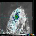
No significant changes have occurred with Leslie overnight. Deep
convection is generally confined to the eastern half of the
circulation as dry air continues to wrap into the western portion
of the cyclone. Satellite images indicate that the circulation has
become stretched from north to south, likely due to the approach of
a cold front that is currently located a few hundred miles to the
northwest of Leslie. The initial intensity is held at 30 kt based
on the earlier ASCAT data.
The cold front is expected to merge with Leslie by tonight, causing
extratropical transition. While transitioning, Leslie is forecast
to strengthen for a couple of days due to significant baroclinic
forcing, and the NHC intensity forecast takes the peak winds just
below hurricane force at 36 and 48 hours. Later in the week, the
extratropical system is expected to cut off and gradually lose its
frontal features. Although this will likely cause some weakening,
it should also allow the system to regain subtropical
characteristics. The NHC intensity forecast is fairly similar to
the previous one and near the IVCN consensus model. This forecast
is also in fairly good agreement with the GFS and ECMWF models,
which are usually reliable intensity models for large subtropical
systems like Leslie. Based on the latest guidance, Leslie is now
expected to transition back to a subtropical cyclone in 96 hours.
Leslie has jogged to the southeast during the past several hours,
but an eastward to northeastward motion is expected during the next
day or so as Leslie makes its extratropical transition. After that
time, a turn to the north is expected followed by a slow westward
motion when Leslie cuts off from the mid-latitude flow. The models
are in fairly good agreement on this looping motion, and the NHC
track forecast follows the various consensus aids.
FORECAST POSITIONS AND MAX WINDS
INIT 25/0900Z 31.9N 46.2W 30 KT 35 MPH
12H 25/1800Z 32.1N 44.8W 40 KT 45 MPH
24H 26/0600Z 32.7N 41.9W 50 KT 60 MPH...POST-TROP/EXTRATROP
36H 26/1800Z 34.5N 40.5W 60 KT 70 MPH...POST-TROP/EXTRATROP
48H 27/0600Z 36.1N 41.1W 60 KT 70 MPH...POST-TROP/EXTRATROP
72H 28/0600Z 36.0N 45.0W 55 KT 65 MPH...POST-TROP/EXTRATROP
96H 29/0600Z 35.3N 48.2W 55 KT 65 MPH...SUBTROPICAL STORM
120H 30/0600Z 35.0N 50.0W 50 KT 60 MPH
$$
Forecaster Cangialosi |


