Show Selection:
|
#942251 (Received by flhurricane at: 11:06 PM 28.Sep.2018)
TCDAT3
Subtropical Storm Leslie Discussion Number 11
NWS National Hurricane Center Miami FL AL132018
1100 PM AST Fri Sep 28 2018
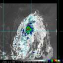
Convective banding has been consolidating to the south of Leslie`s
center since the afternoon, but recent scatterometer data indicate
that the maximum winds have decreased to 40 kt and the area of
gale-force winds has decreased in size. The convective structure
suggests that Leslie may be taking on some tropical characteristics,
but since wave vapor imagery still shows the cyclone embedded within
a complex deep-layer low, Leslie is still being designated as
subtropical.
Leslie is moving west-southwestward, or 255 degrees at 10 kt.
Leslie is entrenched between several mid-tropospheric highs located
to its east and west, and these features are expected to push
Leslie slowly southwestward for the next 3 days. The track
guidance is tightly clustered during this period, and the NHC
forecast is very similar to the previous one. After day 3, Leslie
is likely to meander on days 4 and 5 in weak steering, and the
updated official forecast has been adjusted southward and eastward
at the end of the forecast period to account for the latest model
solutions.
Global model fields indicate that Leslie has migrated to the
northwest of its parent upper-level low, which is putting it under
a regime of moderate north-northeasterly shear. For the next 48
hours, this shear is expected to continue, and phase-space diagrams
suggest that Leslie will be straddling the line between shallow and
deep warm core. As a result, only modest strengthening is
anticipated during this period, and the official forecast maintains
Leslie as a subtropical storm through 48 hours. However, the
transition to a tropical storm could occur any time during the next
day or two. After 48 hours, Leslie should definitely be deep warm
core, and more significant strengthening is expected, with the
cyclone forecast to reach hurricane intensity by day 4. This
scenario is shown by the various intensity models, and the NHC
intensity forecast is very close to the HFIP Corrected Consensus
aid and the Florida State Superensemble. If the statistical-
dynamical models are correct, Leslie could be stronger by the end of
the forecast period than is indicated in the NHC forecast.
Large swells generated by Leslie when it was a stronger
extratropical low have already reached Bermuda, will soon reach the
Lesser and Greater Antilles, and should reach portions of the east
coast of the United States later this weekend. These swells could
cause life-threatening surf and rip currents.
FORECAST POSITIONS AND MAX WINDS
INIT 29/0300Z 35.7N 49.4W 40 KT 45 MPH
12H 29/1200Z 34.9N 50.8W 45 KT 50 MPH
24H 30/0000Z 34.0N 52.0W 45 KT 50 MPH
36H 30/1200Z 33.5N 53.0W 50 KT 60 MPH
48H 01/0000Z 33.1N 53.9W 50 KT 60 MPH
72H 02/0000Z 32.2N 55.4W 60 KT 70 MPH...TROPICAL CYCLONE
96H 03/0000Z 30.5N 56.0W 65 KT 75 MPH
120H 04/0000Z 31.5N 56.5W 70 KT 80 MPH
$$
Forecaster Berg |


