Show Selection:
|
#942762 (Received by flhurricane at: 10:45 PM 02.Oct.2018)
TCDAT3
Tropical Storm Leslie Discussion Number 27
NWS National Hurricane Center Miami FL AL132018
1100 PM AST Tue Oct 02 2018
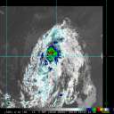
Leslie has been trying to become a hurricane all day, but it is not
one yet. The cloud pattern has changed very little during the past
several hours and in fact, one could make the case that is less
organized that earlier today with no eye feature trying to form at
this time. However, Dvorak classifications still support an initial
intensity of 60 kt, and this is confirmed by a recent ASCAT pass
with winds of at least 55 kt. Having said that, environmental
conditions of low shear and a warm ocean favor strengthening, and
NHC again forecasts Leslie to become a hurricane on Wednesday and
remain one for a couple of days. After that time, Leslie will reach
cooler waters and gradual weakening is anticipated.
Leslie is moving very slowly toward the southwest or 220 degrees at
3 kt while embedded within very light steering currents. Most of the
global models bring an eastward-moving short wave near Leslie, and
this flow pattern should force the cyclone to move northward for the
next 2 to 3 days. Thereafter, Leslie will encounter the mid-latitude
westerlies and will move eastward. The forecast is very similar to
the previous one and closely follows both the corrected-consensus
HCCA and the other multi-model aids.
Large swells generated by Leslie are expected to increase tomorrow
and Thursday across the southeastern coast of the United States,
Bermuda, the Bahamas, and the Greater and Lesser Antilles. These
swells will also begin to increase near the coasts of New England
and Atlantic Canada by the end of the week. Please consult products
from your local weather office as these conditions could cause
life-threatening surf and rip currents.
The initial 34- and 50-kt wind radii have been slightly adjusted
based on recent ASCAT data.
FORECAST POSITIONS AND MAX WINDS
INIT 03/0300Z 29.7N 56.7W 60 KT 70 MPH
12H 03/1200Z 29.4N 56.9W 65 KT 75 MPH
24H 04/0000Z 30.0N 57.0W 70 KT 80 MPH
36H 04/1200Z 31.5N 57.0W 75 KT 85 MPH
48H 05/0000Z 33.8N 57.0W 70 KT 80 MPH
72H 06/0000Z 36.5N 57.2W 65 KT 75 MPH
96H 07/0000Z 37.0N 54.5W 60 KT 70 MPH
120H 08/0000Z 37.0N 51.0W 55 KT 65 MPH
$$
Forecaster Avila |


