Show Selection:
|
#942820 (Received by flhurricane at: 10:33 AM 03.Oct.2018)
TCDAT3
Hurricane Leslie Discussion Number 29
NWS National Hurricane Center Miami FL AL132018
1100 AM AST Wed Oct 03 2018
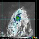
Leslie continues to slowly strengthen. Satellite images indicate
that the deep convection has been gradually increasing in coverage
and become more symmetric around the large ragged eye of the
hurricane. An average of the latest Dvorak classifications from
TAFB and SAB support increasing the initial wind speed to 70 kt.
Leslie still has a little more time to strengthen as it should
remain over waters warmer than 26 deg C and in favorable
atmospheric conditions for about another day. Thereafter, the
hurricane is expected to move over progressively cooler water,
which should induce a slow weakening trend. The NHC intensity
forecast lies closest to the IVCN and HCCA consensus aids.
The hurricane has come to a stall, as expected, in very weak
steering currents. The combination of a shortwave trough moving
off the New England coast and a building ridge to the southeast of
Leslie should cause the hurricane to begin moving northward this
evening. This motion with an increase in forward speed should
continue through Friday. By the weekend, the hurricane is expected
to turn to the east due to a broad trough over the north Atlantic.
The models remain in very good agreement, and little change was
made to the previous NHC forecast track.
Large swells generated by Leslie are expected to increase over the
next day or two across the southeastern coast of the United
States, Bermuda, the Bahamas, and the Greater and Lesser Antilles.
These swells will also begin to increase near the coasts of New
England and Atlantic Canada on Friday. Please consult products from
your local weather office as these conditions could cause
life-threatening surf and rip currents.
FORECAST POSITIONS AND MAX WINDS
INIT 03/1500Z 29.5N 56.8W 70 KT 80 MPH
12H 04/0000Z 30.0N 56.9W 75 KT 85 MPH
24H 04/1200Z 31.6N 56.8W 75 KT 85 MPH
36H 05/0000Z 33.9N 57.0W 75 KT 85 MPH
48H 05/1200Z 35.6N 57.3W 70 KT 80 MPH
72H 06/1200Z 36.9N 56.3W 65 KT 75 MPH
96H 07/1200Z 37.0N 54.0W 60 KT 70 MPH
120H 08/1200Z 36.7N 49.8W 55 KT 65 MPH
$$
Forecaster Cangialosi |


