Show Selection:
|
#943007 (Received by flhurricane at: 10:51 PM 04.Oct.2018)
TCDAT3
Tropical Storm Leslie Discussion Number 35
NWS National Hurricane Center Miami FL AL132018
1100 PM AST Thu Oct 04 2018
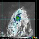
Leslie lacks an inner core and now consists of a vigorous large
circulation with small outer bands of shallow to moderate
convection. Satellite intensity estimates have continued to yield a
lower intensity, and the winds have been reduced to 55 kt in this
advisory based on a recent ASCAT pass. The shear does not appear to
be a problem for Leslie, and the cyclone is forecast to be moving
over SSTs which appear to not be cool enough to result in
significant weakening. In fact, the average of the intensity
guidance suggests that Leslie basically will be a 50-kt cyclone
through the forecast period and so does the NHC forecast.
Leslie is moving northward or 350 degrees at 10 kt steered by the
southerly flow on the western edge of the subtropical ridge. In
about 24 to 36 hours, the storm will encounter the mid-latitude
westerlies, and this flow pattern will force Leslie to make a sharp
turn to the east and even to the east-southeast with no change in
forward speed. Track guidance is in extremely good agreement with
this solution for the next 3 to 4 days. After that time, the models
vary significantly in speed, but since the cyclone will be embedded
in the westerlies, the NHC forecast maintains the eastward
progression of Leslie as indicated in the previous forecast.
Large swells generated by Leslie are expected to continue during the
next few days across the southeastern coast of the United States,
Bermuda, the Bahamas, and the Greater and Lesser Antilles. These
swells will also begin to increase near the coasts of New England
and Atlantic Canada on Friday. Please consult products from your
local weather office as these conditions could cause life-
threatening surf and rip currents.
FORECAST POSITIONS AND MAX WINDS
INIT 05/0300Z 34.9N 57.6W 55 KT 65 MPH
12H 05/1200Z 36.2N 58.0W 50 KT 60 MPH
24H 06/0000Z 37.2N 57.7W 50 KT 60 MPH
36H 06/1200Z 37.5N 56.5W 50 KT 60 MPH
48H 07/0000Z 37.5N 54.5W 50 KT 60 MPH
72H 08/0000Z 36.5N 50.0W 50 KT 60 MPH
96H 09/0000Z 34.5N 45.5W 50 KT 60 MPH
120H 10/0000Z 33.0N 42.5W 50 KT 60 MPH
$$
Forecaster Avila |


