Show Selection:
|
#974427 (Received by flhurricane at: 4:42 PM 12.Jul.2019)
TCDAT2
Tropical Storm Barry Discussion Number 10
NWS National Hurricane Center Miami FL AL022019
400 PM CDT Fri Jul 12 2019
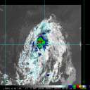
Although the storm continues to look disorganized in satellite
imagery, surface observations and data from an Air Force Reserve
Hurricane Hunter aircraft indicate that the central pressure has
fallen to 993 mb with the maximum winds still near 55 kt. A
prominent cloud swirl has rotated more than halfway around the
eastern and northern side of the mean center since 17Z, and there
were several reports of strong winds in association with this
feature. Strong convection persists to the south of the center, but
to this point northerly shear has prevented the convection from
becoming better organized.
The initial motion is now an erratic 300/5. Barry should turn
northwestward during the next several hours as it approaches a
weakness in the mid-level ridge over the Mississippi Valley, and
this motion should bring the center across the central coast of
Louisiana between 12-24 h. After landfall, the system should
move northward through a break in the ridge until the 72 h point,
after which it should recurve northeastward into the westerlies.
The guidance envelope has shifted slightly westward since the last
advisory, but the shift is not large enough to require significant
changes to the forecast track. Thus, the new track forecast again
has only minor tweaks from the previous one, and it lies just east
of the the various consensus models.
Barry continues to strengthen despite the asymmetric convective
structure, the shear, and the presence of mid- to upper-level dry
air over the northern semicircle. The intensity guidance forecasts
continued intensification until landfall, and so will the NHC
forecast. While not explicitly shown in the forecast, Barry is
expected to become a hurricane near the time it makes landfall
between the 12 and 24 h forecasts points. After landfall, the
cyclone should steadily weaken, with decay to a remnant low
expected to occur in about 72 h and dissipation after 96 h.
Key Messages:
1. There is a danger of life-threatening storm surge inundation
along the coast of southern and southeastern Louisiana, portions of
Lake Pontchartrain, and portions of coastal Mississippi where a
Storm Surge Warning is in effect. Water levels are already beginning
to rise in these areas, with the peak inundation expected on
Saturday. The highest storm surge inundation is expected between
Intracoastal City and Shell Beach.
2. The slow movement of Barry will result in a long duration heavy
rainfall and flood threat along the central Gulf Coast, across
portions of the Lower Mississippi Valley and north into the
Tennessee Valley through the weekend into early next week. Flash
flooding and river flooding will become increasingly likely, some of
which may be life-threatening, especially across portions of
southeast Louisiana into Mississippi.
3. Hurricane conditions are expected along a portion of the coast of
Louisiana, where a Hurricane Warning is in effect. Tropical storm
conditions are expected elsewhere along much of the Louisiana coast
and inland across portions of the lower Mississippi Valley where
tropical storm warnings are in effect.
FORECAST POSITIONS AND MAX WINDS
INIT 12/2100Z 28.7N 90.9W 55 KT 65 MPH
12H 13/0600Z 29.2N 91.3W 60 KT 70 MPH
24H 13/1800Z 30.1N 91.9W 60 KT 70 MPH...INLAND
36H 14/0600Z 31.3N 92.3W 45 KT 50 MPH...INLAND
48H 14/1800Z 32.5N 92.5W 30 KT 35 MPH...INLAND
72H 15/1800Z 35.0N 92.5W 20 KT 25 MPH...POST-TROP/REMNT LOW
96H 16/1800Z 38.0N 91.0W 20 KT 25 MPH...POST-TROP/REMNT LOW
120H 17/1800Z...DISSIPATED
$$
Forecaster Beven |


