Show Hurricane/Tropical Local Statment - Corpus Christi, TX (Corpus Christi, TX Area) Selection:
|
No data for this date - Showing most recent prior to 06-26-2024
HLSCRP
TXZ229>234-239>247-342>347-442-443-447-201715-
Tropical Storm Alberto Local Statement Advisory Number 11
National Weather Service Corpus Christi TX AL012024
405 AM CDT Thu Jun 20 2024
This product covers South Texas
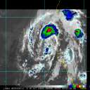
**TROPICAL STORM ALBERTO NEARING LANFALL ALONG THE MEXICO COAST -
WATCHES CANCELLED FOR TEXAS COAST**
NEW INFORMATION
---------------
* CHANGES TO WATCHES AND WARNINGS:
- All watches and warnings have been canceled
* CURRENT WATCHES AND WARNINGS:
- None
* STORM INFORMATION:
- About 380 miles south of Port Aransas TX or about 430 miles
south of Port Oconnor TX
- 22.3N 97.3W
- Storm Intensity 50 mph
- Movement West or 275 degrees at 13 mph
SITUATION OVERVIEW
------------------
Tropical Storm Alberto is nearing landfall along the Mexico coast
early this morning. All tropical storm watches have been cancelled for
the Texas coast as wind speeds have decreased and will continue to
decrease.
Showers and thunderstorms will continue to impact the southern Coastal
Bend and west across South Texas this morning with a few brief
tropical tornadoes still possible. Additional rainfall for most of the
area will be an inch or less, though a few bands of heavier convection
are still noted and could produce another inch or two of rain.
Coastal flooding will persist along the coast today into tomorrow for
gulf facing areas, and will likely persist longer along the bays as
water will take some time to get back to normal. Expect
inundation of up to 3 feet to continue in these areas.
POTENTIAL IMPACTS
-----------------
* SURGE:
Little to no additional surge impacts expected.
* FLOODING RAIN:
Additional impacts from flooding rain are still a concern across
South Texas. Remain well guarded against locally hazardous flood
waters having further impacts of limited potential.
* TORNADOES:
Additional impacts from tornadoes are still a concern across South
Texas. Remain well braced against tornado event having further
limited impact potential.
PRECAUTIONARY/PREPAREDNESS ACTIONS
----------------------------------
* OTHER PREPAREDNESS INFORMATION:
Be alert for flooded roads which could be compromised or littered
with debris. Avoid travel until water levels subside and roads have
been cleared. Do not drive through places where flood waters cover
the road. Turn around, don`t drown!
Have multiple ways to receive Tornado Warnings if issued. Consider
nearby shelter options as you move about. Be ready to shelter quickly.
* ADDITIONAL SOURCES OF INFORMATION:
- For information on Texas evacuation routes, see
txdot.gov/driver/weather/hurricane.html
- For information on creating emergency kits, see texasready.gov
- For state assistance in an emergency event,
tdem.texas.gov/response/state-of-texas-emergency-assistance-registry
- For information on registering for emergency notifications in your
area visit the websites below...
- Corpus Christi and Nueces County: cctexas.com/reversealert
- San Patricio, Aransas, and Refugio County: coastalplainlepc.org
- Victoria County: vctx.org/page/oem.home
- Calhoun County: www.calhouncotx.org
NEXT UPDATE
-----------
As it pertains to this event...this will be the last local statement
issued by the National Weather Service in Corpus Christi TX regarding
the effects of tropical cyclone hazards upon the area.
$$
|


