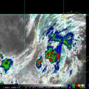
Current Radar or Satellite Image

Flhurricane.com - Central Florida Hurricane Center - Tracking Storms since 199530 Years of Hurricanes Without the Hype - Since 1995


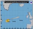
#Erin still moving west, a bit weak today but forecast to very slowly strengthen as it moves into better conditioons. Northern Leewards should monittor, Bermuda as well. Elsewhere too soon to tell.
Days since last H. Landfall - US: Any 307 (Milton) , Major: 307 (Milton) Florida - Any: 307 (Milton) Major: 307 (Milton)
16.3N 45.0W
Wind: 50MPH
Pres: 1001mb
Moving:
W at 17 mph
Click for Storm Spotlight
Invest 96LClick for Invest Information from CIMSS
COMMUNICATION
STORM DATA
CONTENT
FOLLOW US
 

Flhurricane Animated Storm Model Plots for 96L (2025)
(source images from Levi Cowan's Tropical Tidbits)

18 images in loop. Last Checked: 05:12 pm 13-Aug-2025 EDT. Last Updated: 08:23 pm 10-Aug-2025 EDT

Other animated plots: Clark Evan's Spaghetti Model - Clark Evans Intensity Model - Satellite Image

Updates checked for every hour, Actual changes depend on NHC/Models themselves.
XTRP is a line indicating the current direction of the storm, it is not a model.
TVCN is usually the best one to use on this page