MikeC
Admin
Reged:
Posts: 4667
Loc: Orlando, FL
|
|
10:00 AM CDT 13 July 2019 Update
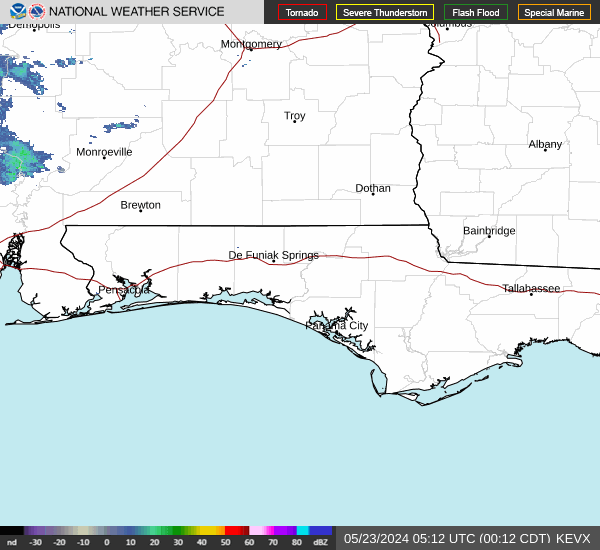
Hurricane Barry forms in the Gulf just as it makes landfall in the Central Louisiana coastline. Despite being very lopsided to the south and southeast, Buoy, Aircraft, Rig reports have found Barry has reached hurricane strength. Rainfall once the southern portion arrives will be the largest threat, those north and west of the center will likely hardly notice anything.
However the southern section does extend fairly far west, so Tropical storm warnings have been extended westward to Sabine Pass.
6:30 PM CDT 12 July 2019 Update
Barry's structure has improved throughout the day Friday, with progressively stronger surface winds the closer one is to the very center. In addition, upper-level outflow has improved in all quadrants, and most importantly so, in the northern half of the cyclone. Barry is now a fully tropical Tropical Cyclone and by all accounts, likely maturing into a hurricane before landfall.
While not expected, Barry, likely to be a full-fledged and not fledgling, dangerous TC before landfall, could strengthen even more than forecast with so much of it over anomalously warm Gulf waters. With high-end tropical storm to full hurricane-force gusts likely to push inland, given all the rain on the way, trees will fall. Easily. Wind-related injuries and fatalities are often from falling trees and branches.
The greatest threat by far is coming in the way of life-threatening, flooding rain that could continue for an extended duration. Anyone who has remained in areas prone to flooding should be rushing to completion efforts to protect life and property, if not evacuating if so advised by local authorities. Flooding in this event may exceed all previous records in several places.Quote:
NWS Weather Prediction Center College Park MD
421 PM EDT Fri Jul 12 2019 Day 2 Valid 12Z Sat Jul 13 2019 - 12Z Sun Jul 14 2019
...THERE IS A HIGH RISK OF EXCESSIVE RAINFALL SATURDAY AND SATURDAY NIGHT OVER EASTERN LOUISIANA AND FAR SOUTHWEST MISSISSIPPI. THIS INCLUDES THE CITIES OF NEW ORLEANS AND BATON ROUGE...
...Central Gulf Coast and Lower Mississippi Valley...
Extreme rainfall will likely lead to significant and life-threatening flash flooding from coastal LA into southwestern MS and the LA/MS border from Saturday into Sunday.
-Ciel
10:30 AM CDT 12 July 2019 Update
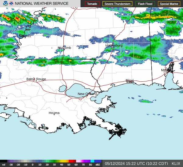
Barry is doing a run on strengthening today, but it still a fairly sloppy system, although the primary center is not expected to make landfall until tomorrow morning, a strong are of convection currently on south side of the center likely will rotate around and up over the Louisiana coastline and near New Orleans, likely late afternoon or evening. This will bring heavy rain and surge into the areas. Lake Pontchartrain is now under a storm Surge Warning.
10 AM CDT 11 July 2019 Update
Tropical Storm Barry has formed
6 AM CDT 11 July 2019 Update
Recon failed to find enough orgnaiztion to upgrade the system overnight, but it still remains close to becoming a tropical depression or storm this morning. The track was adjusted slightly in central Louisiana bringing more eastern side rains potentially to New Orleans.
The recon flying right now is finding lower pressures (1003 mb) and a bit more organizatio9n which implies an upgrade may happen sooner than later.
This system is mostly going to be a rain maker, although a hurricane at landfall is still forecast by late tomorrow or Saturday morning. Because the system has not properly formed there is still a great deal o9f uncertainty in he official forecast
Those in the watch area should pay attention to local media and officials for informatio9n specific to their area.
8:30PM CDT July 10, 2019 Update
PTC looks to have completed Tropical Cyclogenesis, or is right on the cusp of doing so, and may easily be a named, and fully tropical, storm, Thursday. This is a particularly dangerous situation, with the risk of extreme inland flooding high. Barry may even cause overtopping Saturday of the Mississippi river levee in the Lower 9th Ward, Algiers and St. Bernard Parish. Even though 92L/proto-Barry is "not (yet) named," preparations along its path to protect life and property should now be underway. Time is limited, and at some point evacuation routes, hotels, shelters, stores and such may be completely inaccessible.
Further discussion and speculation for potential impacts and future track of proto-Barry can be found in the TWO/Barry Forecast Lounge.
-Ciel
Original Post
Potential Tropical Storm 2 Advisory issued, Hurricane forecast for Louisiana Saturday midday.
The idea of potential advisories is to allow for official watches and warnings even before a storm has properly formed if it will impact land areas.
Flooding rainfall has already occurred in New Orleans and more is on the way to potentially the worst flooding there since 1927. More to come soon.
A Storm Surge Watch has been issued from the Mouth of the Pearl River to Morgan City, Louisiana.
A Tropical Storm Watch has been issued from the Mouth of the Mississippi River to Morgan City, Louisiana.

HAZARDS AFFECTING LAND
----------------------
STORM SURGE: The combination of a dangerous storm surge and the tide will cause normally dry areas near the coast to be flooded by rising waters moving inland from the shoreline. The water could reach the following heights above ground somewhere in the indicated areas if the peak surge occurs at the time of high tide...
Mouth of the Pearl River to Morgan City...3 to 5 ft
Surge-related flooding depends on the relative timing of the surge and the tidal cycle, and can vary greatly over short distances. For information specific to your area, please see products issued by your local National Weather Service forecast office.
RAINFALL: The system is expected to produce total rain accumulations of 6 to 12 inches near and inland of the central Gulf Coast through early next week, with isolated maximum rainfall amounts of 18 inches.
WIND: Tropical storm conditions are possible within the watch area by late Thursday or early Friday.
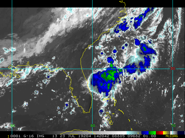
MesoScale Satellite of Barry
Louisiana Power Outage Map
|
MikeC
Admin
Reged:
Posts: 4667
Loc: Orlando, FL
|
|
Recon in en route now (Short trip)
|
cieldumort
Moderator

Reged:
Posts: 2517
Loc: Austin, Tx
|
|
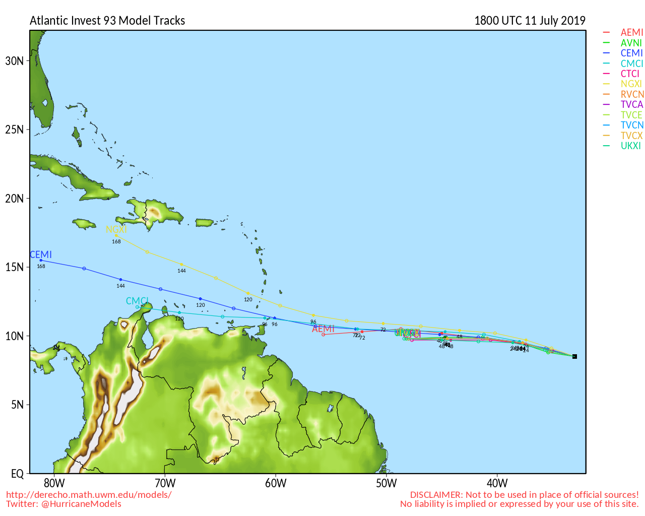
Recon has been finding tropical storm force winds well removed from the mean center, within the southernmost band. Proto-Barry is probably now a 40/45 mph storm, but still looks to be lacking qualification for TC classification - namely a tighter and more coherent center. This will likely change today, and we will probably see advisories on "Barry" soon.
|
MikeC
Admin
Reged:
Posts: 4667
Loc: Orlando, FL
|
|
ATFC and recon should be enough to upgrade it to a TD or TS at 11 (Any minute now).
|
cieldumort
Moderator
Reged:
Posts: 2517
Loc: Austin, Tx
|
|
First Vortex messageQuote:
Product: Air Force Vortex Message (URNT12 KNHC)
Transmitted: 11th day of the month at 15:34Z
Agency: United States Air Force
Aircraft: Lockheed WC-130J Hercules with reg. number AF97-5303
Tropical Depression: Two (flight in the North Atlantic basin)
Mission Number: 4
Observation Number: 11
A. Time of Center Fix: 11th day of the month at 14:35:20Z
B. Center Fix Coordinates: 27.77N 88.82W
B. Center Fix Location: 170 statute miles (273 km) to the SSE (154°) from New Orleans, LA, USA.
C. Minimum Height at Standard Level: Not Available
D. Minimum Sea Level Pressure: 1006mb (29.71 inHg) - Extrapolated
E. Dropsonde Surface Wind at Center (Undecoded): NA
F. Eye Character: Not Available
G. Eye Shape: Not Available
H. Estimated (by SFMR or visually) Maximum Surface Wind Inbound: 33kts (38.0mph)
I. Location & Time of the Estimated Maximum Surface Wind Inbound: 122 nautical miles (140 statute miles) to the SE (134°) of center fix at 13:56:00Z
J. Maximum Flight Level Wind Inbound: From 229° at 41kts (From the SW at 47.2mph)
K. Location & Time of the Maximum Flight Level Wind Inbound: 128 nautical miles (147 statute miles) to the SE (134°) of center fix at 13:54:00Z
L. Estimated (by SFMR or visually) Maximum Surface Wind Outbound: 37kts (42.6mph)
M. Location & Time of the Estimated Maximum Surface Wind Outbound: 33 nautical miles (38 statute miles) to the WNW (297°) of center fix at 14:47:30Z
N. Maximum Flight Level Wind Outbound: From 14° at 23kts (From the NNE at 26.5mph)
O. Location & Time of the Maximum Flight Level Wind Outbound: 60 nautical miles (69 statute miles) to the WNW (302°) of center fix at 14:56:30Z
P. Maximum Flight Level Temp & Pressure Altitude Outside Eye: 23°C (73°F) at a pressure alt. of 236m (774ft)
Q. Maximum Flight Level Temp & Pressure Altitude Inside Eye: 25°C (77°F) at a pressure alt. of 241m (791ft)
R. Dewpoint Temp & Sea Surface Temp: Not Available
S. Fix Determined By: Penetration and Wind
S. Fix Levels (surface & flight level centers within 5nm of each other): Surface and 1,500 feet
T. Navigational Fix Accuracy: 0.02 nautical miles
T. Meteorological Accuracy: 8 nautical miles
Remarks Section:
Maximum Flight Level Wind: 41kts (~ 47.2mph) which was observed 128 nautical miles (147 statute miles) to the SE (134°) from the flight level center at 13:54:00Z
Sea Level Pressure Extrapolation From: Below 1500 feet
|
kspkap
Weather Watcher
Reged:
Posts: 35
|
|
Mike,
I live in one of the three counties on the Mississippi Gulf Coast. Several of the models have Barry curving back east to take it straight up Mississippi or between LA & MS. One model impacts Alabama. Thoughts, please.
--------------------
Donna-1960, Charley-2004, Frances-2004, Jeanne-2004, Issac-2012, Zeta-2020
|
cieldumort
Moderator
Reged:
Posts: 2517
Loc: Austin, Tx
|
|
Recon still finding a wind structure that more closely resembles that of a hybrid storm, than one classically tropical. In the screenshot below (original credit Tropical Tidbits) I've drawn circles around what are roughly "belts" of wind intensities. The current order of things, with the belts of progressively stronger winds further removed from the calm center, is the opposite of what one expects to see in a classic TC, and as such, there may be some continued abnormally large fits and starts until this reverse order flips (with the strongest winds encircling the calm center, and not at the extremities).

As an aside, the two center fixes in the image above may give the incorrect impression of a northwesterly motion. In fact the second fix in this image was the one to the southeast. In reality, the fixed center is likely just hopping around, wobbling, or perhaps rotating a bit cyclonically within what is still a relatively broad center. And in general, it's usually not a good idea to extrapolate too much from just a few fixes in any system, let alone a messy, new one, anyway.
Recon is currently passing through Barry's center for a third time, and as of 12:45PM CDT seems to be about to fly into the prominent northernmost lobe/swirl, which has since rotated about the mean center and looks to be getting subsumed. These small-scale features can somtimes have outsized influence over future tracks and intensities.
Edited by cieldumort (Thu Jul 11 2019 01:59 PM)
|
cieldumort
Moderator
Reged:
Posts: 2517
Loc: Austin, Tx
|
|
Rare Day 3 HIGH RISK has been issued by WPC. Significant, life-threatening flooding is likely, and extreme, record-setting flooding is possible.
The only other Day-3 High Risks WPC has issued were for Harvey (2017) and Florence (2018).
Quote:
Excessive Rainfall Discussion
NWS Weather Prediction Center College Park MD
427 PM EDT Thu Jul 11 2019
Day 3
Valid 12Z Sat Jul 13 2019 - 12Z Sun Jul 14 2019
...THERE IS A HIGH RISK OF EXCESSIVE RAINFALL SATURDAY AND
SATURDAY NIGHT OVER EASTERN LOUISIANA AND FAR SOUTHWEST
MISSISSIPPI. THIS INCLUDES NEW ORLEANS AND BATON ROUGE...
...Central Gulf Coast and Lower Mississippi Valley...
Scenarios involving Barry become especially concerning on Saturday
and Saturday night. Significant flooding and life-threatening
flash flooding are likely across eastern Louisiana and southwest
Mississippi. The official track, supported especially by
recent and runs, will bring a hurricane or strong
tropical storm slowly inland, producing widespread heavy tropical
rainfall. The worst case scenario, then, which is depicted in
multiple and runs, would be for a persistent band or
bands of convective rainfall to form and then train from
south-southwest to north-northeast within a broadly convergent
inflow region off the Gulf. With a slow cyclone track and broadly
available moist and unstable airmass to the south, there is
potential several hours training convection, producing high-end
rainfall amounts. The 12Z CONUS Nest, for instance, only runs
out to 00Z Sunday, but produces over 10 inches of rain in some
places over just a 6 hour period ending at 00Z. The and
Nest may be a bit fast. We would expect the threat to worsen
during the overnight hours leading into Sunday morning. But what
is concerning is that when removing placement differences, and
just viewing the intensity of the storm total rainfall, we are
seeing broad swaths of 20-plus inches of rain in the , NAM,
Canadian, and . The 06Z even produced a 30 inch maximum in
southwest Louisiana. If this banded scenario sets up, it easily
could shift somewhat to the east or west. But based on our best
available information at this time, we are depicting the maximum
west of New Orleans and east of Lake Charles, placing Lafayette
and Baton Rouge in the area of greatest threat. In crafting the
associated , we also expected that the heaviest amounts may
tend to prefer areas near and south of Interstate 10 to find the
unstable airmass.
This scenario is not quite as certain as other storms of recent
memory like Florence last year. Barry has not yet become very well
organized. But we have seen in numerous examples, including the
unnamed system that struck Louisiana in August 2016, that when the
global models unanimously begin depicting these high-end rainfall
amounts they are usually correct in forecasting a strongly
anomalous event with potential to produce substantial impacts. For
now we have trended the WPC up to indicate areal average 10 to
20 inch amounts, with isolated 25 inch amounts, and with much of
the bulk of this occurring on Day 3.
Related Flhurricane links:
Unnamed Louisiana Low of 2016
Florence Lounge (2008)
|
Prospero
Storm Tracker

Reged:
Posts: 269
Loc: Gulfport, FL
|
|
Strange storm from the first mention of it. The only time this amateur could be sure I knew the center of rotation it was still over land. Looking at satellite and radar, it's an enigma to me. It never looks like it is moving west. But that is just me, I trust the FLhurricane team and that's why I am here.
We have had a good and welcome breeze here in Gulfport, Florida for a couple days. Our local news says it is from Barry.
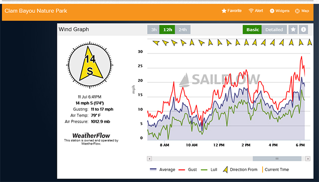
It had been stagnant for days and it rained everyday. Today was dryer here, but there was still a lot of rain around. The Gulf of Mexico seems to be sweating profusely. That's scary from what cieldumort says for LA and our neighbors to the northwest.
Just hoping Barry stays wide and weak. We'll not complain about rain here, and the cooler temperatures and breeze are making a nice early to mid July so far in Florida for we locals. Tourist might be complaining a bit though.
--------------------
Gulfport Florida Webcam - Gulfport Florida Weather Station - Clearwater Beach Cams
Edited by Prospero (Thu Jul 11 2019 08:31 PM)
|
Prospero
Storm Tracker
Reged:
Posts: 269
Loc: Gulfport, FL
|
|
Looks like it might be blowing up this morning!
--------------------
Gulfport Florida Webcam - Gulfport Florida Weather Station - Clearwater Beach Cams
|
Prospero
Storm Tracker
Reged:
Posts: 269
Loc: Gulfport, FL
|
|
Am I seeing circulation coming from the center of that big area of convection just south of the other area of circulation??
--------------------
Gulfport Florida Webcam - Gulfport Florida Weather Station - Clearwater Beach Cams
|
KY Bourbon Maker
Registered User
Reged:
Posts: 2
|
|
Been a while since we have seen any posts from the resident METS and experts. Would be great to know what everyone is thinking with the latest models and the 11AM Discussion and Advisories. :-)
|
MikeC
Admin
Reged:
Posts: 4667
Loc: Orlando, FL
|
|
Storm Surge and rain. Several visual recordings here https://flhurricane.com/cyclone/animationlist.php
Trying to analyze the situation to see what's up. Not looking good for NOLA.
|
MikeC
Admin
Reged:
Posts: 4667
Loc: Orlando, FL
|
|
Recon just found a Pressure of 994, 4 below the advisory.
Barry is doing a run on strengthening today, but it still a fairly sloppy system, although the primary center is not expected to make landfall until tomorrow morning, a strong are of convection currently on south side of the center likely will rotate around and up over the Louisiana coastline and near New Orleans, likely late afternoon or evening. This will bring heavy rain and surge into the areas. Lake Pontchartrain is now under a storm Surge Warning.
|
MikeC
Admin
Reged:
Posts: 4667
Loc: Orlando, FL
|
|
Recon recently ran into an 83mph gust at flight level.
|
MikeC
Admin
Reged:
Posts: 4667
Loc: Orlando, FL
|
|
All the NOLA floodgates are shut, I think that's the first time that's happened. Anyway the center is exposed, but the convection is rapidly approaching it, it'll probably have one more strengthening period before landfall.
|
Prospero
Storm Tracker
Reged:
Posts: 269
Loc: Gulfport, FL
|
|
Horrible situation.
I assume there is another discussion somewhere with more activity, I just have not looked.
This storm has me so discombobulated it is ridiculous. All day being obsessed with every storm, I have been watching satellite images and just staring at the animations confused. I'd think there would be a LOT of talk here, but we are in Florida so maybe not our discussion.
So question to anyone who has time to answer:
What in the world is this spinning thing that came out of the convection and swirled back around? For a while I thought maybe "this" was the center of circulation, as the center has been so vague to me. But it circled around another circulation. I've never ever seen anything like this in any of the countless storms I have watched.
Does this phenomena have a name? Is it described anywhere?
This is a 9MB GIF, so might take a moment to load up:
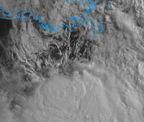
All day I have been fascinated by the "convection" that has stayed in place. To me it appears its own system being fed by Barry and sure looks like there is some rotation in there. I suspect I am very wrong, the only mention anyone anywhere says about it is that there is a "large area of convection" south of the center. I know it is over the Gulf's hotplate of water, so maybe why it stays in place, but it just looks like its own storm to me. Yea, I know, doesn't make sense. But nobody else is talking about it.
Can a storm be born on the edge of another storm? Has it ever happened?
--------------------
Gulfport Florida Webcam - Gulfport Florida Weather Station - Clearwater Beach Cams
|
Prospero
Storm Tracker
Reged:
Posts: 269
Loc: Gulfport, FL
|
|
Here's an animation of the convection I've been watching all day. At first, to me, it looked like a standalone storm with some circulation of its own. You'll see what I mean.
Then the last frames it looks like a fire hose of gasoline being sprayed into a fire...
18MB, so a pretty big file:
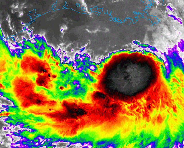
Good thing this is staying offshore, at least for now.
--------------------
Gulfport Florida Webcam - Gulfport Florida Weather Station - Clearwater Beach Cams
|
Prospero
Storm Tracker
Reged:
Posts: 269
Loc: Gulfport, FL
|
|
From another forum an hour ago:
Quote:
That meso swirl that was rotating around the eastern and northern side of the broader circulation may have disrupted a persistent push upstream. High tide was around 4-4:30 pm. These last couple flights have shown a tendency for the lowest sea level pressures to be farther south than that swirl today although by just a few mb's i.e. Kermit currently finding 996 up over the far southern marshes and 991 maybe 100 miles south. Still a somewhat broad elongated inner structure but I do agree, from the last 6 hours of HDOB drops there does finally seem to be some consolidation happening. How far south that might end up being? We've seen the low level circulations tuck under stronger convection in past TS's/canes before.
One reply of note:
Quote:
Honestly, it looks like that meso vortex has become the dominant one as it tracks southward and gets pulled into the mid-level circulation and deep convection.
Interesting...
--------------------
Gulfport Florida Webcam - Gulfport Florida Weather Station - Clearwater Beach Cams
|
cieldumort
Moderator
Reged:
Posts: 2517
Loc: Austin, Tx
|
|
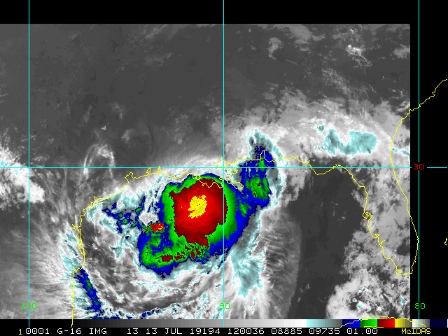
Quote:
What in the world is this spinning thing that came out of the convection and swirled back around? For a while I thought maybe "this" was the center of circulation, as the center has been so vague to me. But it circled around another circulation. I've never ever seen anything like this in any of the countless storms I have watched.
That is one of Barry's many mesovortexes, and probably the most prominent one thus far. Agree that it could become the dominant LLC now that it is tucking under the deepest convection and has a chance to lock up with the mid-level center. Otherwise, it will have been the most impressive mesovort spinning cyclonically about the center thus far.
Should this mesovort link up with that deep convection and the mid-level center (which has been south of the surface center), it could lead to a period of more rapid intensification and possibly tug the TC more to the southwest or even south, for a bit, before the west to northwest to north forecast track resumes.
|


 Threaded


