F
Current Radar or Satellite Image

Flhurricane.com - Central Florida Hurricane Center - Tracking Storms since 1995Hurricanes Without the Hype! Since 1995


90L crossing over Florida with flooding rains, strong winds and brief tornadoes/spouts. Next week eyes turn to W Gulf in active June pattern
Days since last H. Landfall - US: Any 288 (Idalia) , Major: 288 (Idalia) Florida - Any: 288 (Idalia) Major: 288 (Idalia)


Archives 2020s >> 2023 Forecast Lounge

Pages: 1
cieldumort
Moderator


Reged:
Posts: 2311
Loc: Austin, Tx
Tropical Wave E of Windwards
      #114669 - Sun Aug 27 2023 08:24 PM


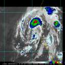
An area of disturbed weather associated with a tropical wave located about 500 miles east of the Windward Islands is starting to look a little more interesting, and may become a nucleus for, or at least responsible for a large portion of what some modelling is advertising as yet another Central America break-off area of low pressure in either/both the southern Caribbean and/or western Gulf during the first ten days of September.

The background state remains favorable, the time for potential development is heading into peak, and it might not surprise to see this wave get frisky even prior to reaching Central America.

This feature is not yet Invest tagged and is not yet on the NHC 7-Day, but should this change the title will be updated accordingly.


Post Extras: Print Post   Remind Me!   Notify Moderator  
Pages: 1


Extra information
0 registered and 0 anonymous users are browsing this forum.

Moderator:  

Print Topic

Forum Permissions
      You cannot start new topics
      You cannot reply to topics
      HTML is disabled
      UBBCode is enabled

Rating:
Topic views: 915

Rate this topic

Jump to

Note: This is NOT an official page. It is run by weather hobbyists and should not be used as a replacement for official sources. 
CFHC's main servers are currently located at
Hostdime.com in Orlando, FL.
Image Server Network thanks to Mike Potts and Amazon Web Services. If you have static file hosting space that allows dns aliasing contact us to help out! Some Maps Provided by:
Great thanks to all who donated and everyone who uses the site as well. Site designed for 800x600+ resolution
When in doubt, take the word of the National Hurricane Center