CoconutCandy
User

Reged:
Posts: 245
Loc: Beautiful Honolulu Hawaii
|
 Fernanda, the Tropical Storm that Could ...
Tue Aug 16 2011 04:41 PM
|
|
|
Aloha Friends! As to be expected as we rapidly approach the peak of Hurricane Season, the tropics are 'heating up', with noticeably increased activity in all oceanic basins.
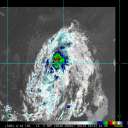
A Small Depression in the far western EastPac has attained sufficient convection and organization this morning to be upgraded to Tropical Storm Status and thus allocated the name "Fernanda".
Earlier, easterly sheer that had kept the LLC from aligning with the deepest convection has apparently slackened enough to facilitate a better co-location, and thus improved vertical alignment of the cyclone, as evidenced by the development of a Central Dense Overcast (CDO) feature, with the low level center somewhat closer to the deepest and most intense thunderstorms.

I'll let the latest advisory (excerpted) from the NHC, Miami, to speak for itself ...
SATELLITE IMAGES INDICATE THAT TROPICAL DEPRESSION SIX-E HAS STRENGTHENED INTO A TROPICAL STORM. THE CENTER IS NOW EMBEDDED WITHIN (the) CONVECTION ... ALTHOUGH IT IS STILL ON THE NORTHEASTERN EDGE.
THE INTENSITY FORECAST FOR FERNANDA IS PROBLEMATIC. WHILE SHEAR IS FORECAST TO BE LIGHT FOR THE NEXT COUPLE OF DAYS ... THE THERMODYNAMIC ENVIRONMENT IS MARGINAL WITH MORE STABLE AIR AND COOLER WATERS JUST TO THE NORTH.
HOWEVER ... THE GUIDANCE IS NOW SHOWING CONSIDERABLY MORE INTENSIFICATION ... WITH THE SHIPS / LGEM / HWRF MODELS (to be) NEAR HURRICANE STRENGTH IN A COUPLE OF DAYS.
AFTER THAT TIME ... AN INCREASE IN SOUTHEASTERLY SHEAR ALONG WITH DECREASING SST'S SHOULD INDUCE A WEAKENING TREND. ALTHOUGH THE NEW NHC FORECAST IS HIGHER THAN THE PREVIOUS ONE ... THE FORECAST WILL STAY LOWER THAN THE BULK OF THE GUIDANCE ... GIVEN HOW CLOSE FERNANDA IS TO MORE HOSTILE ENVIRONMENTAL CONDITIONS.

So, perhaps the BEST thing that could happen to 'Fernanda' is for it to 'spin up' to a high end Tropical Storm or a low end Hurricane over the next few days, weaken thereafter by the impending 'hostile environmental conditions', and then perhaps having it's remnant circulation passing over or just south of the Hawaiian Islands, hopefully providing some beneficial rain for the 'Big Island' of Hawaii, which is still being adversely affected by persistent drought conditions.
Thus, Fernanda (is) the 'Midget Cyclone' that *could* bring a very humid airmass to the Hawaiian Islands in about a week, and hopefully(!) some beneficial rain, as well.
Also of interest to note is that the storm will cross 140 W longitude in about 2 days, and the official responsibility for tracking and issuing advisories will be *transferred* from the NHC in Miami, to the Central Pacific Hurricane Center (CPHC) in Honolulu.
More on 'Fernanda' as the situation develops ...
..
Edited by danielw (Thu Aug 18 2011 05:30 AM)
|
|


 Flat
Flat


