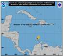
The Eastern Pacific is maintaining it's very Active Status this year, and we still have over 3 Months of Hurricane Season yet to unfold. Yikes!
And also keep in mind that, with active El Nino Years, November is *NOT* a 'Sleeper Month,' where not much of anything happens. Quite the obverse. Sometimes it's a *very active* month with numerous cyclones developing and/or entering into the Central Pacific Basin. Hurricane Iwa, in 1982, another El Nino Year, made landfall on Kauai in late November, mere DAYS before Thanksgiving. Obviously, many folks on Kauai didn't have a lot to be thankful for, other than their lives and their loved ones!!
So we have to remain VERY viligent right through November and even into December. Hurricane "PAKA" Formed in mid-December and went on to become TYPHOON PAKA, which SLAMMED Guam a week before CHRISTMAS(!) as a MAJOR Typhoon.
Now then, getting to the 'storm-of-the-day' ... seems the EastPac is just churning 'em out in assembly line fashion.
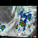
Now we have Cat. 2 Hurricane Guillermo, about midway between Mexico and the Hawaiian Islands. The good news is that Geillermo is tracking *farther north* than did FELICIA a week ago, and will traverse somewhat cooler SST's than did Felicia, and is also expected to start encountering some SW'erly shear in a day or two, which should lead to further weakening.
Here's a nice graphic of Guillermo spinning away harmlessly over the open ocean (we like 'em like that  ) and a "pretty nice hurricane", for those of us who find beauty in tropical cyclones, yet dread their horrifying effects when that beauty clashes with the doings of mankind and all the horrible effects they wreak on the ecosystem, the coral reefs, the native flora and fauna, and the like. ) and a "pretty nice hurricane", for those of us who find beauty in tropical cyclones, yet dread their horrifying effects when that beauty clashes with the doings of mankind and all the horrible effects they wreak on the ecosystem, the coral reefs, the native flora and fauna, and the like.

Wishing everyone a pleasant weekend. The breezy tradewinds have returned to Hawaii after Felicia's departure to the west, and they feel GREAT !! Lucky to live Hawaii. Aloha! 
Edited by CoconutCandy (Fri Aug 14 2009 10:51 PM)
|


 Flat
Flat

 ) and a "pretty nice hurricane", for those of us who find beauty in tropical cyclones, yet dread their horrifying effects when that beauty clashes with the doings of mankind and all the horrible effects they wreak on the ecosystem, the coral reefs, the native flora and fauna, and the like.


