F
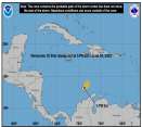
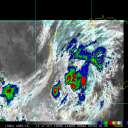
Current Radar or Satellite Image

Flhurricane.com - Central Florida Hurricane Center - Tracking Storms since 1995Hurricanes Without the Hype! Since 1995


Historic #HurricaneBeryl is now also the earliest #Cat 5 Hurricane in the Atlantic basin in recorded history
Days since last H. Landfall - US: Any 306 (Idalia) , Major: 306 (Idalia) Florida - Any: 306 (Idalia) Major: 306 (Idalia)
13.4N 64.0W
Wind: 155MPH
Pres: 938mb
Moving:
Wnw at 21 mph
Click for Storm Spotlight
20.2N 97.8W
Wind: 35MPH
Pres: 1007mb
Moving:
Wnw at 7 mph
Click for Storm Spotlight
Invest 96LClick for Invest Information from CIMSS
COMMUNICATION
STORM DATA
CONTENT
FOLLOW US


News Talkback >> 2005 Storm Forum

Pages: 1
Ed DunhamAdministrator
Former Meteorologist & CFHC Forum Moderator (Ed Passed Away on May 14, 2017)


Reged:
Posts: 2565
Loc: Melbourne, FL
Area of Interest - Invest 96L
      #47819 - Sat Aug 13 2005 12:31 AM

Fairly large but ill-defined tropical wave with a weak circulation located at 12.1N 43.2W at 13/04Z moving west at 12 knots. Between 21Z and 01Z the system actually made a short jog to the north - either under the influence of a weak trough well to the north northeast or simply an organizing relocation. Movement should be west to west northwest over the weekend. Pockets of shear (although not too strong) still are forecast to the north and west of the system, so development and intensification of this wave is likely to be slow.
ED


Post Extras: Print Post   Remind Me!   Notify Moderator  
Cycloneye11
Weather Hobbyist


Reged:
Posts: 70
Loc: San Juan,Puerto Rico
Re: Area of Interest - Invest 96L [Re: Ed Dunham]
      #47824 - Sat Aug 13 2005 06:54 AM

Agree with your comments about the system ED.As the subtropical ridge is not too strong the system will gain more latitud and be less of a threat to the islands.But still from where I am the watching will go ahead to see what occurs with it.

Post Extras: Print Post   Remind Me!   Notify Moderator  
B.C.Francis
Storm Tracker


Reged:
Posts: 331
Loc: Indiatlantic Florida
Re: Area of Interest - Invest 96L [Re: Cycloneye11]
      #47827 - Sat Aug 13 2005 09:43 AM

Well, looks like maybe we`ll have Jose in the next few days, if it misses the islands, I wonder where it will go from there if it keeps the west north west movement. Bahamas ?or move more to the north as a fish spinner ?......Weatherchef......... web page

Post Extras: Print Post   Remind Me!   Notify Moderator  
Ryan
Storm Tracker


Reged:
Posts: 281
Loc: Long Island, NY / Stuart, FL
TD#10 [Re: B.C.Francis]
      #47854 - Sat Aug 13 2005 07:42 PM

annoothherr TD in ou hands, as we bid goodbye to Irene, TD 10 pops up, i think she will continue a northwest track and with a fairly big trough in the central atlantic, do something like Irene, or unfortunatley afffect land, i think by the end of the weekend/monday we should have Tropical Storm Jose., just think if we do, last year we had Jeanne September 25th, and we could possibly have Jose by August 13-16

hope for the best, for everyone.

Summary, So Long Irene..and welcome TS Jose ???????????????

notice the ? marks

Ryan.

(off topic material removed)

Edited by Ed Dunham (Sat Aug 13 2005 09:24 PM)


Post Extras: Print Post   Remind Me!   Notify Moderator  
SkeetoBiteAdministrator
Master of Maps


Reged:
Posts: 298
Loc: Lakeland, FL
Re: Area of Interest - Invest 96L [Re: Ed Dunham]
      #47856 - Sat Aug 13 2005 08:28 PM

Models for TD#10


Missing UKMET for some reason.... checking into it.


Post Extras: Print Post   Remind Me!   Notify Moderator  
Pages: 1


Extra information
0 registered and 15 anonymous users are browsing this forum.

Moderator:  

Print Topic

Forum Permissions
      You cannot start new topics
      You cannot reply to topics
      HTML is disabled
      UBBCode is enabled

Rating:
Topic views: 6387

Rate this topic

Jump to

Note: This is NOT an official page. It is run by weather hobbyists and should not be used as a replacement for official sources. 
CFHC's main servers are currently located at
Hostdime.com in Orlando, FL.
Image Server Network thanks to Mike Potts and Amazon Web Services. If you have static file hosting space that allows dns aliasing contact us to help out! Some Maps Provided by:
Great thanks to all who donated and everyone who uses the site as well. Site designed for 800x600+ resolution
When in doubt, take the word of the National Hurricane Center