F
Current Radar or Satellite Image

Flhurricane.com - Central Florida Hurricane Center - Tracking Storms since 1995Hurricanes Without the Hype! Since 1995


90L crossing over Florida with flooding rains, strong winds and brief tornadoes/spouts. Next week eyes turn to W Gulf in active June pattern
Days since last H. Landfall - US: Any 288 (Idalia) , Major: 288 (Idalia) Florida - Any: 288 (Idalia) Major: 288 (Idalia)


Archives 2010s >> 2012 Storm Forum

cieldumort
Moderator


Reged:
Posts: 2311
Loc: Austin, Tx
Area of Concern: Tropical Storm Helene
      Tue Aug 07 2012 05:17 AM


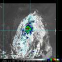
A healthy tropical wave with an associated surface low pressure has been tagged as Invest 92L.

As of 12:30 AM EDT 8/7/2012, Invest 92L is located roughly 250 miles southwest of the Cape Verde islands, moving westward at about 15 MPH.

92L follows on the heels of another unusually early Cape Verde feature, Invest 90L, which went on to become Tropical Storm Florence.

Unlike 90L/Florence, Invest 92L is running along at a slightly lower latitude. For comparison:
04/0000 UTC 13.3N 27.0W T1.5/1.5 90L
06/2345 UTC 11.2N 27.0W T1.0/1.0 92L

Considering that 92L is developing at a slower pace than 90L/Florence by this longitude, that it is located slightly deeper south with high pressure solid as a brick wall to its north, odds strongly favor 92L getting further west than north over the next 3 to 5 days.

As for intensity, 92L is presently in an environment marginally conducive for gradual strengthening, and which is the most likely scenario over the next 24-48 hours. SSTs in this region are running a warm 28C, shear is a light to moderate 10-20 knots, and has actually been easing, 92L's forward speed is not ripping at its internals the way we have recently seen with Ernesto, and excessively dry air is mostly to its north.

As long as 92L stays south of roughly 14N, it stands a much better chance of gradually developing and making it farther west. Should it have a burst of development, and veer poleward, it could very well encounter much the same fate as (X) Florence, which is now a struggling remnant tropical low.

In summary, given 92L's present position, likely track, and environment, it is increasingly possible that this feature becomes yet another extremely early Atlantic tropical cyclone. (NHC has recently given it a 20% chance of developing within the next 48 hours, which could be conservative).

Post Extras Print Post   Remind Me!     Notify Moderator


Entire topic
Subject Posted by Posted on
* Area of Concern: Tropical Storm Helene cieldumort Tue Aug 07 2012 05:17 AM
. * * Re: Area of Interest - Tropical Depression 7 cieldumort   Fri Aug 17 2012 09:03 PM
. * * Re: Area of Interest - Tropical Storm Helene danielwAdministrator   Fri Aug 17 2012 09:34 PM
. * * Re: Area of Interest - Tropical Storm Helene WeatherNut   Fri Aug 17 2012 11:10 PM
. * * Re: Area of Interest - Tropical Depression 7 cieldumort   Fri Aug 17 2012 07:26 AM
. * * Re: Area of Interest - Tropical Depression 7 weatherhead   Fri Aug 17 2012 12:15 PM
. * * Re: Area of Interest - Invest 92L Ed DunhamAdministrator   Thu Aug 09 2012 04:19 AM
. * * Re: Area of Interest - Invest 92L LoisCane   Thu Aug 09 2012 08:12 PM

Extra information
0 registered and 2 anonymous users are browsing this forum.

Moderator:  


Forum Permissions
      You cannot start new topics
      You cannot reply to topics
      HTML is disabled
      UBBCode is enabled

Rating:
Thread views: 4914

Rate this thread

Jump to

Note: This is NOT an official page. It is run by weather hobbyists and should not be used as a replacement for official sources. 
CFHC's main servers are currently located at Hostdime.com in Orlando, FL.
Image Server Network thanks to Mike Potts and Amazon Web Services. If you have static file hosting space that allows dns aliasing contact us to help out! Some Maps Provided by:
Great thanks to all who donated and everyone who uses the site as well. Site designed for 800x600+ resolution
When in doubt, take the word of the National Hurricane Center