F
Current Radar or Satellite Image

Flhurricane.com - Central Florida Hurricane Center - Tracking Storms since 1995Hurricanes Without the Hype! Since 1995


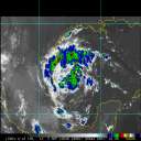
#93L now a small better defined circulation with deep convection set to come ashore N of Tampico, MX. Recon investigating. Still 40% odds.
Days since last H. Landfall - US: Any 298 (Idalia) , Major: 298 (Idalia) Florida - Any: 298 (Idalia) Major: 298 (Idalia)


News Talkback >> 2008 News Talkbacks

MikeCAdministrator
Admin


Reged:
Posts: 4560
Loc: Orlando, FL
Not Much in the Tropics Today
      Wed Aug 06 2008 02:35 PM

Friday August 8 Update 10:15AM
The low east of the Bahamas has dissipated and there is very little to nothing going on in the tropics right now. It's likely there won't be anything to talk about until the end of next week, but it is August so watching for spin ups is still worth doing.

The latter half of August into September starts the peak of the season, so it would be wonderful if nothing occurs up through then.

For now, nothing, but watch off Africa or the mid Atlantic sometime late next week.


Original Update
With Edouard moving across Texas generating rain, we look to the rest of the tropics, and the old wave (formerly 99L) that was being watched some last week is starting to near the Bahamas, and has a small chance to develop before reaching or after crossing over Florida.

The most likely near term scenario is that it provides an extra boost of rain to the Bahamas and Central/South Florida when it crosses.

Because of the location this will be watched closely over the next few days. It currently isn't being tracked as an "Invest" area, so the usual class of models are not available for it yet.


East of Bahamas Low Development Chances in Next 24 hours
Code:

(forget it) 0 1 2 3 4 5 6 7 8 9 10 (sure thing)
[-*------------------]


This is the only game in town in the Atlantic Basin right now.

More discussion here

Event Related Links:

{{StormCarib}}
Florida Keys Long Range Radar Loop
Tampa, FL Long Range Radar Loop
Miami, FL Long Range Radar
Melbourne, FL Long Range Radar

Post Extras Print Post   Remind Me!     Notify Moderator


Entire topic
Subject Posted by Posted on
* Not Much in the Tropics Today MikeCAdministrator Wed Aug 06 2008 02:35 PM
. * * Re: Wait for it... Storm Hunter   Sun Aug 10 2008 01:46 AM
. * * Re: Wait for it... craigm   Sat Aug 09 2008 01:07 PM
. * * Re: Wait for it... metwannabe   Sat Aug 09 2008 11:17 AM
. * * Wait for it... HanKFranK   Sat Aug 09 2008 05:15 AM
. * * Re: Not Much in the Tropics Today Robert   Fri Aug 08 2008 02:54 PM
. * * Re: Quiet Out There Storm Surfer   Fri Aug 08 2008 12:58 PM
. * * Quiet Out There mikethewreck   Fri Aug 08 2008 12:25 PM
. * * Re: Watching Wave East of the Bahamas LoisCane   Thu Aug 07 2008 08:41 PM
. * * Re: Watching Wave East of the Bahamas M.A.   Thu Aug 07 2008 09:42 AM
. * * Re: Watching Wave East of the Bahamas LoisCane   Wed Aug 06 2008 10:02 PM
. * * Re: Watching Wave East of the Bahamas craigm   Wed Aug 06 2008 06:13 PM
. * * Re: Watching Wave East of the Bahamas kpost   Wed Aug 06 2008 04:50 PM
. * * Re: Watching Wave East of the Bahamas Patrick99   Wed Aug 06 2008 03:53 PM
. * * Re: Watching Wave East of the Bahamas Lee-Delray   Wed Aug 06 2008 02:43 PM

Extra information
0 registered and 122 anonymous users are browsing this forum.

Moderator:  


Forum Permissions
      You cannot start new topics
      You cannot reply to topics
      HTML is disabled
      UBBCode is enabled

Rating: *****
Thread views: 9802

Rate this thread

Jump to

Note: This is NOT an official page. It is run by weather hobbyists and should not be used as a replacement for official sources. 
CFHC's main servers are currently located at Hostdime.com in Orlando, FL.
Image Server Network thanks to Mike Potts and Amazon Web Services. If you have static file hosting space that allows dns aliasing contact us to help out! Some Maps Provided by:
Great thanks to all who donated and everyone who uses the site as well. Site designed for 800x600+ resolution
When in doubt, take the word of the National Hurricane Center