11 PM EDT 28 August 2011 Update
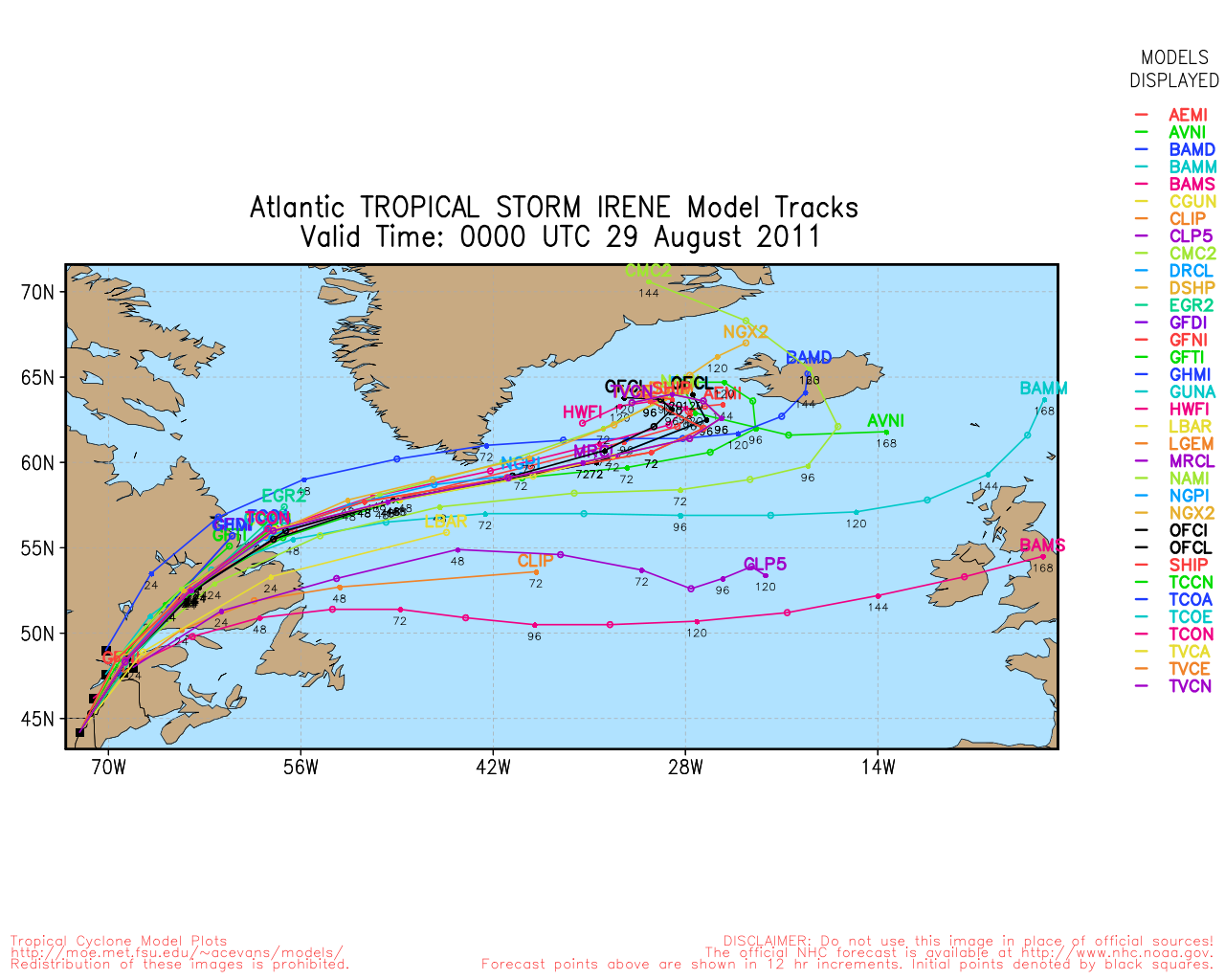
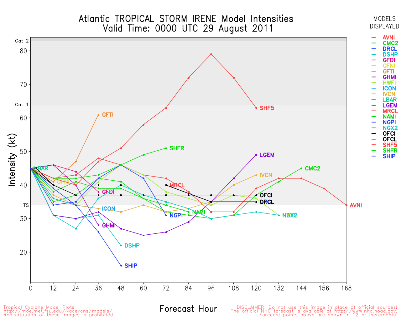
The last advisory on Irene was just issued. Irene is very likely to be retired as a name.
10 PM EDT 28 August 2011 Update
The invest 92L has a 100% chance to develop and advisory should be issued on it shortly later tonight or tomorrow. Odds still favor a recurve, but are dropping. There will be a long time to watch this one, hot towers are firing around the center and something may form at any time.
The general center of 92L seems to be forming just south of 10 N.
Power outages across the Irene landfall area continue, with the worst inland flooding reports coming from Vermont, Western Massachusetts, Northwest New Hampshire, and upstate New York. Events in Vermont may make this the worst storm in Vermont's history as multiple reports of historic buildings and bridges of being destroyed by floodwaters.
Original Update
Irene has made landfall near Little Egg Inlet, officially as a 75mph hurricane.
Irene continues to weaken as it heads generally north northeast the wind and rain should continue over New England today.
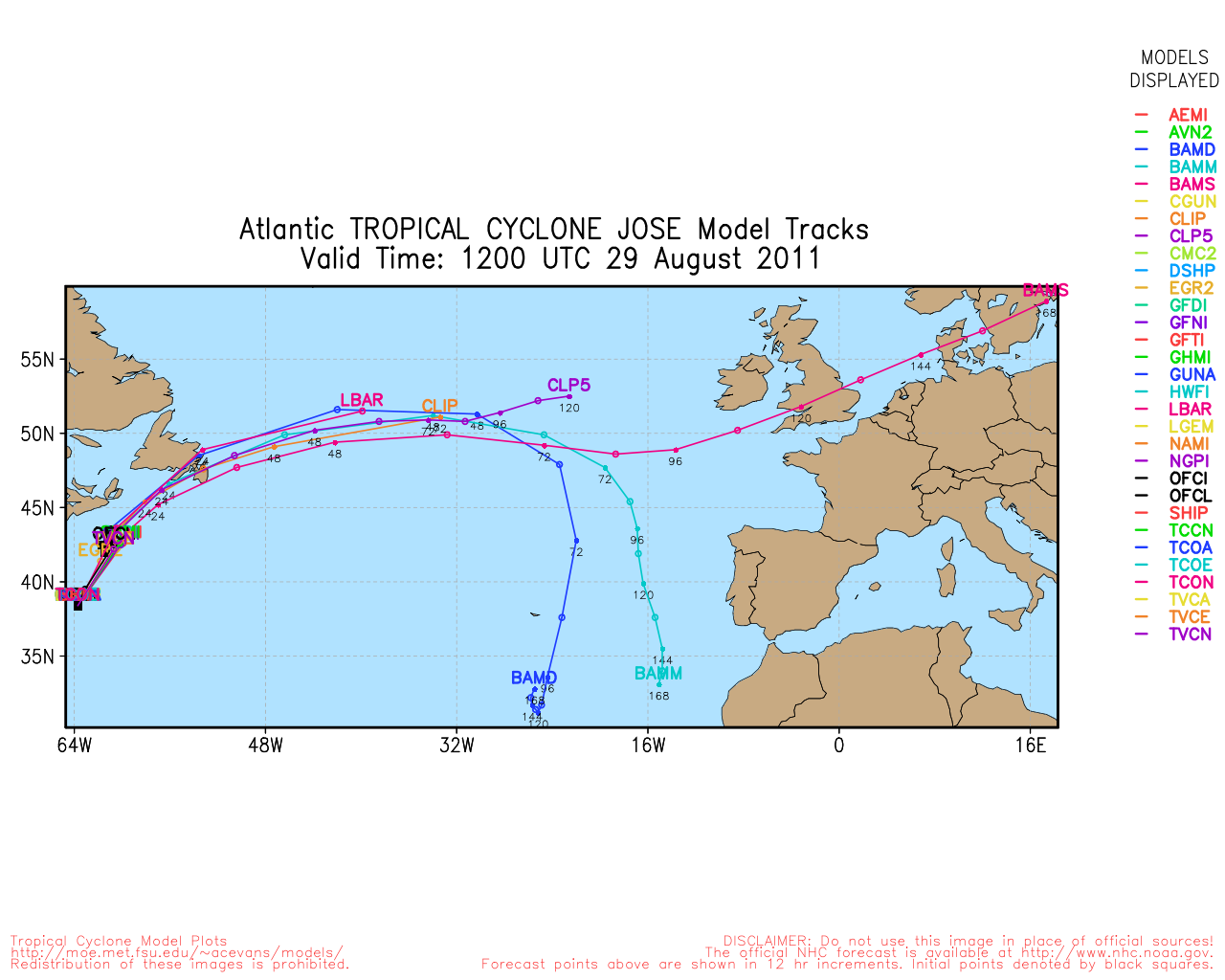
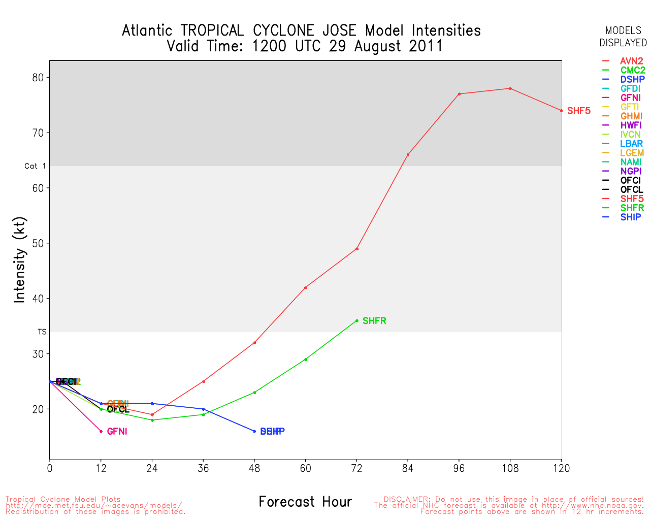
Meanwhile southwest of Bermuda, Jose has formed from 91L, it is expected to stay west of Bermuda and not make landfall, because of the proximity Tropical Storm Warnings are up for Bermuda.
'
Elsewhere, a large wave exiting from Africa (92L) has a 40% chance to develop in the next few days. Odds favor this recurving also, but it is not as certain as the last wave.
Event Links
Flhurricane Disaster and preparatory information thread.
Landfall Area Media:
WECT 6TV - Wilmington, NC
WITN 7 - Eastern North Carolina TV (NBC)
WCTI 12 - Eastern North Carolina (ABC)
WNCT TV 9 - Eastern North Carolina (CBS)
Wavy 10 (NBC) - Hampton Roads/VA Beach, VA TV
WTKR 3 (CBS) - Hampton Roads/VA Beach, VA
WVEC 13 (ABC) - Hampton Roads/VA Beach, VA
Webcams: (south to north)
Live Myrtle Beach Cam
Myrtle Beach Earthcam
Bar Harbor Myrtle Beach Live Cam
Crown Reef Myrtle Beach Live Cam
North Myrtle Beach Controllable Cam (Flhurricane Recording of this camera
Holden Beach, NC Cam (flhurricane recording)
Oriental, NC Harbor Cam -- flhurricane recording
HurricaneTrack.com Tower Cam 1 (Hatteras) -- Flhurricane recording
Dare County Em Management
Papers:
Outer Banks Sentinel
Wilmington Star News Online
Hampton Roads Pilot
Power Outage Maps (roughly south to north)
Eastern Carolinas Power outage map
Virginia Power outage map
DelMarva Power outage map
Novec/Northern Virginia Power outage map
Portions Maryland/DC power outage Map
Baltimore area Power outage map
Southern Maryland Power outage map
Southeastern Pennsylvania Outage Map
Atlantic City (Southern New Jersey) Power outage map
Jersey Central Power outage map
Northern New Jersey PSEG outage map
New York City/ConEd Power outage map
Long Island Power outage map
Connecticut Power outage map
Rhode Island/Mass Power outage map
New Hampshire Power outage map
Audio streams of Various police/EM scanners
Keep up with where Mark Sudduth (Hurricanetrack.com) is as he drives around the Outer Banks of North Carolina
Chasercam live
CrazyMother Severe Weather Live Feed (Lot's of Nature Here)
Irene Storm Surge Probabilities
Hope Town Fire rescue on Abaco Island, storm information
Updated Map of Mark Sudduth from HurricaneTrack.com, with video and radar for Irene approach See HurricaneTrack.com for more information.
RGB satellite recording of Irene.
Long Term Long Range US Radar of Irene
Level 3 Radar recording of Irene's NC approach (HCW)
Map plot of Irene overlaid on Hurricane Floyd (1999) as well as other notable New England storms
Long term Central Atlantic wide area Water Vapor Satellite for Hurricane Season Peak flhurricane)
Long term West Atlantic wide area Water Vapor Satellite for Hurricane Season Peak flhurricane)


 Threaded


