cieldumort
Moderator

Reged:
Posts: 2338
Loc: Austin, Tx
|
 Wave Watching: 94L in Caribbean and also 95L out in the Tropical Atlantic
Tue Jun 25 2024 03:06 PM
|
|
|
2:30AM EDT 27 June 20214 Update
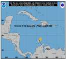
It is clear that seasonal predictions suggesting 2024 could see an early start to the heart of the hurricane season owing to expected extraordinarily favorable conditions for development in the Tropical Atlantic may already verifying this week into next with 95L, and perhaps even another wave coming in behind it that is not yet Invest tagged.
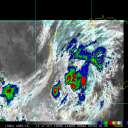
While Invest 94L presently in the Caribbean still has more of that typical early season flavor, these two approaching waves from the east do not. Those in or with interests in the Antilles may want to begin paying very close attention to these two systems.
We now have a Lounge up for 95L and will go deeper into model output there.
As of the time of this update, NHC has 70% development odds within 7 days for 95L. What is not readily apparent in these odds, is that the Main Development Region (east of the Caribbean) is presently August/September-like levels of conducive for development, suggesting that should TC genesis occur, which is likely, such a system could become quite strong.
95L Forecast Lounge
7:45PM EDT 26 June 20214 Update
95L is now up to 60% chance for development, and the forecast is unusually conducive for late June.
4PM EDT 26 June 20214 Update
Invest 95L is now being tracked in the central Atlantic, with a 40% chance to develop and sometimes very strong model support. Those in the Lesser Antilles of the Caribbean should watch it closely Sunday/Monday.
Original Update
As we head into the last week of June the trend for early development coming out of the Central American Gyre shifts to more development from approaching tropical waves, "home grown" old frontal boundaries and other methods, until the CAG season returns in fall.
We have been watching a couple of impressive waves coming in from Africa and two in particular have our attention.
First, we have a hearty wave now in the eastern Caribbean that has just been Invest tagged, 94L. It has a slight chance of development in the near term, but its chances could be going up if and once it is in the west or northwestern Caribbean, and probably even more so if it makes it into the Bay of Campeche, much like Alberto and 93L before it.
Behind 94L, yet another wave has seen some model support for development late this week or next, although at the moment it is being held in check by a blast of dry and dusty Saharan air that is crossing the Atlantic. This one is not yet Invest tagged.
{{StormLinks|TD#2|02|2|2024|Two|Tropical Depression Two}}
{{StormLinks|94l|94|3|2024|94|lnvest 94L}}
{{StormCarib}}
Edited by CFHC (Fri Jun 28 2024 03:11 PM)
|
|


 Flat
Flat


