F
Current Radar or Satellite Image

Flhurricane.com - Central Florida Hurricane Center - Tracking Storms since 1995Hurricanes Without the Hype! Since 1995


#Beryl on track to become a Major while crossing or near the Windwards. Low behind it now Invest #96L with 70% odds. #94L in Bay of Campeche as well. What month is this?
Days since last H. Landfall - US: Any 304 (Idalia) , Major: 304 (Idalia) Florida - Any: 304 (Idalia) Major: 304 (Idalia)
10.7N 53.1W
Wind: 100MPH
Pres: 981mb
Moving:
W at 21 mph
Click for Storm Spotlight
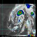
Invest 94LClick for Invest Information from CIMSS
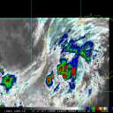
Invest 96LClick for Invest Information from CIMSS
COMMUNICATION
STORM DATA
CONTENT
FOLLOW US


General Discussion >> The Tropics Today

allan
Weather Master


Reged:
Posts: 468
Loc: Palm Coast, Florida
96L/ TD15 lounge
      Thu Oct 11 2007 11:59 AM

While I do believe 96L has maintained TD status throughout the morning, it's still known as 96L. Should move harmessly out to sea affecting only the fish thus the reason why we call these fish storms. It MAY become Noel but very little chance. However, the BAMM model shows 96L moving south which could have a better chance at becoming Noel.. so we'll see, nothing too important.

--------------------
Allan Reed - 18,9,5

Post Extras Print Post   Remind Me!     Notify Moderator


Entire topic
Subject Posted by Posted on
* 96L/ TD15 lounge allan Thu Oct 11 2007 11:59 AM

Extra information
0 registered and 18 anonymous users are browsing this forum.

Moderator:  


Forum Permissions
      You cannot start new topics
      You cannot reply to topics
      HTML is disabled
      UBBCode is enabled

Rating:
Thread views: 3696

Rate this thread

Jump to

Note: This is NOT an official page. It is run by weather hobbyists and should not be used as a replacement for official sources. 
CFHC's main servers are currently located at Hostdime.com in Orlando, FL.
Image Server Network thanks to Mike Potts and Amazon Web Services. If you have static file hosting space that allows dns aliasing contact us to help out! Some Maps Provided by:
Great thanks to all who donated and everyone who uses the site as well. Site designed for 800x600+ resolution
When in doubt, take the word of the National Hurricane Center