F
Current Radar or Satellite Image

Flhurricane.com - Central Florida Hurricane Center - Tracking Storms since 1995Hurricanes Without the Hype! Since 1995


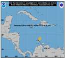
#HurricaneBeryl is now an extremely dangerous, one-of-a-kind Category 4 Hurricane and could be making a run for Cat 5 prior to landfall.
Days since last H. Landfall - US: Any 305 (Idalia) , Major: 305 (Idalia) Florida - Any: 305 (Idalia) Major: 305 (Idalia)
11.1N 56.5W
Wind: 130MPH
Pres: 960mb
Moving:
Wnw at 18 mph
Click for Storm Spotlight
19.8N 95.6W
Wind: 35MPH
Pres: 1006mb
Moving:
W at 12 mph
Click for Storm Spotlight
Invest 96LClick for Invest Information from CIMSS
COMMUNICATION
STORM DATA
CONTENT
FOLLOW US


General Discussion >> Hurricane Ask/Tell

Margie
Senior Storm Chaser


Reged:
Posts: 1191
Loc: Twin Cities
Paint me confused
      Sun Jun 25 2006 06:18 PM

This probably belongs in the other thread you started, but I just wanted to note on your comment, "That's why I take issue with the papers coming out attributing 2005's season to SSTs and anthropogenic global warming, suggesting warmer waters in the tropical Atlantic (10-20N) led to the record number of storms." Actually, both sides claim that warmer SSTs are responsible, and that the warmer SSTs do cause a set of associated atmospheric conditions that contribute to hurricane activity. NOAA's hurricane forecast is very specific about this:

"The regional atmospheric circulation contributing to these long-period fluctuations in hurricane activity is strongly linked to the tropics-wide multi-decadal signal"

and they have a slide showing all of the associated atmospheric conditions that are generated by warm SSTs, in the same way that ENSO effects upper level winds over the ATL.

However, NOAA and William Gray say the warm SSTs are only due to the AMO (i.e, Atlantic Multidecadal Oscillation, multi-decadal signal, multi-decadal oscillation, thermohaline circulation), and climate scientists say the warm SSTs are due mainly in part to AGW.

Also, from the AOML website, a clear definition of the AMO:

"The AMO is an ongoing series of long-duration changes in the sea surface temperature of the North Atlantic Ocean, with cool and warm phases that may last for 20-40 years at a time and a difference of about 1°F between extremes."

This is consistent with Kerr's definition (he coined the phrase, AMO).

--------------------
Katrina's Surge: http://www.wunderground.com/hurricane/Katrinas_surge_contents.asp

Post Extras Print Post   Remind Me!     Notify Moderator


Entire topic
Subject Posted by Posted on
* Paint me confused Margie Sun Jun 25 2006 06:18 PM
. * * Re: Paint me confused Clark   Sun Jun 25 2006 08:49 PM
. * * Clark.. can you talk to me about the wave east of the islands LoisCane   Mon Jun 26 2006 12:28 AM
. * * Re: Paint me confused Margie   Sun Jun 25 2006 10:17 PM
. * * Re: Paint me confused cieldumort   Thu Jun 29 2006 04:14 AM
. * * Re: Paint me confused Clark   Mon Jun 26 2006 01:22 PM
. * * Re: Paint me confused Convergence   Mon Jun 26 2006 09:17 PM
. * * Re: Paint me confused cieldumort   Thu Jun 29 2006 04:00 AM
. * * Re: Paint me confused cieldumort   Sun Jun 25 2006 07:56 PM
. * * Re: Paint me confused ftlaudbob   Sun Jun 25 2006 06:29 PM

Extra information
1 registered and 31 anonymous users are browsing this forum.

Moderator:  


Forum Permissions
      You cannot start new topics
      You cannot reply to topics
      HTML is disabled
      UBBCode is enabled

Rating:
Thread views: 6167

Rate this thread

Jump to

Note: This is NOT an official page. It is run by weather hobbyists and should not be used as a replacement for official sources. 
CFHC's main servers are currently located at Hostdime.com in Orlando, FL.
Image Server Network thanks to Mike Potts and Amazon Web Services. If you have static file hosting space that allows dns aliasing contact us to help out! Some Maps Provided by:
Great thanks to all who donated and everyone who uses the site as well. Site designed for 800x600+ resolution
When in doubt, take the word of the National Hurricane Center