MikeC
Admin
Reged:
Posts: 4811
Loc: Orlando, FL
|
|
11:00AM EDT 20 September 2022 Update
TD#8 forms, in the Central Atlantic, will stay out to sea.
98L Up to 70% chance for development, and will need to be monitored closely.
9:00AM EDT 20 September 2022 Update
Major Hurricane Fiona is near the Turks and Caicos islands this morning and is heading up toward Bermuda, but likely staying enough west to keep hurricane conditions out, but tropical storm conditions in. Beyond that Nova Scotia and Newfoundland in Canada may have to deal with Fiona.
Beyond FIona there's an area in the Central Mid Atlantic (97L) that has an 80% chance to develop, and will likely become Gaston today or tomorrow, however this system is moving north and out and will likely not direct affect land.
Another area east of the Caribbean islands has a 50% chance to develop when it gets closer to the Caribbean, and will likely move into the Caribbean and reach closer to the western Caribbean. This one will likely keep our attention well into next week. The Windward Islands should watch this closely as well. Now being tracked as Invest 98L.
8:00PM EDT 19 September 2022 Update
Hurricane Fiona is now back over the Atlantic and a category 2 storm, the eye has cleared out. But only after moving over Guadaloupe, Puerto Rico and The Dominican Republic. The flooding in Guadalupe and especially Puerto Rico has been catastrophic. With power still out to almost all the island. The bands thankfully are starting to thin out this evening, but a few are still over the island.
The Turks and Caicos will be dealing with a strengthening Fiona soon, and Bermuda will be close on Thursday according to the forecast. Hurricane Warnings are up for the Turks and Caicos and extreme southeast Bahamas. Watches may go up for Bermuda tomorrow or Wednesday. Beyond Bermuda, Newfoundland and northeastern Nova Scotia should monitor it also.
Beyond Fiona, an area east of the Caribbean has a 30% chance to develop over the next 5 days, and will likely be the next system to watch closely as models suggest it could get into the western Caribbean and turn north at some point.
Another area in the central Atlantic has a 40% chance to develop but unlikely to affect any land
8:00PM EDT 18 September 2022 Update
Hurricane Fiona made landfall in extreme southwestern Puero Rico around 3:35PM in the afternoon, bringing extreme flooding rainfall to much of Puerto Rico and very widespread power outages. The system is currently heading a bit west of the official track and is near Mona Island between Puerto Rico and the Dominican Republic. It's expected to move north fairly soon an may get close enough to the Turks and Caicos for Tropical storm force winds, although if it moves west enough, hurricane force winds may arrive. Beyond then a major hurricane is forecast and it eventually may get close to Bermuda late Thursday.
8:00AM EDT 18 September 2022 Update
Fiona is getting more organized this morning and forecast to become a hurricane before crossing the western part of Puerto Rico late today. Flooding and Mudslides in PR are possible. Beyond this tropical storm watches are up for the Turks and Caicos and southeastern Bahamas. Forecast takes it just east of there, however. Beyond this Bermuda should watch.
11:00AM EDT 17 September 2022 Update
Hurricane Warnings are up for Puerto Rico this morning as Fiona is expected to reach hurricane strength before nearing Puerto Rico Sunday evening. Due to where it's likely to cross near Puerto Rico, the risk of heavy rain and mudslides is high. Fiona has gotten a little disorganized this morning, but is also entering an area more favorable for development. Since fiona's structure is still quite sound, its likely to take advantage of that tomorrow, and thus the warnings.
A Hurricane Watch has also been issued for the US Virgin Islands. A hurricane watch and Tropical Storm warning remains up for parts of the Dominican Republic. Beyond this the Turks and Caicos and Bermuda should keep close watch.
8:00AM EDT 17 September 2022 Update
Tropical Storm Fiona's position shifted this morning back down, convection is heavy, but the center was a bit disrupted by the islands since recon found a bit lower winds since the 8am advisory. However, it's poised to enter a more favorable area for development soon and has a chance to become a hurricane before nearing Puerto Rico and the DR. Therefore hurricane watches are up (And tropical storm warnings) for Puerto Rico and eastern parts of the Dominican Republic.
Beyond this, perhaps the Turks and Caicos islands and eastern Bahamas.
Either way Fiona is forecast to become a hurricane just before it reaches the Dominican Republic.
11:00PM EDT 16 September 2022 Update
Tropical Storm FIona has passed over the island of Guadeloupe tonight and now has entered the Caribbean. It managed to form some convection closer to the center tonight and is back up to 60mph winds. Tropical Storm Warnings now extend into the Dominican Republic. Hurricane Watches may go up there if Fiona continues to strengthen. Tomorrow it will pass south of the Virgin Islands and Puerto Rico and likely begin to slow down once past there, and turn to the north. The southeastern Bahamas may also have tropical storm watches tomorrow or Sunday.
Beyond this, there's still a bit of a spread in the models, but it's unlikely to affect the mainland US and stay offshore, although it's still worth monitoring to see how far west Fiona gets before turning. The 's official track is the most likely. Bermuda may also need to watch in the longer term.
7:45AM EDT 16 September 2022 Update
Tropical Storm Fiona is sheared and moving rapidly to the west and has even slipped a little south of west since Yesterday. The exposed center remains to the west of the convection. Tropical Storm Warnings are up for Antigua, Barbuda, Saint Kitts, Nevis, Montserrat, Anguilla, Saba, Saint Eustatius, Saint Maarten, Guadeloupe, Saint Barthelemy. And watches are up for Puerto Rico and the Virgin Islands. Those that get into the convection may see quite a bit of rainfall, some of it potentially flooding. But the system is moving too quickly to really get a chance to strength much.
It's forecast to get to Hispaniola then start to turn north, possibly slowly. Beyond this point there remains a ton of questions. The factors include the forward speed of Fiona (currently, it may be ahead of schedule), the land interaction from Hispaniola,, and a lot more. Therefore the forecast models have a tremendous amount of spread once past the islands. The consensus has shifted further west from yesterday, and depending on if Fiona continues to be ahead of schedule today and remains more weak, could shift more. In short, those in the Bahamas, Bermuda, and the Eastern US (From Florida to Cape Cod) should continue to monitor it, once it gets away from the Caribbean several factors go away which may make it more clear on the path it goes.
There are also 2 other areas in the Atlantic, one Northwest of Bermuda with a 10% chance to develop, and another in the east Atlantic with a 20% chance. Neither will likely impact land, although Bermuda should watch the one closer to it.
7:30PM EDT 15 September 2022 Update
Fiona has managed to get up to 60mph (From recon) despite it's convection running behind its center. The outflow still remains impressive, but the short tem future is probably a bit weaker or sustained for a bit. The models have shifted a good deal west of earlier positions as well, implying a weaker system, and increasing the threat to the Bahamas and the US. It is something that needs to be monitored.
The islands near the path of Fiona may see flooding rainfall in parts, especially once on the eastern side of the Center. The Dominican Republic in particular may see some of the worst from that on Monday.
A Tropical Storm Warning is in effect for...
* Antigua, Barbuda, St. Kitts, Nevis, Montserrat, and Anguilla
* Saba and St. Eustatius
* St. Maarten
* Guadeloupe, St. Barthelemy, and St. Martin
A Tropical Storm Watch is in effect for...
* Puerto Rico, including Vieques and Culebra
* U.S. Virgin Islands
* British Virgin Islands
10:45PM EDT 14 September 2022 Update
Tropical Storm Fiona has formed east of the Leeward islands A Tropical Storm Watch is in effect for. Saba and St. Eustatius, St. Maarten, Antigua, Barbuda, St. Kitts, Nevis, Montserrat, and Anguilla. This will likely expand westward into the Virgin Islands and Puerto Rico tomorrow.
Beyond the Caribbean islands, it's a bit difficult to say with any certainty, but the eastern Bahamas should watch closely. Currently most long range models keep it away from the SE US, but there is a lot in play that may change this, so it's worth monitoring there as well. But odds favor it staying away once past the Bahamas.
The system itself is somewhat lopsided, but the storm has strengthened to about 50mph winds. So strengthening of the storm will likely be slow to occur during the next day or so. It could move into a less hostile environment in a couple of days where it has a chance to become stronger. Especially if it manages to avoid Puerto Rico and especially Hispaniola.
9:45PM EDT 14 September 2022 Update
Tropical Storm Fiona has formed from TD#7 after a ASCAT Pass showed winds above tropical storm force at 50mph.
A Tropical Storm Watch is in effect for...
* Saba and St. Eustatius
* St. Maarten
* Antigua, Barbuda, St. Kitts, Nevis, Montserrat, and Anguilla
7PM EDT 14 September 2022 Update
Tropical Depression 7 formed earlier today from invest area 96L. No tropical storm watches or warnings are up yet, but could as early as late tonight or tomorrow morning. The next name on the list is Fiona
Those in the Leeward Islands, Virgin Islands, and Puerto Rico and Hispaniola should watch this closely. Beyond this, the Bahamas (particularly eastern Bahamas) should also pay attention. The southeast needs to monitor it, but the odds favor it staying offshore from there at the moment, but with a fair bit of spread in the models it could change. Bermuda should monitor it as well.
8AM EDT 14 September 2022 Update
Invest area 96L has jumped up to 70% chance to develop in 48 hours overnight and has gotten a bit better organized overnight and is close to tropical depression status. Those in the Leeward Islands, the Virgin Islands, and Puerto Rico should monitor the progress of
this system.
Beyond that, the models are spread from Texas to Bermuda on it beyond there with varying strengths, so it'll likely be something to keep an eye on into late next week. How much land interaction with the islands may have a tremendous impact on future track The next name is Fiona.
9AM EDT 13 September 2022 Update
The central Atlantic wave is now being tracked as Invest area 96L.
Original Update
After a fairly slow start to the week after Earl has passed there's something worth watching again in the Atlantic.
The area in the Central Atlantic has increased to 40% chance for development over the next 5 days, and has mixed model support for this. Those in the Northeastern Caribbean Islands should monitor this closely as it is moving fairly quickly and could reach the northeastern part as soon as this Friday, and may be close to the Virgin Islands and Puerto Rico by Sunday. Some models, such as the keep it moving quickly and never develop it, while most others are a little bit slower and do develop it close to the islands. The Canadian model is in between the others. Beyond this much depends on the interaction with the greater Antilles, but this system is something to watch closely into next week. This system is currently not being tracked as an Invest, but likely to become so later today.
The system in the east Atlantic has a 20% chance to develop and will likely stay out to sea.
Beyond this another wave may be worth watching once in the Atlantic, but still too soon to say for sure.
Fiona Animations/cams recordings
|
MichaelA
Weather Analyst

Reged:
Posts: 956
Loc: Pinellas Park, FL
|
|
The models are pretty inconclusive this AM. Even so, my alert level is raised to about a 3 on a scale of 1 - 10. Time to review storm preparedness supplies and procedures, though. I’m in northern NY on vacation, but my daughter is at home in Florida. She’s usually well aware of weather forecasts having been raised by me.
--------------------
Michael
PWS
|
IsoFlame
Weather Analyst

Reged:
Posts: 411
Loc: One block off the Atlantic Oce...
|
|
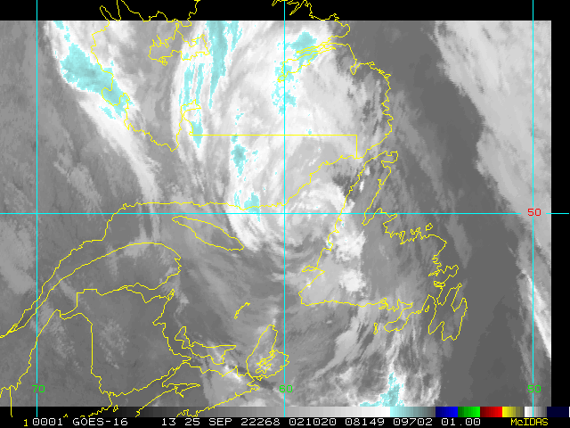
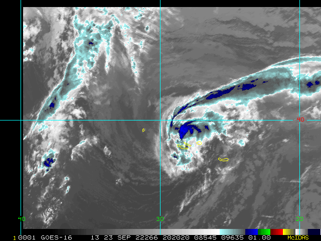
The GOES 16 IR loop today has a burst of deep convection surging a bit south of west toward the center. Willing to bet wind gusting 60+ mph in this convective flare-up.
--------------------
CoCoRaHS Weather Observer (FL-VL-42) & Surf Forecaster: https://www.surf-station.com/north-florida-surf-forecast-3/
|
MichaelA
Weather Analyst
Reged:
Posts: 956
Loc: Pinellas Park, FL
|
|
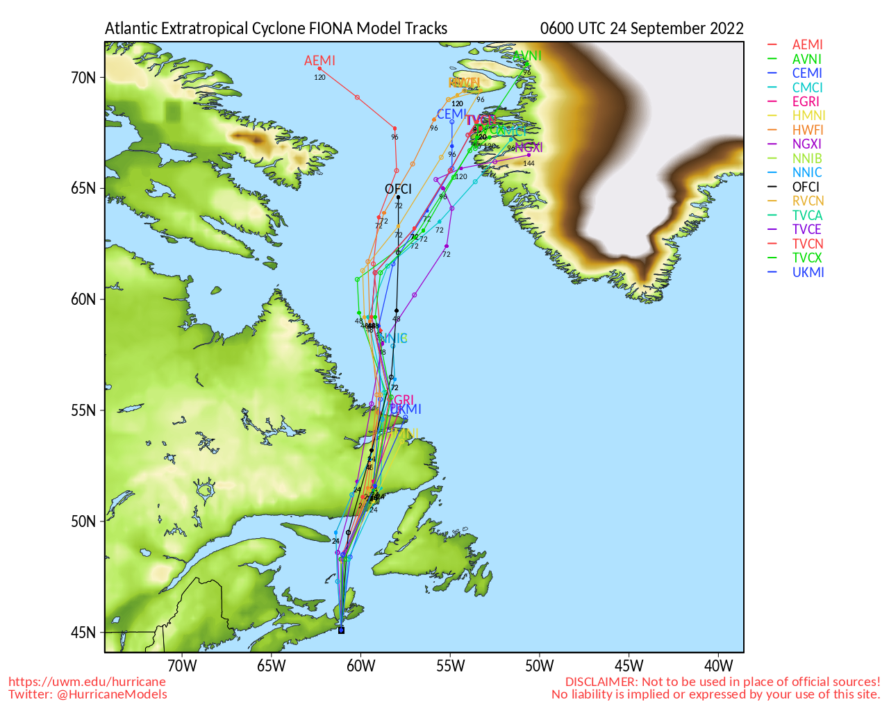
The overnight models are coming into more agreement on a path through or just east of the Bahamas. After that, they spread from near the Outer Banks to a more northeastward track well offshore. All of that is dependent on whether Fiona holds together over the larger islands.
--------------------
Michael
PWS
|
MikeC
Admin
Reged:
Posts: 4811
Loc: Orlando, FL
|
|
Several cameras and radars added to Image Recordings on the right for the USVI And Fiona
|
MikeC
Admin
Reged:
Posts: 4811
Loc: Orlando, FL
|
|
Recon is showing the system is either doing a bit of the loop or jogging back southwest. With the new convection, at the forecast, I'm curious why the Dominican Republic only has a tropical storm warning. Hurricane Watches are usually issued for that type of forecast. PR could maybe even use one since it's looking a bit better tonight and recon is showing some pressure drops.
|
MikeC
Admin
Reged:
Posts: 4811
Loc: Orlando, FL
|
|
Link for camera recordings and radars
For live feeds of them the links are usually under the camera description
http://flhurricane.com/cyclone/animationlist.php?year=all&tag=Fiona+%282022%29
|
MikeC
Admin
Reged:
Posts: 4811
Loc: Orlando, FL
|
|
Fiona's ranbands look like Harvey style rainbands. There's been a few daytime flooding photos, but nothing since dark. So Puerto Rico is in a world of hurt tonight.
|
|


 Threaded


