11PM EDT Update 25 September 2022 Update
Tropical Storm Ian has gained strength this evening and is forecast to become a hurricane tomorrow. The cone of uncertainty has shifted right this evening. Tropical Storm Warnings are up for the Lower Florida Keys, and a Tropical Storm Watch is up from Englewood south to Chokoloskee. More watches and warnings are likely tomorrow. Ian is going to come dangerously close to the west coast of Florida, and likely will force evacuations closures in some of the surge prone areas. For information for your particular area check local media and officials. floridadisaster.org has links to varying county sites for more information as well. Local National Weather Service offices (Tampa for the west coast of Florida) may have more local information as well.
The track is still uncertain in the 3-5 day range and adjustments may still occur. Because of the angle of the approach it won't take much for landfall, and even if it doesn't make landfall in your area, if it's close enough it will still impact you. Note that the track slows down later in the forecast period, which would likely bring flooding rains to some parts of Florida, possibly even well inland.
5PM EDT Update 25 September 2022 Update
Tropical Storm Ian is moving west northwest and now expected to become a hurricane tomorrow, as it has struggled to consolidate today. Modeling has shifted east and so has the official track by about 20 miles or so. Since Ian is likely to be a large (in area) storm in the Gulf, wind and surge impacts will be large enough to be felt along the west coast of Florida, stronger the closer it gets to the coast. There is still significant spread in the forecast models, but most have shifted to the right today, increasing the risk for the west coast of Florida and Big Bend area. Anyone in the cone should prepare for this system, as impacts may be widespread.
Tropical Storm Watches are up in the lower Keys, west of the 7 mile Bridge. Since Ian will be arriving there early Wednesday morning first. The timing for closest approach to west central Florida is Wednesday afternoon and Evening.
Again It's important not to focus on exact track in this situation since Ian will be a large system and track adjustments are likely which could bring it closer to the coast.
7AM EDT Update 25 September 2022 Update
"With the cross-track spreading remaining between 200-220 n mi at days 4 and 5, it cannot be overstated that significant uncertainty remains in Ian's long-range prediction. " Is the emphasized quote in the morning National Hurricane Center discussion.
Everyone in the cone needs to prepare for this as even the better models are split.
Ian today is expected to organize at some point, possibly quickly as it is clear of the shear it was under earlier and entering better conditions in the Western Caribbean. It's starting out a bit rough, but signs are there that is changing. Recon is potentially finding a center shifting toward where the main convection is.
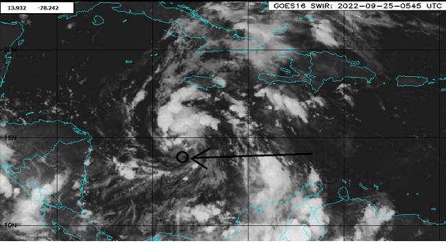
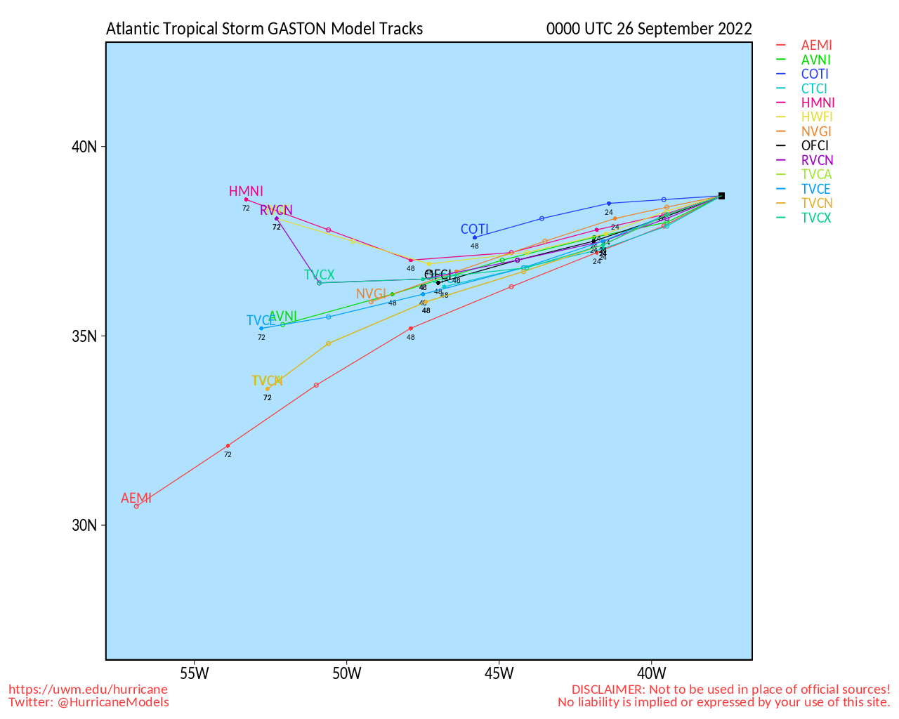
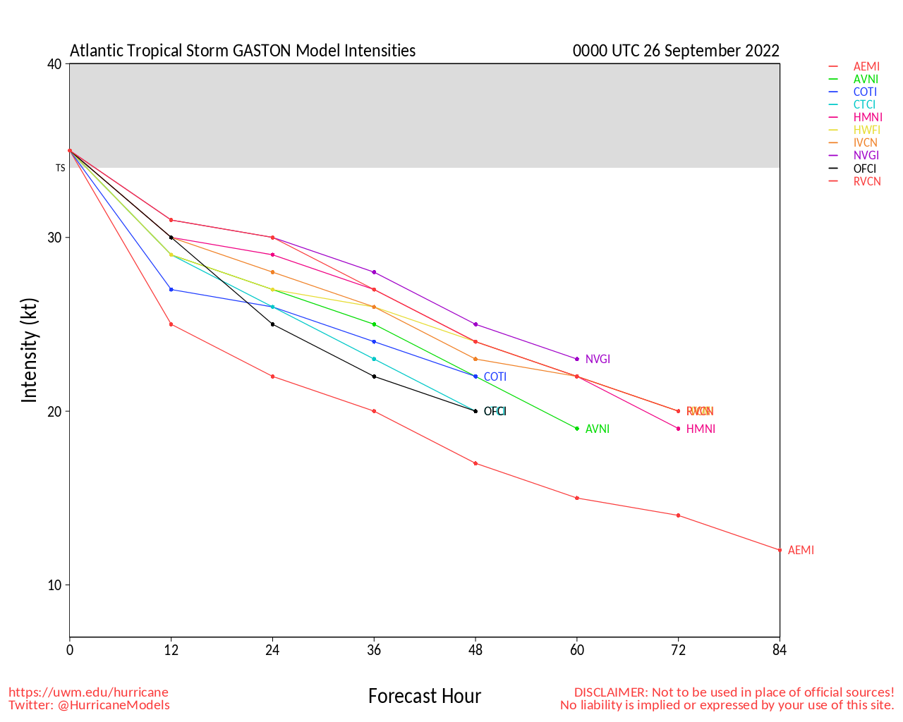
Elsewhere Gaston is holding on, but Hermine has dissipated.
5PM EDT Update 24 September 2022 Update
Ian's poised to intensify tomorrow, but remains a 45mph storm today. The center may be reforming, northwest of the current position. The future track is highly uncertain beyond 3 days with models even more spread out than earlier. Anyone in the cone should prepare for the system, but hopefully we'll know more once it gets closer to Caymans, probably Monday morning.
"The track forecast is still highly uncertain at days 4-5, with the and positions
about 200 n mi apart by 96 h. There is significant spread noted even among the ensemble members, with positions that range from the north-central Gulf of Mexico to the west coast of Florida. Hopefully, data collected from special radiosonde releases and a
NOAA G-IV flight this evening will help better resolve the steering flow around Ian and the deep-layer trough that is forecast to be over the eastern U.S. early next week."
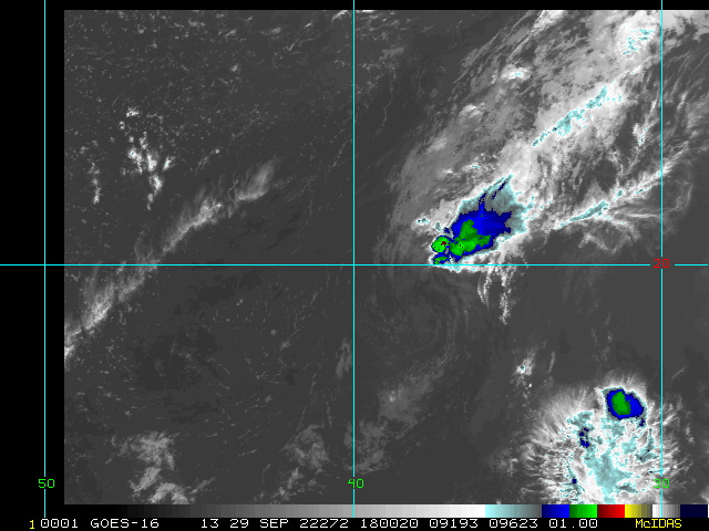
Gaston is still continuing on, but Hermine has weakened to a depression.
9AM EDT Update 24 September 2022 Update
Tropical Storm Ian is going through bit of a reformation process, this morning, slightly further south. But the track is generally correct. Conditions for Ian improve greatly tomorrow beyond Jamaica, so it will likely intensify at that point. The forecast track cone is important in this one since slight variations could change the track either direction, so more so than usual don't focus on the track line in the middle. Surge impacts along the coast also depend greatly which direction and side the storm crosses since the water is generally driven by the wind direction. If landfall were south of Tampa, for instance, water would be driven out of the bay and surge flooding wouldn't be bad there, but worse for those south/right of the eye. If the storm went directly over or just to the north, surge flooding would be worse in the bay. The cone range is from the Keys to Apalachicola right now. Track shifts are likely
The further north the system would get the more it runs into shear associated with a front, so if it were to get in the northern parts of the Gulf, it would likely weaken before landfall.
Any watches for Florida likely wouldn't show up until tomorrow night or Monday morning.
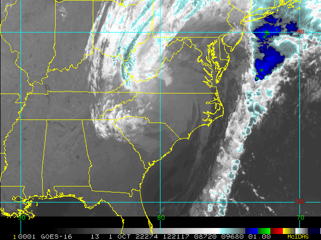
Fiona made landfall as an extra tropical storm in Canada overnight, much of the wind trailed the rain shield. But there are reports of damage in eastern Nova Scotia.
Gaston is expected to become extra tropical today.
Hermine is bringing rain to the Canary Islands and likely will hang around for another few days.
11PM EDT Update 23 September 2022 Update
Tropical Storm Ian has formed from TD#9, and Tropical Storm Watches are up for Jamaica, and Hurricane Watches are up for the Cayman Islands.
Beyond this Cuba and the West Coast of Florida are in the cone. Florida Landfall, based on this track, would be a category 3 hurricane Overnight Tuesday to Wednesday morning along the coast Between Fort Myers and Sarasota, however, anywhere in the Cone should make preparations this weekend.
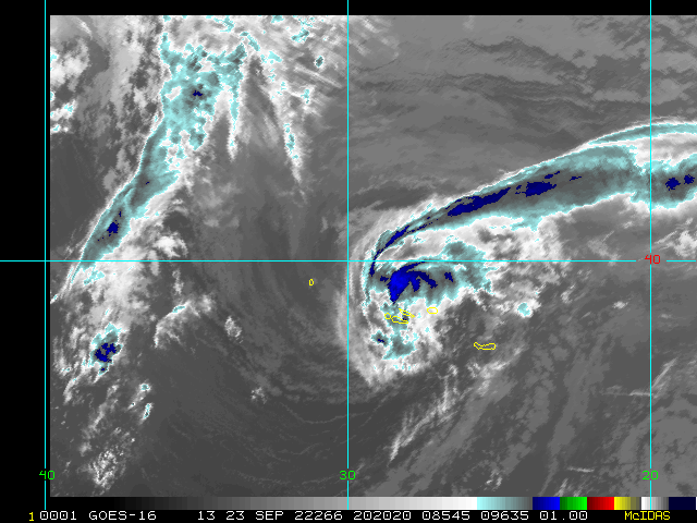
Fiona has become a very power System and is moving over Nova Scotia tonight.
Gaston is over the Western Azores, bringing low end tropical storm force winds.
Hermine is off the coast of Africa and expected to hang around just a few days before dissipating.
Original Update
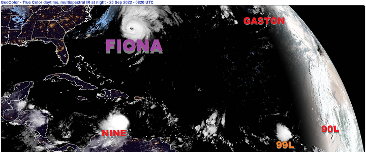
After the stunningly quiet August, multiple storms are now impacting and threatening land. Major Hurricane Fiona is presently lashing Bermuda and potentially set to become a record-setting hybrid cyclone in coastal Canada this weekend. Tropical Storm conditions are affecting the Azores with Gaston. And in the southern Caribbean, the stout wave we have been tracking (tagged 98L) has become the ninth real-time officiated tropical cyclone of the 2022 Atlantic Hurricane Season, and this is one Floridians in particular are watching.
After inconsistent development and track trends, TD 9 has formed in a region that given all known knowns and known unknowns, is more likely than not to become a very significant tropical cyclone and one that could ultimately impact Florida in a very serious way. This far out, speculation belongs in model-talk, and we do have have lounges up for both Fiona and TD9, where modelling is often discussed in greater detail: Fiona Forecast Lounge TD9 Forecast Lounge , but it is already looking more likely than not that NINE will threaten the US Southeast, and very possibly Florida.
Elsewhere, Invest 90L is odds-on to become a tropical cyclone that impacts the Cabo Verde Islands by the end of this week, and 99L west of there has model support for development too, but that one may stay a fish storm.
Florida Emergency Management
News Media (South Florida):
Television:
Newspapers:
News Radio:
Check local media and officials when a storm is approaching your area.
News Media (East Central Florida):
Television:
Newspapers:
News Radio:
Check local media and officials when a storm is approaching your area.
Edited by MikeC (Sun Sep 25 2022 11:12 PM)


 Threaded


