cieldumort
Moderator

Reged:
Posts: 2520
Loc: Austin, Tx
|
|
10:00AM EDT Update 3 November 2023
Invest 97L is down to 10% chance to develop and is unlikely to last much longer. For now the first half of November remains quiet in the Atlantic.
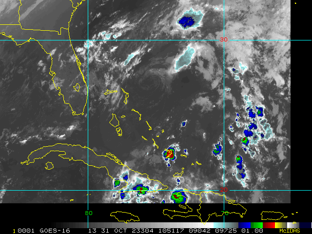
9:00PM EDT Update 28 October
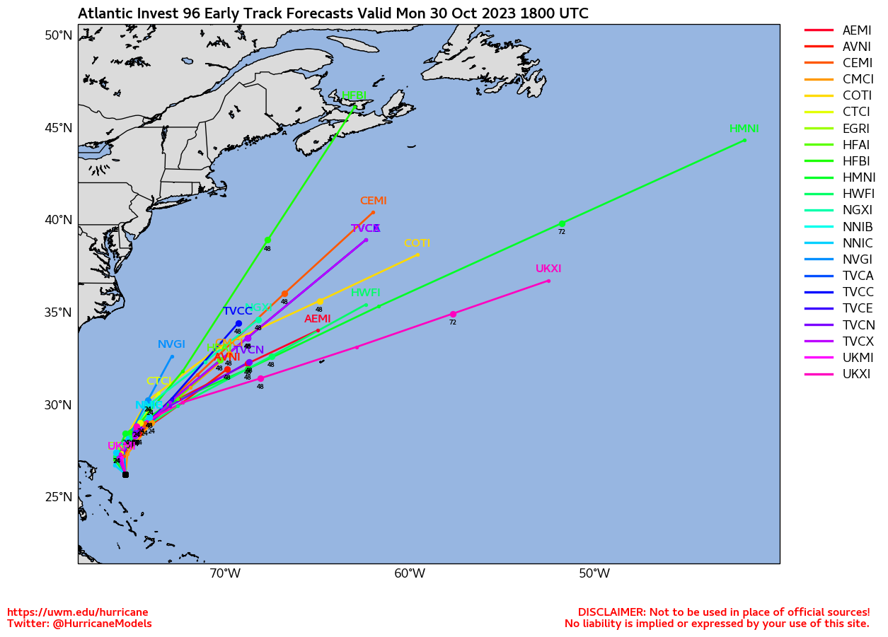
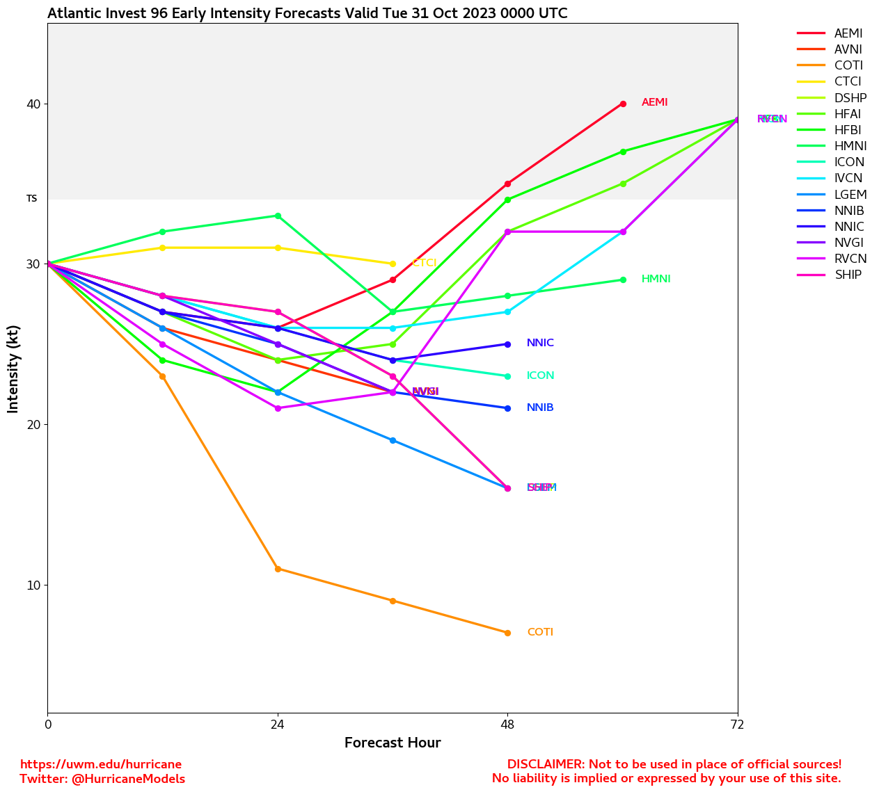
As October ends there are two areas in the Atlantic on the Outlook, east of the Bahamas Invest 96L may develop into a short lived system, it has a 40% chance to develop, if it did it would move away from the Bahamas and the US.
In the southwest Caribbean there's a 30% chance something could develop over the next 7 days. Those in the Western Caribbean, Caymans, Western Greater Antilles, Keys/South Florida, and Bahamas will likely want to watch how this one progresses.
11:30PM EDT Update 24 October
A moment away from the Atlantic to mention that Acapulco, MX is getting walloped and may take a direct hit from extremely dangerous and powerful now Category 5 Hurricane Otis. Otis has undergone phenomenal Rapid Intensification and places the cyclone in a rare class of hurricane.
From Quote:
1000 PM CDT Tue Oct 24 2023
A nightmare scenario is unfolding for southern Mexico this evening
with rapidly intensifying Otis approaching the coastline. Satellite
images show that Otis has continued to intensify, with
Data-T estimates between 130-145 kt during the past few hours. The
initial wind speed is set to 140 kt as a blend of these values,
making Otis a Category 5 hurricane. Otis has explosively
intensified 95 kt during the past 24 hours, a mark only exceeded in
modern times by Patricia in 2015.
Otis should maintain category 5 status before the hurricane makes
landfall near the Acapulco area overnight or early on Wednesday.
The only significant change to mention to the track forecast is
that it has been shifted to the right due to a recent wobble to the
east and the latest model trends, and a general north-northwest
motion at about 8 kt is anticipated through landfall. Rapid
weakening is anticipated after landfall, and Otis should dissipate
tomorrow night over the higher terrain of Mexico.
This is an extremely serious situation for the Acapulco
metropolitan area with the core of the destructive hurricane likely
to come near or over that large city early on Wednesday. There are
no hurricanes on record even close to this intensity for this part
of Mexico.
Key Messages:
1. Otis is forecast to be a potentially catastrophic Category 5 hurricane when it reaches the southern coast of Mexico early Wednesday. Life threatening hurricane-force winds are expected in portions of the Hurricane Warning area with catastrophic damage expected.
2. A potentially catastrophic storm surge is expected to produce life-threatening coastal flooding near and to the east of where the center makes landfall. Near the coast, the surge will be accompanied by large and destructive waves.
3. Heavy rains from Otis will continue to impact areas of southwest Mexico this week. This rainfall will produce flash and urban flooding, along with mudslides in areas of higher terrain.
1:30PM EDT Update 23 October
Steering currents continue to favor tracks that take systems or their remnants in both the W ATL and E PAC towards Central and/or North America.
Invest 95L, quite possibly already a TD, will probably make landfall in Central America tonight or tomorrow, and could linger, producing heavy rain and flooding. Also, Hurricane Tammy is now officially forecast to recurve back towards the US in the 4-5 day outlook. Beyond that time there are still too many variables to speculate beyond Lounge Talk.
Longer-range keeps much of the West Atlantic in a somewhat favorable state for tropical cyclone formation during the extended period into at least the early part of November.
6:30PM EDT Update 21 October
Both track and development potential continue shifting and consolidating closer to home this weekend, with nearly all activity in both the Atlantic and East Pac either possibly if not likely to have some North America impacts.
Almost definitely soon-to-be-Invest-tagged if it stays over water Caribbean Low may not only become a tropical cyclone, but also has the potential to linger or meander around Central America. Two obvious concerns: Flood threat to Central America. Also, the longer it lingers without crossing over to the East Pac or falling apart over land, the greater the chance steering currents could swoop it up towards the .
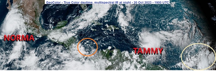
Tammy is skating by just east of the Leewards tonight, with hurricane conditions just offshore. Models have massively diverged on her future track once she clears the Leewards.
Original Update
Recon is continuing frequent flights into Hurricanes Tammy and Norma this weekend, and the invaluable data collected will be fed into models to help fine-tune official forecasts.
Tammy has potential to strengthen more than currently forecast, and possibly track a bit west as well, and interests in the eastern Caribbean should continue to be prepared for substantial impacts from rain, flood, wind and surge.
Major Hurricane Norma in the East Pac has restrengthened, and as such is much more likely to bring central US states from Texas on north-northeast copious rains next week after a direct hit on western Mexico. While the rains will be welcome relief in many locations, too much of a good thing can become problematic, and the risk of flooding may be going up markedly with this set up.
Big picture, steering currents look to be shifting in a way that have the potential to send any tropical cyclones that form or get close enough towards the south to southeast United States for a while, and as waters are still very warm, some conditionally concerning areas are worth noting. First, we have an area of low pressure that has recently formed in the Southern Caribbean. Also, much farther out, another monsoon trof wave east of the Caribbean has some potential to track farther west and cook up. Lounges have been started on both of these.
Forecast Lounges/Model Talk:
Tammy Lounge
South Caribbean Low (Now 95L) Lounge
Tropical Atlantic Wave Lounge
|
|


 Threaded


