MikeC
Admin
Reged:
Posts: 4692
Loc: Orlando, FL
|
|
2:00PM EDT Update 14 July 2025
The area off Florida is now being tracked as Invest area 93L.
12:00PM EDT Update 14 July 2025
Organization of our Area of Interest Invest TBD is underway quite a bit quicker than most models have predicted, and doing so while still east of Florida. Recon has been tasked to head into the system tomorrow, but there may still be a flight later today.
While not typical, it is not at all unheard of for a developing tropical cyclone to cross Florida from east to west, into the Gulf, while strengthening, and those in and around the state may want to begin paying much closer attention as this system is likely to also be a copious rain-producing flood risk, regardless of designation.
Once in the Gulf, conditions there may become sufficiently beneficial for this one to become our first hurricane of the year. Stay tuned.
Ciel
11:30AM EDT Update 13 July 2025
The Area of Interest off the southeast coast has just been tentatively tasked for recon starting Monday. Modeling is increasingly looking favorable on this feature's chances for development and another "homegrown" style system could already be in the making.
While TC numbers during the first two months typically do not foretell how things will play out the rest of a season, they often are from non-tropical entities that acquire sub-tropical to tropical characteristics doing so close to land, which is where most of us live, which means potential impacts.
Occasionally, the broad global atmosphere conspires to make home-grown Atlantic systems considerably more possible than most years. In addition to what is likely to be Invest tagged shortly just off the southeast coast, some attention may also start to be paid to a small, but well-defined area of low pressure located about 250 miles east of the NC/Virginia border that has developed on the trailing end of an east-west oriented front and may be in the process of separating from its parent front.
We now have a Forecast Lounge up on the Area of Interest off the southeast, where we will be delving deeper into its model runs and such: 93L Lounge
Ciel
Original Update
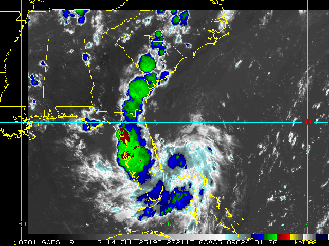
The lemon area (20%) of the coast is being watched for potential weak development mid week. With models mixed on it, mostly weak, with the exception of the icon.
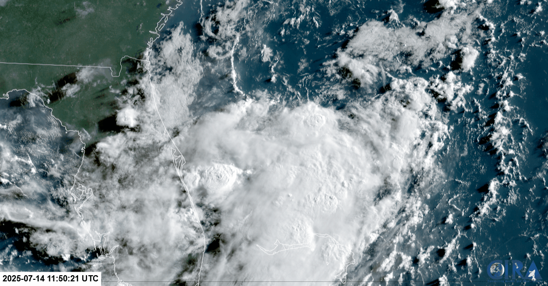
On satellite the area in question is coming from the convection off the southeast coast, which is expected to travel over Florida monday evening and enter the Gulf. Right now it's only a 20% development.
(Satellite photo from 8AM EDT Sunday 13 July 2025)
This means anywhere the convection passes over will see lots of rain into Florida, and it's likely this area will have a shot at development. It's plenty warm in the Gulf, shear may affect it somewhat. It'll be worth watching closely over the next few days to see how this area progresses. It's likely the area of storms off the Southeast will become an invest area either later today or tomorrow.
For now it's just something to monitor closely.
Edited by cieldumort (Mon Jul 14 2025 02:19 PM)
|
CFHC

Reged:
Posts: 176
Loc: East Central Florida
|
|
Recon scheduled for Tuesday and possibly tomorrow.
Edited by MikeC (Sun Jul 13 2025 01:47 PM)
|
MikeC
Admin
Reged:
Posts: 4692
Loc: Orlando, FL
|
|
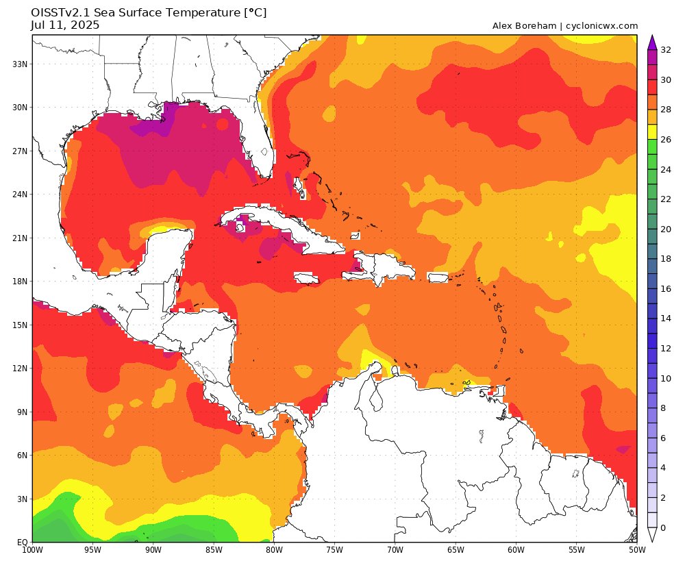
sea surface temperatures
|
MikeC
Admin
Reged:
Posts: 4692
Loc: Orlando, FL
|
|
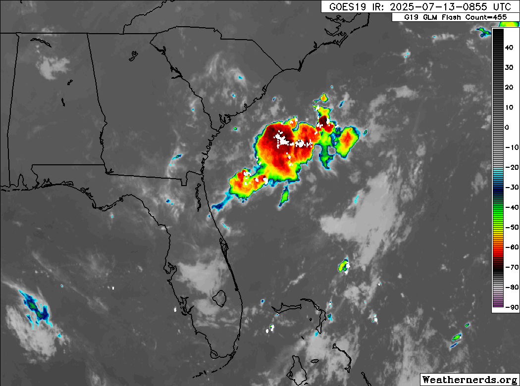
Melbourne Radar is out unexpectedly. (Jacksonville was for planned maintenance)
FTMMLB
MESSAGE DATE: SUN JUL 13 2025 5:35 PM EDT
THE MELBOURNE WSR-88D (KMLB) REMAINS DOWN DUE TO AN UNANTICIPATED
DISRUPTION. AT THIS TIME THERE IS NO ESTIMATION FOR WHEN IT WILL
RETURN TO SERVICE. PARTS ARE ON ORDER. THANK YOU FOR YOUR PATIENCE
|
CFHC
Reged:
Posts: 176
Loc: East Central Florida
|
|
recon for tomorrow
REPRPD
WEATHER RECONNAISSANCE FLIGHTS
CARCAH, National Hurricane Center, MIAMI, FL.
1010 AM EDT MON 14 JULY 2025
SUBJECT: TROPICAL CYCLONE PLAN OF THE DAY (TCPOD)
VALID 15/1100Z TO 16/1100Z JULY 2025
TCPOD NUMBER.....25-044
I. ATLANTIC REQUIREMENTS
1. SUSPECT AREA (EAST OF FLORIDA)
FLIGHT ONE - TEAL 71
A. 15/1800Z
B. AFXXX 01DDA INVEST
C. 15/1600Z
D. 30.0N 80.0W
E. 15/1730Z TO 15/2200Z
F. SFC TO 10,000 FT
G. LOW LEVEL INVEST
H. WRA ACTIVATION
2. OUTLOOK FOR SUCCEEDING DAY: POSSIBLE MISSION INTO SUSPECT
AREA OFF THE FLORIDA PANHANDLE NEAR 29.0N 86.0W FOR 16/1800Z
|
Ryan L
Registered User
Reged:
Posts: 2
|
|
I don't think the sea surface graphic is accurate, at least not for for the east coast for central FL. Ocean temps from April to now have consistently been 5 degrees below normal. Right now it's at 78.6 F at buoy 41113 and buoy 41009 is at 81.1F and the graphic above seems to show more like 86 which doesn't quite match. Buoy 41047 is at 84.2 F which is close to what is shown but that one is far off shore and further South than the others mentioned.
I think the Melbourne radar was likely knocked out by the thunderstorm that hit around 3-4PM EST yesterday. Gusts looked like they were hitting 50-60 mph in 2 separate bursts.
|
MikeC
Admin
Reged:
Posts: 4692
Loc: Orlando, FL
|
|
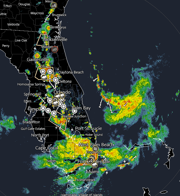
Radar showing the banding, dry north, sheared south, but it's starting to wrap around
.
|


 Threaded


