MikeC
Admin
Reged:
Posts: 4752
Loc: Orlando, FL
|
|
8AM EDT 12 August 2025 Update
Erin continues to move west quickly around 22mph. Some easterly shear influence should keep it from strengthening much, if at all, for the day or so. Beyond that conditions start to improve, and by the time it gets over to the west conditions greatly improve, especially west of 60 west, where it has a chance to become very intense. The official forecast takes it north of the Caribbean, but folks in the islands will want to watch in the unlikely case anything changes. Low confidence beyond that, Bermuda has the largest chance to see impacts from the system, but other areas including the Bahamas and US coast, although fairly unlikely, cannot be ruled out.
I do want to reiterate how fast and weak the system are now could nudge the forecast track south enough to get closer to (not necessarily) over the Caribbean islands. So do not let your guard down there. The shear may be enough to weaken Erin a bit before it has a chance to strengthen again.
10:15AM EDT 11 August 2025 Update
Tropical Storm Erin has formed in the East Atlantic, it's something to watch closely, but not too concerning at the moment.
Most likely the energy remains offshore of the US, Bermuda will likely need to watch this very closely as it's most likely they will at least see some periphery impacts.
There's still about a 5% chance it could come closer to the Continental United States. The Caribbean Islands are unlikely, the Bahamas (particularly south and east) may need to watch. The Canadian Maritimes will also want to keep tabs on Erin.
It could get close however, close to the outer banks or new England are most likely if it does, but landfall is unlikely. So it's important to watch for trends over the next week or two.
8:15PM EDT 10 August 2025 Update
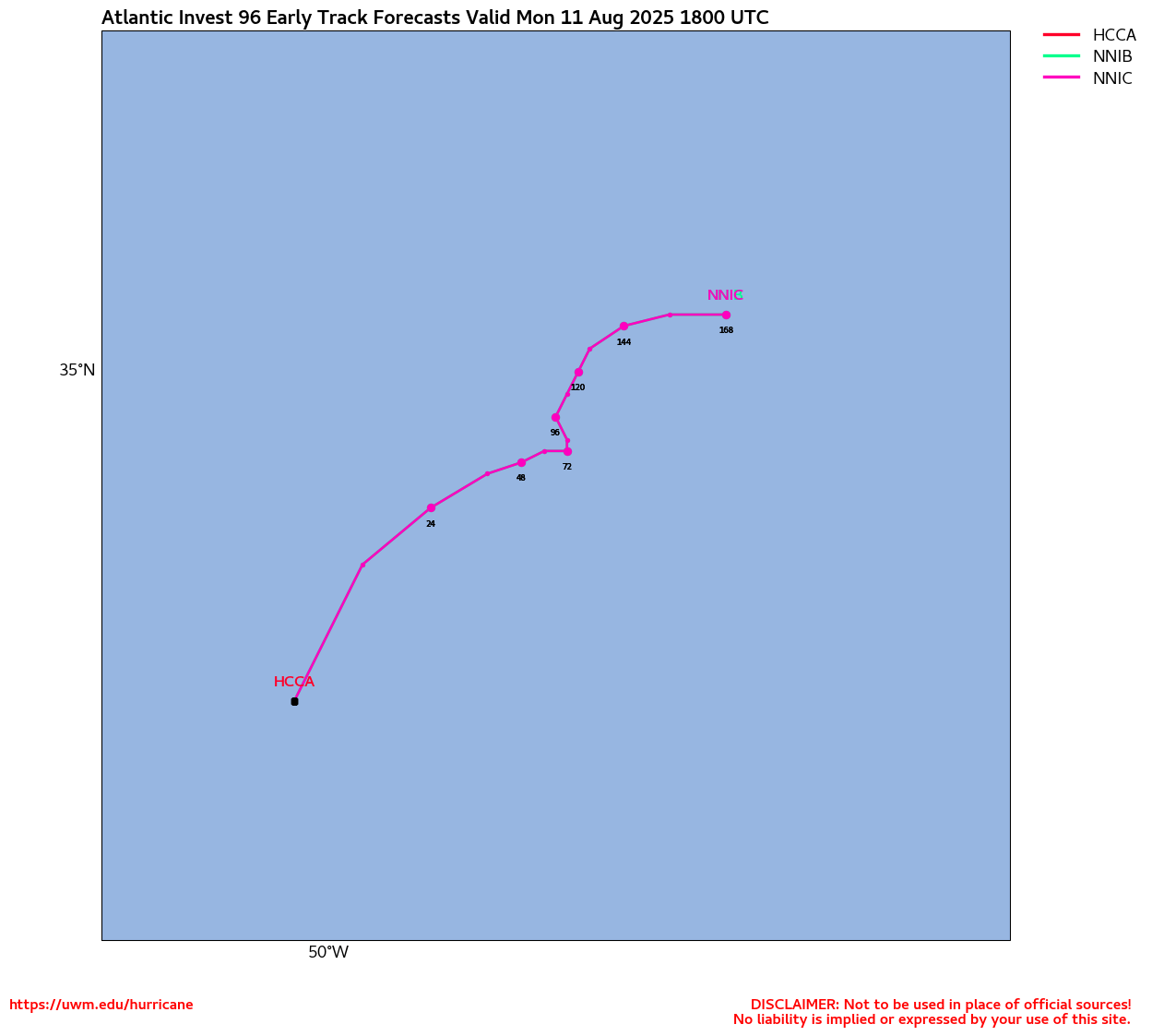
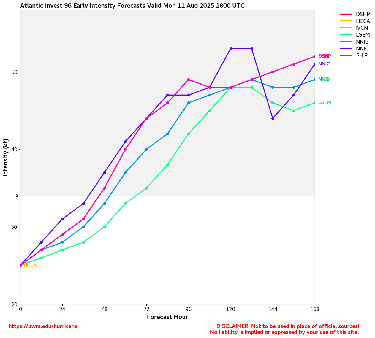
There have been worse looking tropical lows called TDs than Invest 97L at this time, and it is likely that the system gets the official designation within the next 12 hours or so. Presently, very tropical depression-like conditions are tracking over the Cabo Verde Islands in the far eastern Atlantic.
Over the next 24-48 hours, our incipient Tropical Cyclone (97L) bumps into a region of less unstable and outright subsident air while it tracks over slightly cooler waters. This may stall any further intensification until it reaches the warmer SSTs further west where it has a better chance to become a formidable Cape Verde type hurricane if all the stars remain aligned.
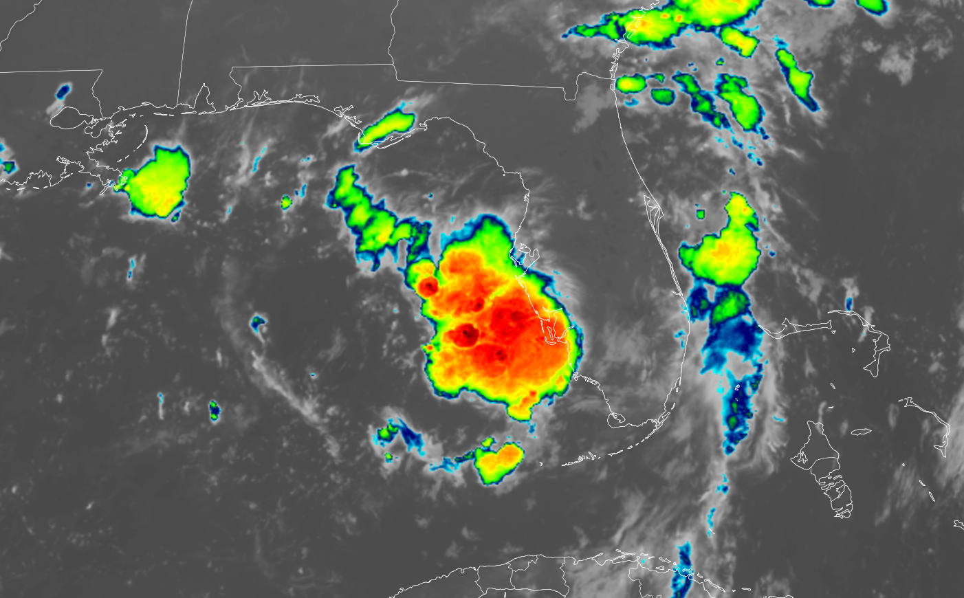
Closer to home, a curious area of low pressure, primarily aloft but also with a surface reflection, exists within a larger trof region in the eastern Gulf. While not yet Invest tagged, there are some ensembles that want to develop it into a depression before it pushes inland over north Florida early in the coming week, and we'll be watching. Lots and lots of rain, either way.
Ciel
Original Update
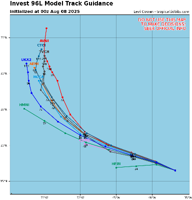
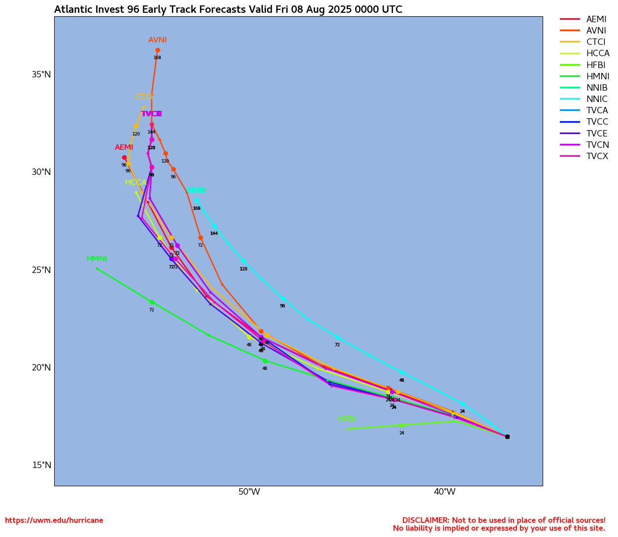
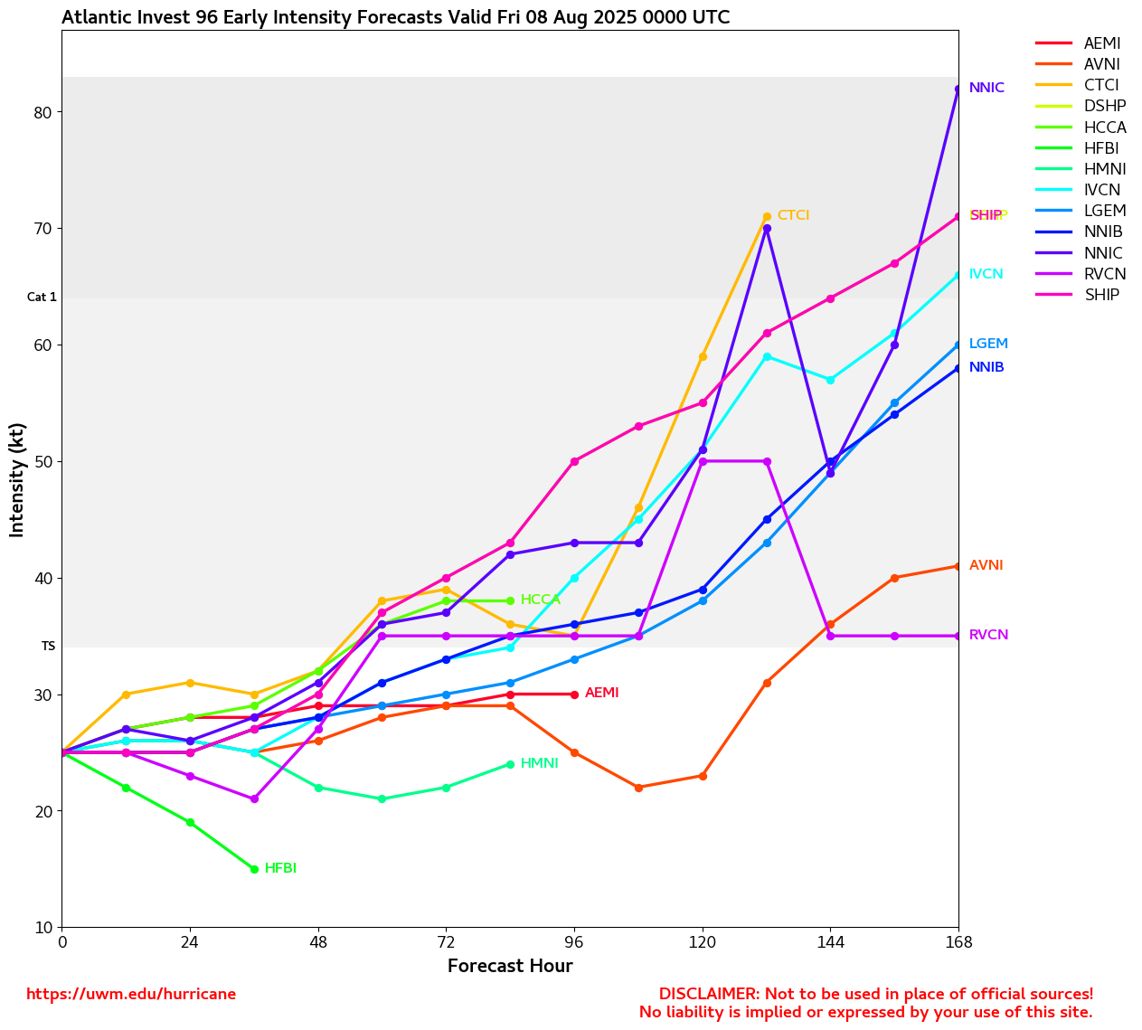
Invest 97L is a system in the far east Atlantic that just exited Africa, it's poised to a be a long track system. If it gets a name it'll be Erin. The 1995 version of Erin was the first hurricane to be covered by this website.
97L's long term future is uncertain, climatology and ensembles suggest it remains offshore, but odds are only slightly favorable for that outcome, not enough for comfort by any means. So it must be watched by those and the Caribbean and beyond for the trends. If the system becomes a depression it'll get advisories as well. Now that the system is an invest the more specific Hurricane models we begin to be ran on it.
Lots of time to watch where this goes.
More models and speculation can be found in the forecast lounge.
|
MikeC
Admin
Reged:
Posts: 4752
Loc: Orlando, FL
|
|
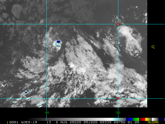
I'm watching this one offshore of SW Florida for a potential "sleeper"
There's a hint of rotation in it. It's not likely for development, but it's a bit closer than 97L.
|
MikeC
Admin
Reged:
Posts: 4752
Loc: Orlando, FL
|
|
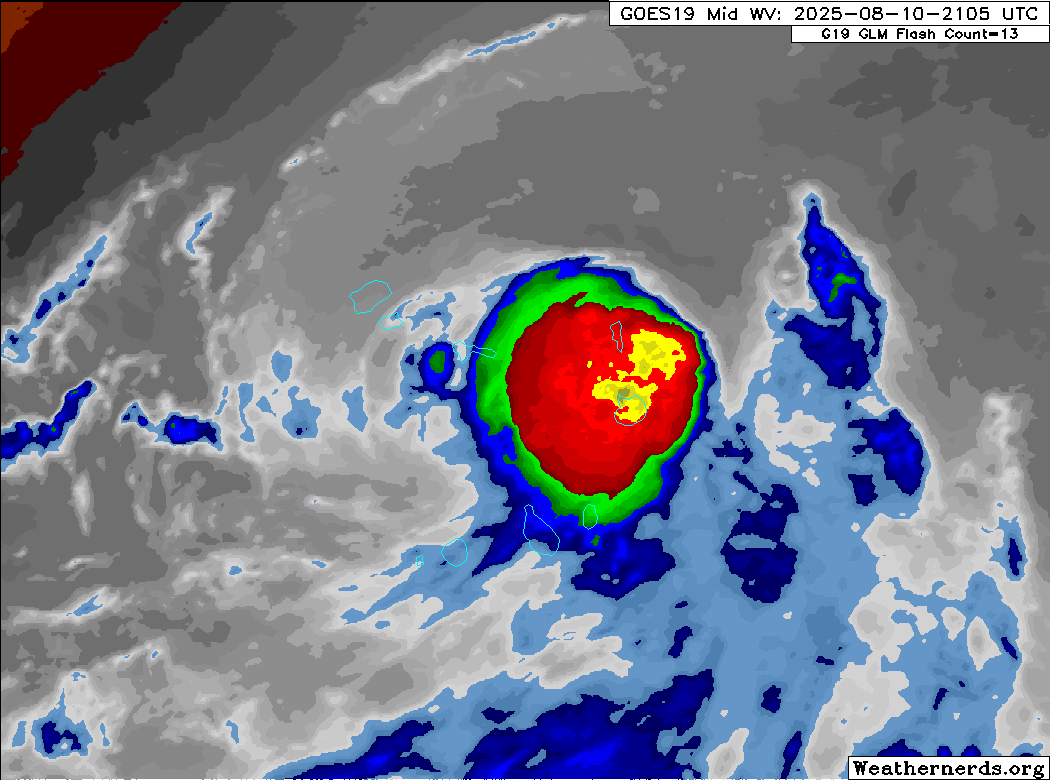
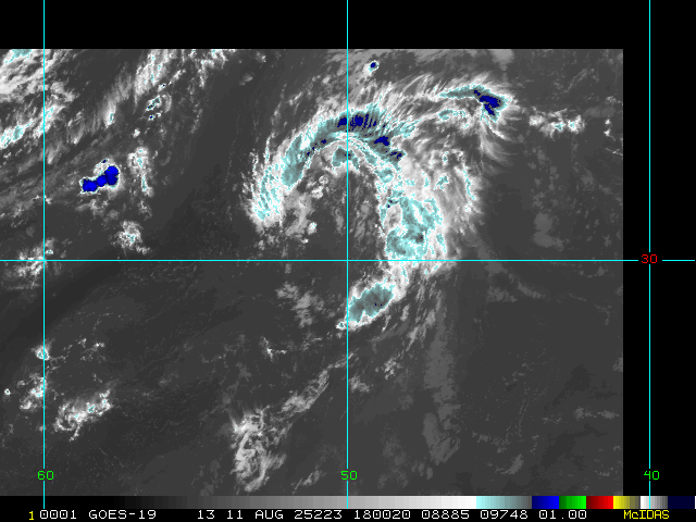
97L over the Cabo Verde islands:
|
MikeC
Admin
Reged:
Posts: 4752
Loc: Orlando, FL
|
|
ATCF best track has it as Erin now, should be upgraded at 11AM.
|
CFHC

Reged:
Posts: 183
Loc: East Central Florida
|
|
Recon is scheduled for 8pm edt Thursday night (0z Friday)
|
cieldumort
Moderator

Reged:
Posts: 2556
Loc: Austin, Tx
|
|
Death toll from pre-Erin now reported to be 7 on the Cabo Verde Island of São Vicente YouTube due to severe flooding from the system. Four of the victims were children.
|
MikeC
Admin
Reged:
Posts: 4752
Loc: Orlando, FL
|
|
Slight WSW drift tonight, but mostly heading due west.
|
Kraig
Weather Hobbyist

Reged:
Posts: 89
Loc: Jupiter, Fl
|
|
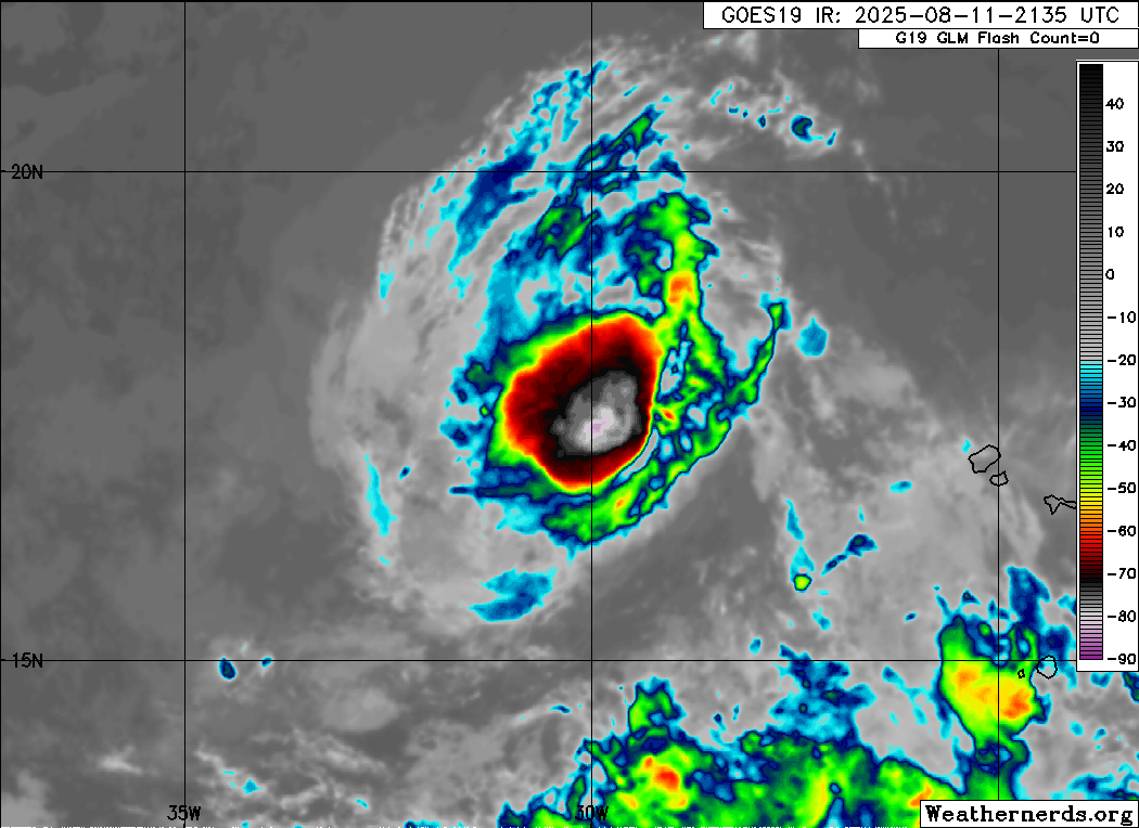
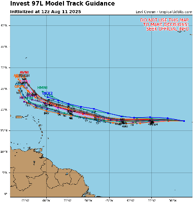
Erin is likely at depression status now at best! No thunderstorms but still has a good rotation. Will take a bit longer to get its act together....
[image]https://www.tropicaltidbits.com/0a010a16-442e-4746-9baf-674f55655376[/image]
|


 Threaded


