1PM ET 25 September, 2026 Update
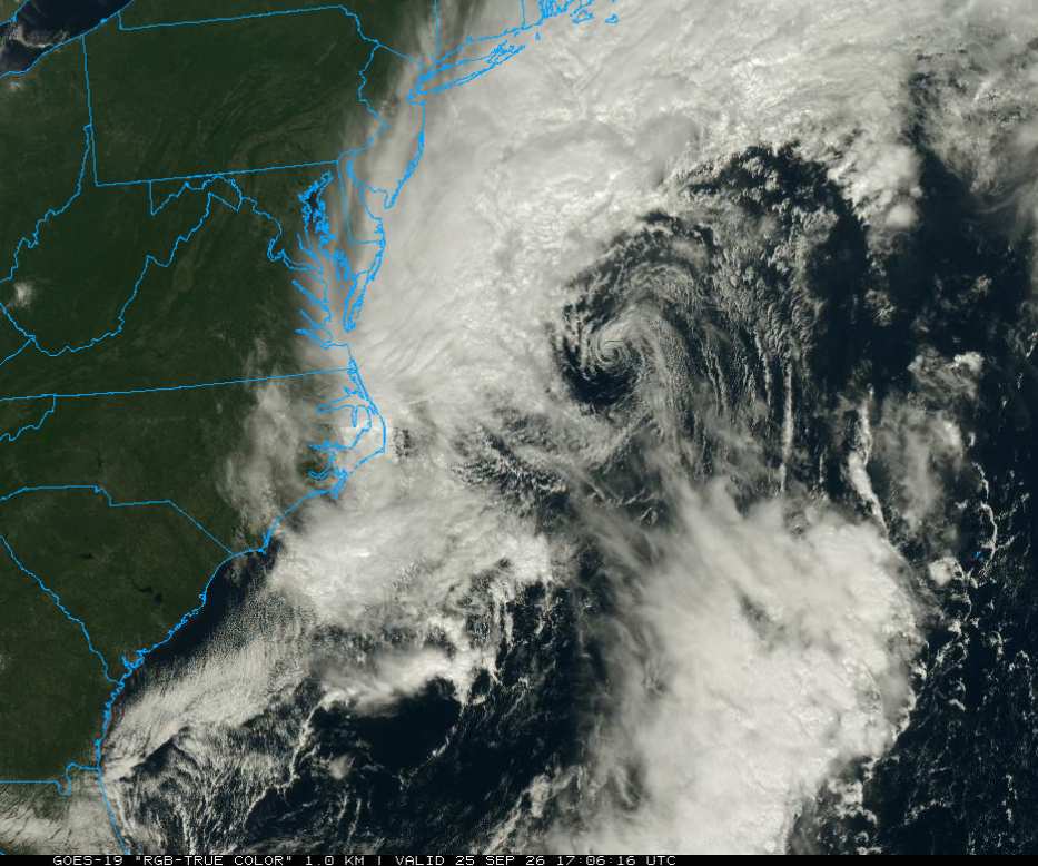
Models are converging on our coastal low nearing the Mid Atlantic and New England continuing to deepen and transition into a full hybrid. A couple of hi-res models earnestly want to have the cyclone become a hurricane, more or less. Regardless of technical classification, interests along the shore, offshore and just inland in and around New Jersey, New York, Rhode Island and Connecticut should prepare for a very strong coastal storm that given the time of year and also full moon, may result in sporadic to widespread downed limbs, downed trees, coastal inundation and power outages.
Ciel
10:30PM ET (4:30PM HT) 24 September, 2026 Update
There are some hi-res models advertising almost Rapid Intensification of the Gulf Stream coastal low and transition into a hurricane over the next day or two. Reminder, while possible, this is still in actuality a lower-probability outcome (but potentially very high impact if it verifies). Hi-res CAMs often do not handle tropical transitions well when systems are so close to shore, as they concurrently underestimate the frontal influences of being so close to land while also tending do overdo deep convection. Take them with a grain or two of salt. More modeling analysis on the coastal low (wet Nor'easter) can be found in the Forecast Lounge.
Elsewhere, Nolo is intensifying tonight and does indeed appear to be well on its way to becoming a Major while approaching the Big Island of Hawaii. Recon is now in the cyclone and this invaluable data will be fed into models. We can expect greater confidence in their output within the next couple of cycles.
Ciel
11:30AM ET (5:30AM HT) 24 September, 2026 Update
Nolo has stalled forward motion south of the Big Island in response to changing steering currents. The forecast right hand turn towards the north-northeast is likely about to commence. Recon has been scheduled to fly Nolo and will be collecting data invaluable to the models and forecasters working day and night to pin down the details, but in the larger picture, regardless of exact track and intensity, the state will be once again having a major flood risk event. Efforts to protect life and property should already be underway on the Big Island and Maui residents should consider getting ready.
The developing coastal low approaching New England continues having model support for a phase change to a shallow to modestly warm core structure. If verified, this could temporarily enhance both wind and rain potential significantly wherever this sets up and focuses the energy. More on this can be found in the Forecast Lounge
Ciel
Original Update
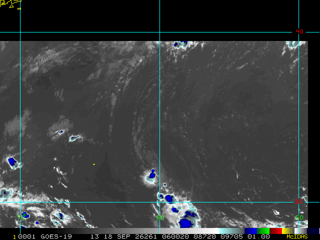
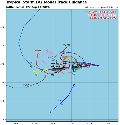
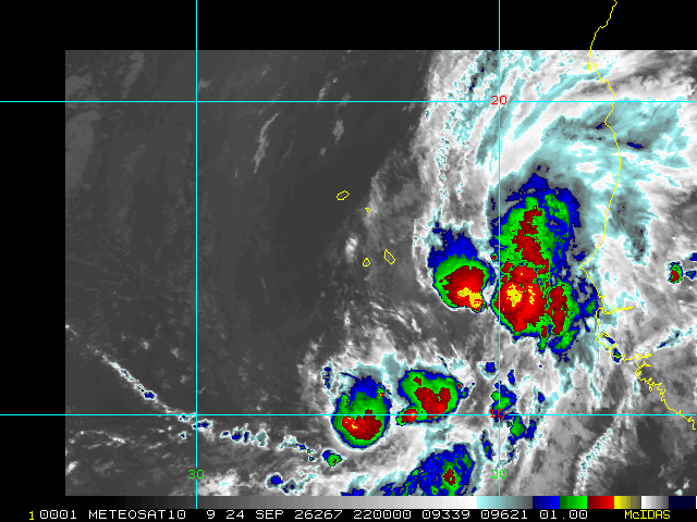
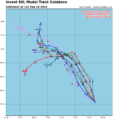
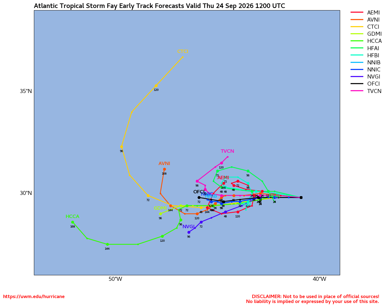
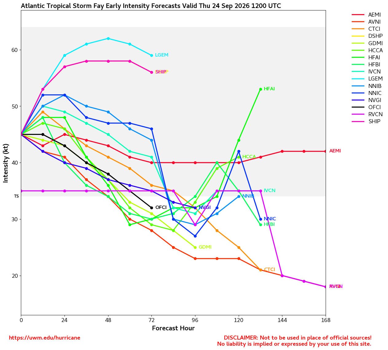
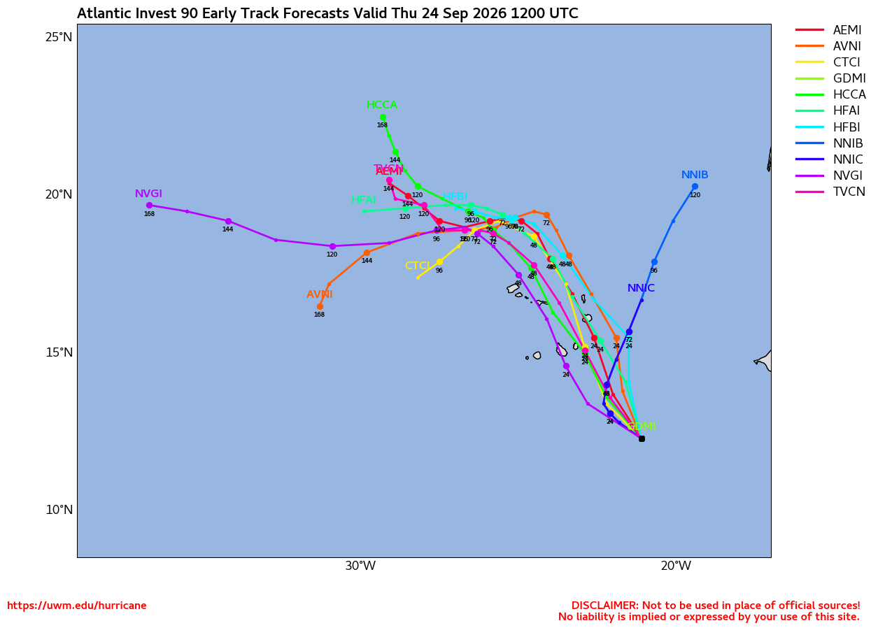
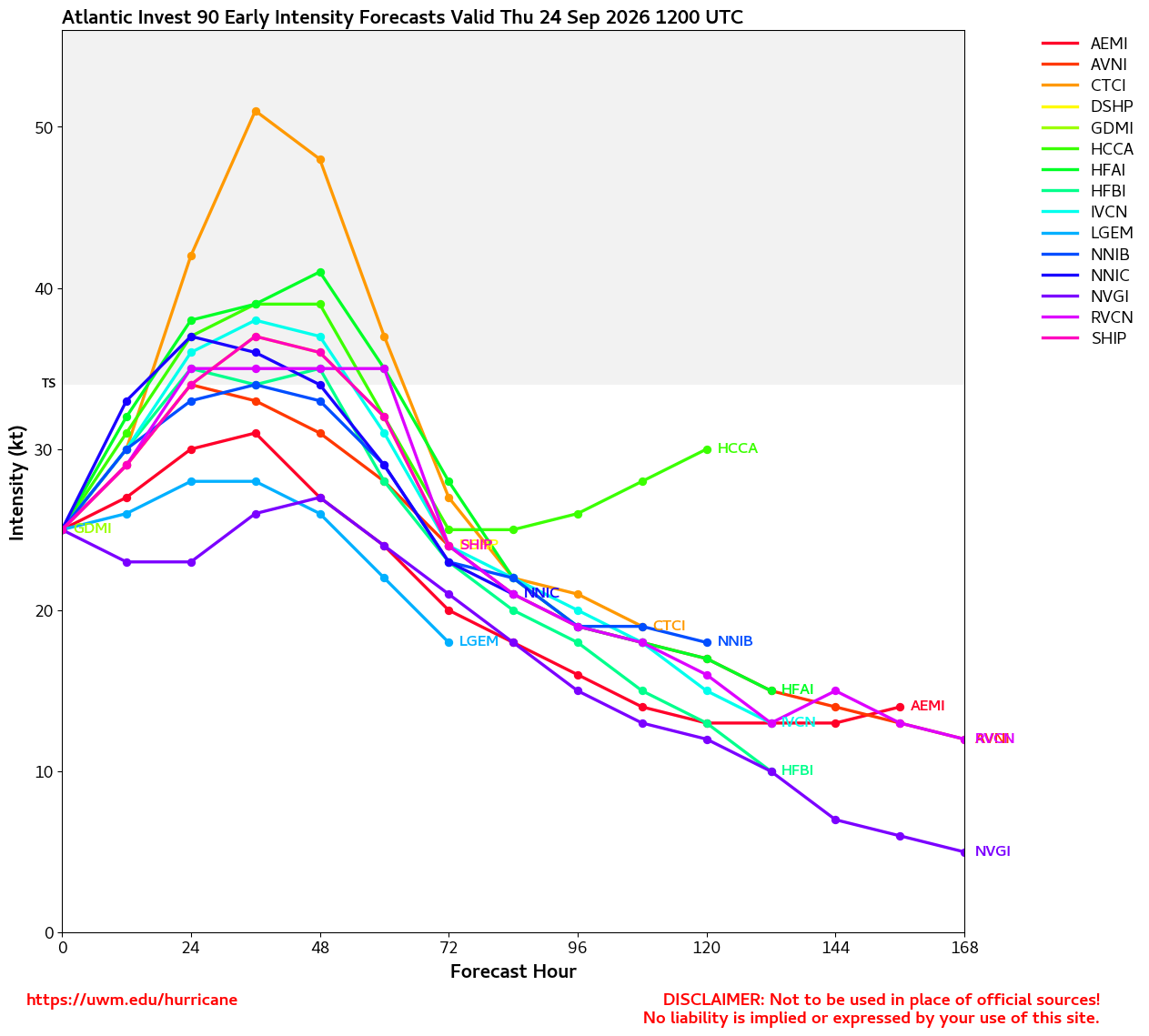
Rising air motions associated with a favorable state are mostly helping turbo charge the already on fire central and eastern Pacific, but some increase in Atlantic basin activity has been underway the past couple of days, where Fay is still spinning fish, Invest 90L is more likely than not to directly hit the Cabo Verde Islands in the far eastern Atlantic as a TD or named storm and a non-tropical coastal low off the Mid Atlantic may acquire some warm core characteristics. But in reality, for a September, the Atlantic is looking very tame, especially compared to the Pacific.
This entry will include updates on Fay, 90L and the coastal low (with links to any relevant Lounges and such), but once again, the main show is Hawaii and increasingly possibly also Arizona-New Mexico-Colorado-Texas next week, from approaching tropical cyclone or cyclones from the west.
NOLO
HURRICANE WATCH NOW IN EFFECT FOR THE BIG ISLAND OF HAWAII
WARNINGS MAY GO INTO EFFECT SOON
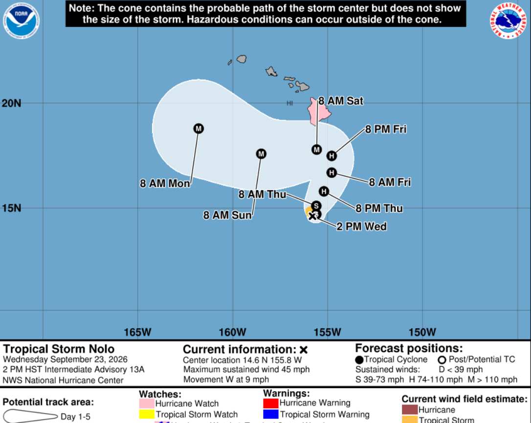
Tropical Storm Nolo is forecast to soon begin turning poleward, even tracking east of north, coming perilously close to the Big Island of Hawaii while also strengthening to what is now expected to be Major Hurricane status. Given the topography of much of the great state of Hawaii and susceptibilities to heavy rain and runoff, the cyclone wouldn't even have to come close enough to result in widespread wind damage to create another catastrophic event from yet another tropical cyclone this year. This would be Hawaii's third of the year.
Warnings are likely to go into effect for the Big Island by Friday. Current rainfall expectations for the island are widespread 15-20 inches and locally up to 35, resulting in potentially life-threatening flash flooding and mudslides. For track and intensity deep-dives, we have a Lounge already up for Nolo.
POLO
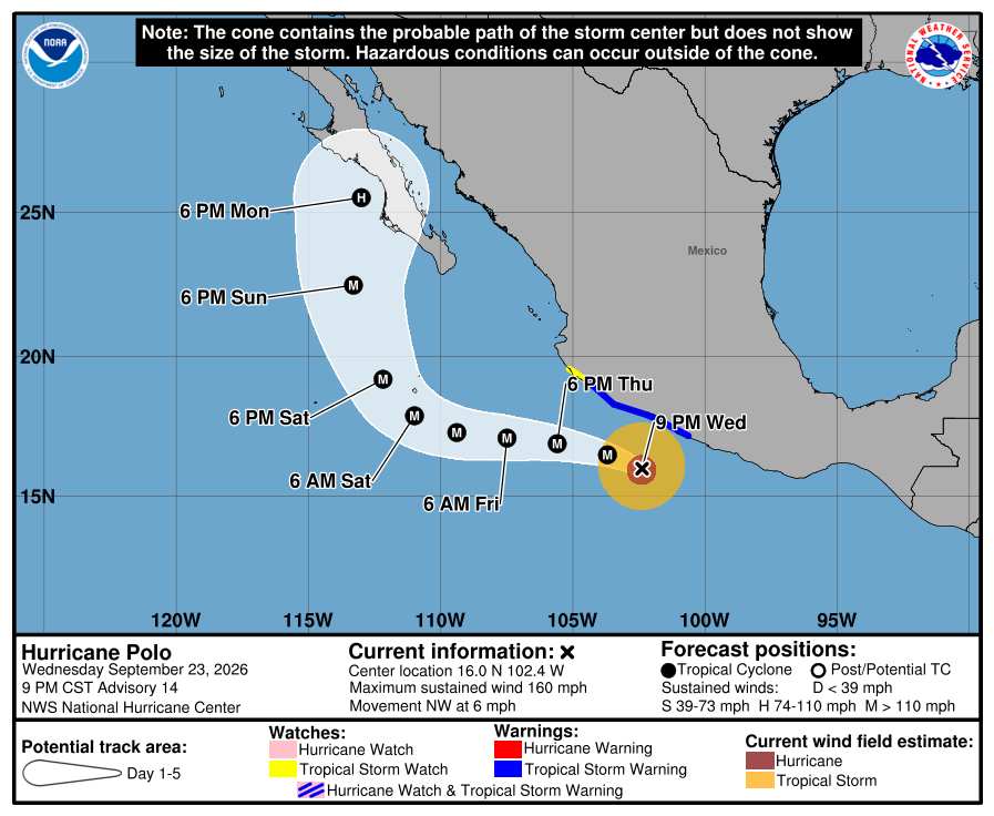
Category 5 Polo is presently located about 240 miles south-southeast of Manzanillo, MX, tracking northwest. Models increasingly insist that interaction with another approaching eastern Pacific hurricane as well as an approaching mid/upper-level trof will loop Polo back around and into the Baja. Regardless of whether or not the cyclone continues tracking northeast while maintaining much of its intensity, rounds and rounds of rain are already occurring and set to continue in the southwestern United States. Much more on Polo here, including longer range model deep-dives.
Edited by cieldumort (Fri Sep 25 2026 01:16 PM)




 Previous
 Index
Index
 Next
Next
 Threaded





 Edit
Edit
 Reply
Reply
 Quote
Quote