ftlaudbob
Storm Chaser

Reged:
Posts: 829
Loc: Valladolid,Mx
|
|
I agree that it is a toss up at this point,but given it's most likely path,people in S. Florida need to pay attention to see what happens with this system.
--------------------
Survived: 10 hurricanes in Rhode Island,Florida and the Yucatan of Mexico .
|
doug
Weather Analyst
Reged:
Posts: 1006
Loc: parrish,fl
|
|
There does seem to be some broad, and I guess mid-level cyclonic circulation that is focused around a point near 22 N (actually just south of 22N) and 65 W. The effect of the ULL is playing havoc with the system right now, however.
Finally, the system is a non-factor in the two main models, which indicates this system will follow the fate of its immediate predecessor.
--------------------
doug
Edited by doug (Mon Jul 29 2013 12:09 PM)
|
JMII
Weather Master

Reged:
Posts: 546
Loc: Cape Coral & Margate, FL
|
|
Someone on the main thread already said what I was thinking: for a non-storm (IE: open wave) xDorian is really looking good atleast in terms of outflow and overall rotation (mid to upper levels). However the shear is keeping it from stacking vertically and there is no low at the bottom to focus the energy. Something is there, but all the moisture has been blown away throughout the day. Maybe this is finally the end? Or will it drift west for 3 days then refire as a Cat 1 in the GOM by week's end?
--------------------
South FL Native... experienced many tropical systems, put up the panels for:
David 79 - Floyd 87 - Andrew 92 - Georges 98 - Frances 04 - Wilma 05 - Matthew 16 - Irma 17
Lost our St James City rental property to Ian 22
|
ftlaudbob
Storm Chaser

Reged:
Posts: 829
Loc: Valladolid,Mx
|
|
The system really looks bad now,should be dead soon,but then again I have thought that before.Shear is our friend!
--------------------
Survived: 10 hurricanes in Rhode Island,Florida and the Yucatan of Mexico .
|
Random Chaos
Weather Analyst

Reged:
Posts: 1024
Loc: Maryland
|
|
And then it fires again. Invest 91L up for the remnants of Dorian now off the Florida tip. Nothing major expected - 30% chance of any development - conditions aren't great.
|
doug
Weather Analyst
Reged:
Posts: 1006
Loc: parrish,fl
|
|
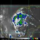
And so it continues: latest visible shows some form of LLC east of Vero with little vertical development near by, and most convection well south. This is the Gulf Stream, it is early August , and the environment is moist...the Outlook did not emphasize unfavorable conditions...and I suggest this be taken seriously.
If memory serves me correctly was born under a similar circumstance: a persistent vortex had meandered across the Atlantic and had been classified and then declassified in its crossing. One August day it wandered into the coastal waters of SE Florida and caught a breath and rapidly intensified. Not saying that will happen here but the possibility for rapid close in intensification is always something to consider.
Update: 10:15 base reflectivity suggests a weak surface rotation east of the coast between Ft. Pierce and Port St Lucie. Only scattered showers ...
--------------------
doug
Edited by doug (Fri Aug 02 2013 10:14 AM)
|
ftlaudbob
Storm Chaser

Reged:
Posts: 829
Loc: Valladolid,Mx
|
|
I can see the dark clouds over the ocean from this system.Very beautiful to be honest.
--------------------
Survived: 10 hurricanes in Rhode Island,Florida and the Yucatan of Mexico .
|
JMII
Weather Master

Reged:
Posts: 546
Loc: Cape Coral & Margate, FL
|
|
Dorian (or its remnants) have tracked pretty much as forecast regarding time and location, its just the intensity that has been off. I've been telling my wife all week that its going be a washout this weekend. The front pushing in from the north seems pretty strong so xDorian is about to hit a wall that should stop any development.
--------------------
South FL Native... experienced many tropical systems, put up the panels for:
David 79 - Floyd 87 - Andrew 92 - Georges 98 - Frances 04 - Wilma 05 - Matthew 16 - Irma 17
Lost our St James City rental property to Ian 22
|


 Threaded


