JMII
Weather Master

Reged:
Posts: 489
Loc: Margate, Florida
|
|
Quote:
Track has been more or less due north overall. I suspect that looking at its movement as smoothed over three to six hours, as does, is still going to be most informative in the longer-term. Temporary wobbles and jogs as Idalia is approaching the coast would have some greater immediate significance to those in her path of course.
This +1
I use the map at https://www.wunderground.com/wundermap with the hurricane and radar layer active. She was E of track this AM but has wobbled back W. As mentioned wobbles this far out don't mean much unless a clear trend emerges. Based on past storms the can be slow in making long term adjustments as to not over-react. Irma was a good example of this, she kept missing her forecast positions thus the final landfall (5 days later) switched from the E coast to the W coast of FL (100 mile error). Technically she stayed inside the 3 day cone but everyone gets hyper focused on that center line then acts surprised when landfall is somewhere else.
|
Psyber
Storm Tracker

Reged:
Posts: 231
Loc: Ontario, Canada
|
|
There's a ridge on the 588 that has been developing and moving west to the where is is now right over just over the pan handle. The storm is most likely going to turn according to this ridge. This is what is causing the storm to bounce n n/w. Once the storm gets past this southerly pushing ridge, the storm will make its turn. This is one of the reasons why the storm is so close to shore yet landfall projections are up to 100 miles apart of probability where it's going to land.
Lastly, it CANNOT be ignored or stated strongly enough about how much of a flooding event this probably will be.
I know other people have said it but it should be said again because this really is that dangerous. People should consider driving inland, west of the storm to get out of potential 12 feet plus flooding. Possibly once in a lifetime flooding for those areas on the inside of the pan handle.
Edited by Psyber (Tue Aug 29 2023 07:36 PM)
|
HurricaneSteph
Verified CFHC User

Reged:
Posts: 12
|
|
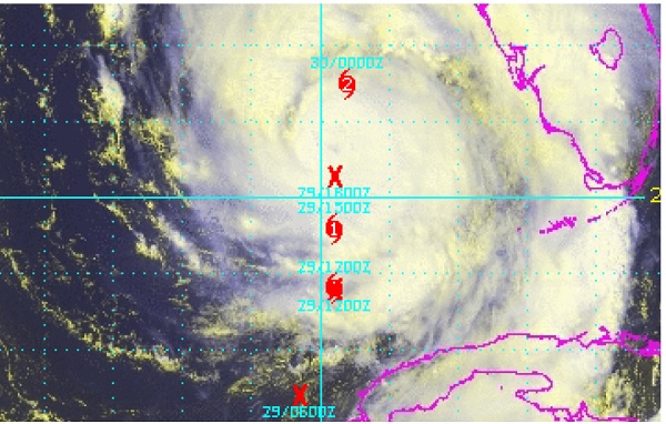
Is it just me or is the latest satellite showing a visible wobble or shift to the east?
--------------------
HurricaneSteph
Orlando
|
vineyardsaker
Weather Guru

Reged:
Posts: 150
Loc: New Smyrna Beach, FL
|
|
As somebody who lost his home from Ian last year, I totally concur. Do *NOT* get stuck in your house, if it floods it will flood VERY QUICKLY and it is even worse in pitch darkness. If you are anywhere along the West coast of FL, evacuate , even for just 24 hours, get to any friends/hotel inland and on higher ground. And, before you leave, try to lift to higher places your most precious belongings (well, the most precious take with yourself): on beds, on closets, 2nd floors, safe rooms, etc. etc. etc. 30 mins of house preparations could make a huge difference to what you might lose.
Good luck to all and God bless!
--------------------
Charley(eyewall), Ivan, Jeanne, Dennis, Wilma, Irma, Ian (eyewall), Nicole
|
cieldumort
Moderator

Reged:
Posts: 2305
Loc: Austin, Tx
|
|
Quote:
Is it just me or is the latest satellite showing a visible wobble or shift to the east?
I've also noticed a very slight lean to the right recently based on radar, Flhurricane Facebook Post , but big-picture, it might not be outside of the forecast plots. Fortunately, recon is almost back in so we should know a lot more this evening.
|
Rick31416
Registered User
Reged:
Posts: 3
|
|
It's drifting slightly east, but that was predicted. It's dead centered on the predicted track.
https://www.wunderground.com/wundermap
|
IsoFlame
Weather Analyst

Reged:
Posts: 295
Loc: One block off the Atlantic Oce...
|
|
A lot of intense lightning in outer band of convection well north and east of Idalia, and the moisture tail extending well south into the western Caribbean Sea:

Edited by IsoFlame (Tue Aug 29 2023 11:38 PM)
|
JMII
Weather Master
Reged:
Posts: 489
Loc: Margate, Florida
|
|
Starting falling apart at landfall, the whole SE quad is missing. NE eyewall hit Perry where several YouTubers were. Radar based estimates put the winds at 70 to 110 MPH, so Cat 2 maybe. The track verified really well but winds are over-estimated which is typical for the as they tend to err on the side of being too high vs too low.
--------------------
South FL Native... experienced many tropical systems, put up the panels for:
David 79 - Floyd 87 - Andrew 92 - Georges 98 - Frances 04 - Wilma 05 - Matthew 16 - Irma 17
Lost our St James City rental property to Ian 22
|
Kraig
Weather Hobbyist

Reged:
Posts: 68
Loc: Jupiter, Fl
|
|
It was a very fortunately timed eyewall replacement cycle that started just after 5am that took much of the momentum and energy away just prior to landfall.
|
IsoFlame
Weather Analyst
Reged:
Posts: 295
Loc: One block off the Atlantic Oce...
|
|
Quote:
It was a very fortunately timed eyewall replacement cycle that started just after 5am that took much of the momentum and energy away just prior to landfall.
That and heading toward low tide at the time of landfall. Still, historical flooding (ongoing) in Steinhatchee Family friend has a generational "cabin" used as a base camp for scallop season that has seen water in it numerous times from lesser storms over the years- but never washed away. I'm not sure if it was able to withstand Idalia's surge.
--------------------
CoCoRaHS Weather Observer (FL-VL-42) & Surf Forecaster: https://www.surf-station.com/north-florida-surf-forecast-3/
|
Sam568
Registered User

Reged:
Posts: 1
Loc: Tampa
|
|
Been a lurker for years; just now registered. Thank you for this forum. Has anyone looked at the Keaton Beach buoy data set from this morning?
https://www.ndbc.noaa.gov/station_page.php?station=ktnf1
Wind speed data from 0800 is missing (reported as 0). reports landfall at 0745, so 0800 windspeed from that buoy would be factual measured information. Pressure/Temp data at 0800 is reported, so unlikely to be a satellite send failure. Anemometer apparently did not blow away, as wind speed data resumed at 0900 and still reporting. Any thoughts or insights regarding this anomaly? Datalogger info would likely still be there and be physically available. Asking for a friend who examines factual data and is curious about how much wind speed suddenly drops in an "eyewall replacement cycle".
|
JMII
Weather Master
Reged:
Posts: 489
Loc: Margate, Florida
|
|
Zero wind speed could be the eye overhead. I didn't check myself, but if the pressure is the lowest during this measurement that would tell me the calm eye crossed this station at that time stamp.
|


 Threaded


