MikeC
Admin
Reged:
Posts: 4695
Loc: Orlando, FL
|
|
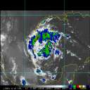
Where do you think Hurricane will make landfall?
|
Bayou64
Registered User
Reged:
Posts: 6
Loc: Magnolia, TX
|
|
I'm hoping for landfall further south then predicted. I believe, however, the storm center will be about 20-30 miles east of Matagorda at landfall. I've been through Betsy and Camille and a slew of others between La. and Tx. This one spooks me.
Good luck to all in the path.
Jim Carbo
Magnolia, TX
|
Bayou64
Registered User
Reged:
Posts: 6
Loc: Magnolia, TX
|
|
Well the has changed its plot. I think I will too. As of this time, I suspect landfall should be near Bolivar Peninsula. My barometer is reading slightly higher than earlier. Let's hope that's a good thing. I'm still in the "cone" but hoping for a more easterly push now.
Good luck to those in the path(wrath).
Carbo
Magnolia, TX
|
reasonmclucus
Verified CFHC User

Reged:
Posts: 17
Loc: Kansas
|
|
The did a good job forecasting 's track. I suspect if they miss it will involve setting the course too far south. Galveston needs to have hit to the north, but I think she will hit close enough on the south side to cause significant damage, particularly if she only falls back to a Category 4. If she hits as a Cat. 5 it may not make much difference. Her pressure has dropped to 898mb. with winds at 175 mph which might qualify as a Cat 6 if there were such a Category.
http://www.nhc.noaa.gov/refresh/graphics_at3+shtml/023809.shtml?3day
The current track indicates we may be feeling some effects from here in central Kansas.
I noticed the computer models at wunderground were showing a northern turn before Texas, but that may be due to problems with the display considering that some of them were showing current location between Cuba and Mexico.
--------------------
Almost only counts in horseshoes, hand grenades and hurricanes.
|
SMOKE
Weather Watcher

Reged:
Posts: 33
Loc: USA, Ga.
|
|
We are definately getting down to the wire for the landfall forecast.
Director Mayfield has made it clear there will be some changes to the track. Model agreement is no greater than 48-72hrs before landfall.
--------------------
|
Bayou64
Registered User
Reged:
Posts: 6
Loc: Magnolia, TX
|
|
As the moves their predictions east I will too. I'm thinking landfall more along the mid La coast, not Beaumont, Port Arthur area. When I was growing up in the New Orleans area we wouldn't rule out a storm hitting us if it was above 25n and it had not passed 90w. New Orleans may take another shot with this one.
Good luck to those in the path.
Carbo
Magnolia, TX
|
cmiller324
Registered User
Reged:
Posts: 6
|
|
I am a newbie on this site.
My guess would be landfall somewhere in the vicinity of Pecan Island, La. That is 50-55miles east of Cameron.
A little too close to me in Terrebonne Parish, La.
|
Bayou64
Registered User
Reged:
Posts: 6
Loc: Magnolia, TX
|
|
I wouldn't put it out of the question for this thing to actually go east of there. I'll have to check some other data in about 6-8 hours. At least with this trend I'm breathing a sigh of relief, for the moment, since traffic leaving the area is at a stand still.
Good luck to those in the path.
Carbo
Magnolia, TX
|
reasonmclucus
Verified CFHC User

Reged:
Posts: 17
Loc: Kansas
|
|
The computer projections are getting wierd. One has turning around and going south along the Texas coast to Mexico.
http://www.wunderground.com/tropical/tracking/at200518_model.html
I gather that some of the projections are expecting to go south around the High pressure system. If they are right 'Rita could hit the La. coast and then go south to Texas.
I still think Texas is a likely target but fortunately north of Galveston rather than south. Unfortunately, too far north east and New Orleans gets flooded again. With 's size that could happen even with landfall at Galveston.
--------------------
Almost only counts in horseshoes, hand grenades and hurricanes.
|
reasonmclucus
Verified CFHC User

Reged:
Posts: 17
Loc: Kansas
|
|
I've been looking at the geography of the area. the indented nature of the shoreline could allow the top winds to affect a much larger area than is often the case. If comes in at the right angle the top winds could affect much of the La. coast even if the eye itself makes landfall in Texas.
--------------------
Almost only counts in horseshoes, hand grenades and hurricanes.
|
Bayou64
Registered User
Reged:
Posts: 6
Loc: Magnolia, TX
|
|
Landfall is almost..."almost" certain. It will probably move inland. BUT....Don't be surprised if this thing doesn't loop around in the next 8-12 hrs. I'm thinking a loop towards the west.
|
reasonmclucus
Verified CFHC User

Reged:
Posts: 17
Loc: Kansas
|
|
Quote:
Landfall is almost..."almost" certain. It will probably move inland. BUT....Don't be surprised if this thing doesn't loop around in the next 8-12 hrs. I'm thinking a loop towards the west.
You're not the only one suggesting a loop. A couple of the computer models are also suggesting a loop. One would have back into the Gulf, one toward the middle of Texas and another moving south west along the Texas coast.
http://www.wunderground.com/tropical/tracking/at200518_model.html
--------------------
Almost only counts in horseshoes, hand grenades and hurricanes.
|


 Threaded


