Steve H.
Unregistered
|
|
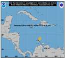
Toni, the position of Kyle is incorrect this morning and admittedly they had trouble locating the center due to the dense overcast. I had him moving WSW at 2mph and a position at 27.5N/67.5 west. Let's see if the visibles verify as I get some part of the vis loops to look at, but it appears the "center" is moving WSW slowly. This would put mim under the ridge instead of ahead of it. This shift may put him in a position to move further west towards the Bahamas. Lili continues on her forecasted track and will threaten LA in a couple of days. Cheers!! Steve H.
|
Frank P
Veteran Storm Chaser
Reged:
Posts: 1299
|
|
Last recon reported 986 mb... that's a 5 mb drop... Lili looks very impressive on both the IR and the vis right now.... Should be upgraded to Hurricane by early this afternoon.... if not by 11:00 am...
Latest model runs still consistently show impact west of New Orleans....
|
CFHC

Reged:
Posts: 170
Loc: East Central Florida
|
|
Apologies for no updates this weekend. Was taking a break as I think things will get busy again once Lili is in the gulf (I almost think Isidore was the "warm up" for Lili now). I'm at work and will try to get an update out after !1AM, and barring that later when I'm back.
Thanks
- Mike C.
|
Frank P
Veteran Storm Chaser
Reged:
Posts: 1299
|
|
GOES vis hints of a small diameter eye forming around 20.0N and 79.9W.... not really sure if this is an eye yet but sure gives the impression of one...
|
Toni
Unregistered
|
|
Thanks Steve, that makes more sense. Keep us informed!
Toni
|
HanKFranK
User

Reged:
Posts: 1841
Loc: Graniteville, SC
|
|
a'ite, here goes. lili was just upgraded to hurricane and keeps mentioning 'rapid intensification criteria' as being met. lili's got RIC. barring the influence of cuba and the yucatan, which should keep the rapid intensification from going down during the next 36hr.. by wednesday the storm should be deepening quite a bit. this should slow thursday as it reaches a lower ocean heat area near the coast. just going to make an arbitrary intensity forecast to go with my beaumont, tx area strike thursday afternoon..
12hr(11pm 9/30)--983mb, 80mph
24hr(11am 10/1)--978mb, 85mph
36hr(11pm 10/1)--974mb, 90mph
48hr(11am 10/2)--963mb, 105mph
60hr(11pm 10/2)--948mb, 120mph
72hr(11am 10/3)--944mb, 135mph
landfall ~78hr, 5pm 10/3--942mb, 140mph
there, that isnt very nice. probably a little on the high side. bastardi has it in the 2/3 range.. official is 3. i'm shooting for 3/4. not just to be different.. think it possible.
for kyle, most models calling for recurvature now. it looks more feasible.. just taking it east. bastardi is talking of some energy getting left behind under the ridge and coming back.. some lunar tidal event that has a history of storms falling near it.. i dunno about that, but any energy left behind could indeed become a new storm. as for kyle.. about ready to hang my hat on it going out.
94L.. an LLC came out this morning.. this thing was pretty near depression. it's under the worst of the shear, with subsidence but lighter shear on the other side.. by tomorrow it may be across (unless it runs straight into the e-w jet). still has a chance at development, but really going to have to fight.
anyhow, lili, thursday afternoon/evening, beaumont, tx. 3/4 range. 940-950mb. 120-145mph.
HF 1555z30september
|
jth
Storm Tracker
Reged:
Posts: 275
|
|
Still seem to think that she will move a little further northeast than anticipated. Not much, but a little. If she gets past 92 I will be surprised. New Orleans needs to watch very closely. This could turn out to be that worst case scenario always talked about. A Major Hurricane approaching from the southeast would absolutely destroy the city. I hope beyaond all hope that I am wrong. I'm afraid the loss of life would be astronomical. Looks like another rainy Saturday Gameday for Bama and the Gameday crew from ESPN in T-town..
|


 Threaded


