VAgirl
Registered User
Reged:
Posts: 1
|
|
Just wondering if SNONUT is still around. Been reading his posts for several years now and miss his input/insight.
|
MissBecky
Weather Guru

Reged:
Posts: 112
Loc: Ft. Myers, FL
|
|
Voluntary evacuations in Collier County will be beginning at 2:00 p.m., for anyone who lives in a manufactured home, or who lives near the coast.
|
Tazmanian93
Weather Master

Reged:
Posts: 495
Loc: Tampa
|
|
Also distances from coastlines would be great, if it can be added, thanks
--------------------
Don't knock the weather; nine-tenths of the people couldn't start a conversation if it didn't change once in a while.
Go Bucs!!!!!!!!!
****************
Ed
|
HumanCookie
Verified CFHC User

Reged:
Posts: 17
|
|
It is High waves not cloud.
|
VandyBrad
Weather Hobbyist

Reged:
Posts: 80
Loc: Bryan, TX
|
|
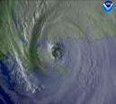
Looking at that IR loop... it appears that extrapolating the path of the eye takes it on a more N-NW course than the forcasted track.
--------------------
Brad Shumbera
|
RedingtonBeachGuy
Moderator
Reged:
Posts: 342
Loc: St. Cloud, FL
|
|
not a good sign.. looks to me like ole'e is starting to make a more northerly turn instead of that WNW everyone wants to believe is going to happen. Somebody tell me this is NOT happening.
|
HanKFranK
User

Reged:
Posts: 1841
Loc: Graniteville, SC
|
|
after going wnw overnight the center is moving nw again.. looks like it will make landfall very close to cienfuegos. extrapolated path would take it back offshore near matanzas early in the evening. there is a saddle between uplands to the west near havana and the eastern two thirds of the island... might thread the needle if it moves straight. then again, it will be landfalling near an eyewall replacement cycle.. last recon fix got 150kt flt lev winds and a 937 cpres. the storm will probably move offshore with its center in disarray... probably a 2/3. how quickly it spins back up is hard to say. environment and SSTs in the se gulf will be supportive, so it will probably be 3/4 on saturday. the SSTs in the northeast/north central gulf are 82-84, so it will probably be a 3 by that standard... then again it will be impacting the coast at more or less a right angle, which has been known to force minor strengthening. i'm really low confidence on this, but going to keep my target on walton/bay co florida as a cat 3 (105-110kt, 955mb or so), sunday afternoon. looked at joe b's thoughts and think they make sense too... aside from personal preferences the area around mobile/pensacola has been at the center of the model spread for a couple of days.
joe b is calling for the wave at 30w to develop over the coming days. i've been with him on that.. should really do much until it gets near 45w though. more northerly track, he says. yeah, models are doing that... did with pre-dennis, but i don't think this one will wait til the caribbean to develop. might bug luis next week... east coast worry if anything beyond that.
keep an eye on the western caribbean in the wake of . a couple of models are following pressure falls there early next week (canadian, ukmet).. around the time that wave near 60w should be arriving on the scene.
by the way, also checked for 'analogs' last night. for cat 4 hurricanes in july, the ones in 1916 (gulf) and 1926 (bahamas, e fl) were the only two i spotted. audrey in '57 was very late june, so worth note in that sense. there were a few other seasons with early season activity like this one... 1959 for instance had it's 4th named storm form on july 5th (and get its name on july 7th).. 1966 had a 4 storm july.. and so did '95. 1933 was on its 5th storm by the end of july. '33 and '95, unfortunately, are probably our strongest analogs... 21 and 19 ts/hurricanes respectively. and back in '33 there was no satelite detection or recon, so that number may be low.
so what is this we're in now.. tsfh jr? starting to look like it.
HF 1733z08july
|
Lysis
User

Reged:
Posts: 451
Loc: Hong Kong
|
|
ok... it's not happening.  Don't focus on every wobble... if something is consistent than that is cause for worry. Don't focus on every wobble... if something is consistent than that is cause for worry.
--------------------
cheers
|
D3m3NT3DVoRT3X
Weather Watcher

Reged:
Posts: 48
Loc: The Burg < FL
|
|
yes looks to be that way .. punching in @ about 80.5 or 80.75 degrees your guess as good as mine =P
|
adogg76
Weather Hobbyist
Reged:
Posts: 53
|
|
He is gonna turn......AM NOT A PRO.....just an opinion......Dennis will be turning more NNW and northerly.....too many factors in west GOM and over North Texas......IMHO.....Tampa will get the experience they missed out on last year!!
|
FlaMommy
Storm Tracker

Reged:
Posts: 225
Loc: Tampa(Riverview), Florida
|
|
please i pray to the weather gods...dont let it hit tampa....i sure hope ur wrong adogg...prayer and thoughts are with those who lost loved ones in cuba.... 
--------------------
"Haven't thought of a witty one lately"
|
Lysis
User

Reged:
Posts: 451
Loc: Hong Kong
|
|
Perhapes this will become the Decade From Hell?
--------------------
cheers
|
WeatherNLU
Meteorologist

Reged:
Posts: 212
Loc: New Orleans, LA
|
|
I'd love to hear the explanation of these "factors" that you think will cause to turn northerly.
I understand you are not a pro, but what do you see to make you believe that is going to run right through high pressure to move north?
--------------------
I survived Hurricane Katrina, but nothing I owned did!
|
VandyBrad
Weather Hobbyist

Reged:
Posts: 80
Loc: Bryan, TX
|
|
Quote:
ok... it's not happening.  Don't focus on every wobble... if something is consistent than that is cause for worry. Don't focus on every wobble... if something is consistent than that is cause for worry.
Not focusing on every wobble. Extrapolating the eye movement from the last 5 hours definiitely appears to be more northerly than the forcast track and much more northerly than the WNW movement we were seeing overnight.
--------------------
Brad Shumbera
|
Terra
Storm Tracker
Reged:
Posts: 286
Loc: Kingwood, Texas
|
|
There is a much larger northward component to the motion now.... seems to be following the path much better than I thought it was last night (granted, it was slightly shifted because of that).
I find it interesting that Jeff and Orleans, LA are on different ends of the spectrum. It is going to be crazy! But, as long as the motion is beginning to be more northerly, I think panic is unnecessary at this point....
--------------------
Terra Dassau Cahill
|
Southern4sure
Weather Guru

Reged:
Posts: 121
Loc: Land O Lakes, FL
|
|
Quote:
He is gonna turn......AM NOT A PRO.....just an opinion......Dennis will be turning more NNW and northerly.....too many factors in west GOM and over North Texas......IMHO.....Tampa will get the experience they missed out on last year!!
Do not say that!
|
jeangfl
Verified CFHC User

Reged:
Posts: 19
Loc: Ft. Myers, FL
|
|
Clark, How close to Ft. Myers are you thinking? This is a scarey storm!
|
KC
Weather Hobbyist
Reged:
Posts: 87
Loc: Naples, FL
|
|
Quote:
Voluntary evacuations in Collier County will be beginning at 2:00 p.m., for anyone who lives in a manufactured home, or who lives near the coast.
If anyone needs additional information regarding Collier County (Naples), check the following:
www.colliergov.net (goes directly to the special emergency resources page)
www.naplesnews.com
Karen
|
jth
Storm Tracker
Reged:
Posts: 275
|
|
Looks like he may miss key West just barely west. I sure hope the residents changed their minds about staying. I believe they will get in the eye wall and in the NE Quadrunt at that. Then I still believe it will be a landfall near Destin as a strong cat 3. The parameters just are not in place for it to pull a . He will go NW to NNW all the way to the coast and beyond. Look out Bham and Atlanta.
|
LizL
Verified CFHC User

Reged:
Posts: 17
Loc: St Cloud, Fl
|
|
Its just to early to tell still, I have a bad feeling about this storm, animals are acting strange and kids are too quiet, i am prepared but this is strange. its really cloudy here today with a slight breeze. they are saying possible tornado warnngs here for saturday. So i sit and hope for all of us not to get this monster from the GOM.
|


 Threaded


 Don't focus on every wobble... if something is consistent than that is cause for worry.


