ShanaTX
Storm Tracker
Reged:
Posts: 226
Loc: Texas
|
|
Check out http://www.stormcarib.com/reports/2005/mexico.shtml
Reports from Cozumel.
Well, a few anyway. The authorities seem to have turned off the power themselves and had mandatory evacuations. They seem to have gotten everyone they could off the coastal areas... from what I've read online elsewhere.
'shana
|
Margie
Senior Storm Chaser

Reged:
Posts: 1191
Loc: Twin Cities
|
|
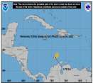
The Cancun radar, which seemed to have died, is up again and you can clearly see the eye half over land, half over water, with the SW eyewall at Tulum.
Looks like a particularly strong band went right over the one town in Cozumel.
(Click on the radar photo at the top of this topic).
--------------------
Katrina's Surge: http://www.wunderground.com/hurricane/Katrinas_surge_contents.asp
|
HanKFranK
User

Reged:
Posts: 1841
Loc: Graniteville, SC
|
|
the fairy godmother got emily today, too. like this storm isn't making landfall at peak intensity, though 135mph is nothing to relax about. storm should probably spin down to a 1/2 by late tomorrow when it slides off into the gulf... and deepen back to a 3 by mid tuesday. it may gain a little latitude as the shortwave slides by to the north on the continent.. models not showing a great deal of this.. then resume wnw course and probably hit extreme ne mexico a couple hours before sunrise on wednesday. may be edging cat 4 intensity by that time again. i don't buy quite the westerly bend is advertising, but don't think it'll get up to texas either.
99L probably didn't survive the upper trough. the southern vortmax from earlier is popping some convection, oddly enough.. but it was the weak one that i didn't expect to survive. essentially no model support for future activity with this feature, but i've still got a shred of remaining concern that the part that made it through can regenerate. stranger things have happened, but this one is probably done.
weak model support for subsequent waves in the east atlantic to spin up. mild suggestion of an -origin fish spinner in the north atlantic also. after emily is done we may not see another july system, though right now i'd say that chances are slightly higher that something else will perk up before the month is out.
HF 0758z18july
|
danielw
Moderator

Reged:
Posts: 3527
Loc: Hattiesburg,MS (31.3N 89.3W)
|
|
Thanks for the update, Hank. And the good word of nothing waiting in the wings...so to speak.
Recon has departed Emily, as of 0637Z, and are on their way home. That was one, long, mission.
They flew their first fix at 2327Z yesterday. Over 6 hours of storm time and they aren't home yet.
I bet they can't stand the "Emily" word. Like the "Dennis" word.
Bunny Rabbit storms this year...they keep going and going.
HURRICANE EMILY TROPICAL CYCLONE UPDATE
NWS TPC/NATIONAL HURRICANE CENTER MIAMI FL
300 AM EDT MON JUL 18 2005
SATELLITE AND RADAR IMAGES INDICATE THAT THE CENTER OF HURRICANE
EMILY MADE LANDFALL JUST NORTH OF TULUM MEXICO NEAR 0630Z...230 AM
EDT THIS MORNING. THE ESTIMATED INTENSITY AT LANDFALL WAS 135
MPH...CATEGORY FOUR ON THE SAFFIR-SIMPSON SCALE. THE NORTHERN
EYEWALL...WHERE THE WORST WEATHER WOULD BE EXPECTED...PASSED
DIRECTLY OVER COZUMEL.
FORECASTER FRANKLIN
Edited by danielw (Mon Jul 18 2005 03:18 AM)
|
Margie
Senior Storm Chaser

Reged:
Posts: 1191
Loc: Twin Cities
|
|
Quote:
Thanks for the update, Hank. And the good word of nothing waiting in the wings...so to speak.
Recon has departed Emily, as of 0637Z, and are on their way home. That was one, long, mission.
They flew their first fix at 2327Z yesterday. Over 6 hours of storm time and they aren't home yet.
I bet they can't stand the "Emily" word. Like the "Dennis" word.
Bunny Rabbit storms this year...they keep going and going.
I saw on the scheule on website that they were going to be doing that (flying in the storm for hours straight). But I guess doesn't make all the recon data avail on its web site. How do you know all that info. Also if you had access to the data what did the winds in the NE quad look like over the six-hr period?
--------------------
Katrina's Surge: http://www.wunderground.com/hurricane/Katrinas_surge_contents.asp
|
danielw
Moderator

Reged:
Posts: 3527
Loc: Hattiesburg,MS (31.3N 89.3W)
|
|
Superfly saw the peak flight level wind around the same time I did.
6 hours of data is a Lot of data. They transmit anywhere from every 30 seconds to every 60 seconds. So that 's 60-120 lines of data per hour. Something like 7-12 columns per line so it's not something you can look at for very long.
Your eyes get tired and the numbers start running together.
The vortex message carries the summation of the data. With No exception that I can think of.
I imagine the folks at and Hurricane Research Division have real time displays of what the data is representing.
It's just that watching the data on a display for 6 hours would be like watching TV or a movie for 6 hours straight.
I guess it's part of their job, and more interesting to them.
|


 Threaded


