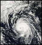
typhoon_tip
Meteorologist
Reged:
Posts: 576
|
|
Quote:
Updated advisory just raised the winds to 130 knots sustained (150 mph). A new forecast has been issued as well, mainly to reflect the increase in intensity.
...That's what I thought.. I knew they would give this Cat 4 status...just to chap our hinies..
|
Margie
Senior Storm Chaser

Reged:
Posts: 1191
Loc: Twin Cities
|
|
Here's something else I just noticed going back and looking at the wv loop...over the last five or six frames you can see the humidity clearing out of the eye, as the color changes down through the spectrum from red to grey-white.
Notice they kept the intensity at Cat 4 because of the winds. A tersely written special disc. I assume the plane will be sticking around to measure any record low central pressures, and to see if winds spin up to match the pressure. Guess the is going to come hard on the heels of this intensification phase. Can hardly believe the eye went from 7 to 4nm. Is it even possible for it to get any smaller? Possibly that is why the winds cannot spin up as they normally would?
--------------------
Katrina's Surge: http://www.wunderground.com/hurricane/Katrinas_surge_contents.asp
|
FelixPuntaGorda
Verified CFHC User

Reged:
Posts: 23
Loc: Punta Gorda, FL
|
|
I hope this isn't the wrong place to ask this, but I'd like some information on storm surge with a Cat 4/5. I know about being on the "good" side vs "bad" side. I learned a lot about surge from . So my question is, does the surge stay with the storm or does it expand out, like dropping a rock into a pond? What are the surge implications at the point of the hard right turn?
In other words, even if you're on the 'good' side, do you still have to worry about surge ahead of the storm?
Thanks.
--Fay
|
Thunderbird12
Meteorologist
Reged:
Posts: 644
Loc: Oklahoma
|
|
130 knots is the by-the-book 20% reduction of 850mb winds, which were reported at 162 kts in the NE quadrant. I'm surprised they went ahead and issued an official update to the forecast, since stronger winds may exist in the NW quadrant, which has not been sampled yet.
|
harmlc.ath.cx
Weather Hobbyist

Reged:
Posts: 54
Loc: Longwood
|
|
At 5:00 it was at 80 mph sustained, so in about 8 1/2 hours it nearly doubled its sustained winds.
|
Lake Toho - Kissimmee
Storm Tracker

Reged:
Posts: 317
Loc: Kissimmee, Florida on Lake Toh...
|
|
Well now starts the wobbles and the its going north, its going south, its going just south of west but north conversations.. LOL.. BTW: Its now wobbled slightly north of the forecast points and appears to have a fairly NW Component.
--------------------
Dream like you will live forever.. Live like there is no tommorow.. Darwin Rules !!
|
Tazmanian93
Weather Master

Reged:
Posts: 495
Loc: Tampa
|
|
Evening all, I walk away for a couple of hours and I am in total amazement. INCREDIBLE
--------------------
Don't knock the weather; nine-tenths of the people couldn't start a conversation if it didn't change once in a while.
Go Bucs!!!!!!!!!
****************
Ed
|
typhoon_tip
Meteorologist
Reged:
Posts: 576
|
|
Quote:
So in english what does that mean Typhoon ?
...In other words... hurricanes often produce a ring a few hundred naut miles from their cores which is marked by subsidence and a surface higher pressure reflection... The more intense the hurricane, the more prominent this type of "moating" becomes..
"Typhoon Tip" in the Pacific Ocean, when combinging all factors used to gauge hurricanes, ranks number 1 as the most intense tropical cyclone on record. On October 12, 1979 he (or she) had winds gusting as high as 190 mph and the central pressure came down to 870 mb! The size of the circulation around Typhoon Tip was approximately 1350 miles (2174 km) across. If placed over the continental U.S., it would almost cover the western half of the country. This is the most profound example I can think of to elucidate the nature of "creating own environment"... Not that will ever be a Typhoon Tip, but, sufficed to say, a storm of that magnitude is a demonstrative example of how so much momentum and physics starts to dictate its surroundings...
Beyond this example, which I'm sure you can find on line, the discussion gets really complex with physics to described why such mega amounts of ascending air tend to be counter-balanced by descending air, at scales larger then meso; which tend to mitigate outside influences and effectively protecting the core.
|
typhoon_tip
Meteorologist
Reged:
Posts: 576
|
|
Quote:
I hope this isn't the wrong place to ask this, but I'd like some information on storm surge with a Cat 4/5. I know about being on the "good" side vs "bad" side. I learned a lot about surge from . So my question is, does the surge stay with the storm or does it expand out, like dropping a rock into a pond? What are the surge implications at the point of the hard right turn?
In other words, even if you're on the 'good' side, do you still have to worry about surge ahead of the storm?
Thanks.
--Fay
Storm surge varies with the topographical layout of the near shore marine bottom.. If you have a sharp declination in oceanic depth very close to the shore, the storm surge of a cat 4 hurricane (for example) won't be as inland inundating as one that occurs where there is a long distance of shallow water... The reason is that the mass carried along with the storm surge in shallow water does not have as readily, a means to disperse before impacting elevations higher than absolute sea-lvl.
The point is, much goes into the calculations for storm surge. There are models on line now specifically designed to calculated surge potentials per wind speed, for various locations.. I'm not a regular user of those products, though, so you'll have to do a little research to find them.
There are some general guidlines however, that can be used for categories of storms and their counterpart surges:
Category One Hurricane:
Winds 74-95 mph (64-82 kt or 119-153 km/hr). Storm surge generally 4-5 ft above normal.
Category Two Hurricane:
Winds 96-110 mph (83-95 kt or 154-177 km/hr). Storm surge generally 6-8 feet above normal.
Category Three Hurricane:
Winds 111-130 mph (96-113 kt or 178-209 km/hr). Storm surge generally 9-12 ft above normal.
Category Four Hurricane:
Winds 131-155 mph (114-135 kt or 210-249 km/hr). Storm surge generally 13-18 ft above normal.
Category Five Hurricane:
Winds greater than 155 mph (135 kt or 249 km/hr). Storm surge generally greater than 18 ft above normal.
...These values are then augmented based on particular incidences of coastlines being impacted...
Oh, and to answer your question - the "good side" is always better... If a storm has a 20ft surge, they are not meaning the area with offshore wind components...they are talking about areas in the eyewall where the winds are normal to the coast - the surge values tend to drop off considerably outside the eyewall, then taper more gradually in the tropical storm force areas..
Edited by typhoon_tip (Wed Oct 19 2005 01:42 AM)
|
typhoon_tip
Meteorologist
Reged:
Posts: 576
|
|
Quote:
130 knots is the by-the-book 20% reduction of 850mb winds, which were reported at 162 kts in the NE quadrant. I'm surprised they went ahead and issued an official update to the forecast, since stronger winds may exist in the NW quadrant, which has not been sampled yet.
yeah...sorry... I was just reading the vortex message more closely...I had it in my head that they were talking about a lower altitude...
|
evergladesangler
Weather Hobbyist
Reged:
Posts: 71
|
|
Any chance it's actually good that it reached this strength so quickly? Or can these pinhole storms sustain this strength for long periods of time?
|
CaneTrackerInSoFl
Storm Tracker

Reged:
Posts: 395
Loc: Israel
|
|
IT NOW HAS THE LOWEST PRESSURE EVER RECORDED. Unbelievable.
--------------------
Andrew 1992, Irene 1999, Katrina 2005, Wilma 2005
|
collegemom
Weather Hobbyist

Reged:
Posts: 82
Loc: Central Arkansas
|
|
Incredible storm. I sure wouldn't have believed we would be here again.
God bless and good luck to anyone nearby.
And as Fred would so aptly say.......WWWWIIIIIILLLLLLMMMMAAAA!!!!!!!!!
--------------------
character has been defined as what we do when no one is looking
Edited by collegemom (Wed Oct 19 2005 07:00 AM)
|


 Threaded


