Clark
Meteorologist
Reged:
Posts: 1710
Loc:
|
|
typhoon_tip and HF pretty much hit the nail on the head regarding 95L out there and subtropical vs. tropical cyclones, so I'll only add a few tidbits.
You can get a lower-level warm core (like you see in a tropical system) when you have convection firing near the center of a cold-core system. More often than not, this convection is a response to the process of gathering heat and moisture from the ocean's surface going, which can lead to the development of this lower-level warm core. (Note that convection does not directly provide the heating for this, though!) If it goes on for long enough given other favorable conditions, you can get a subtropical cyclone out of it.
If the convection persists, the inner core gets going (maximum winds move inward toward the center of the storm rather than found well removed from it), and underlying conditions are still favorable, you can get an upward growth of this warm core into the upper levels. This is what brings about "tropical transition" and the development of a tropical cyclone.
(If any of this is too technical/scientific, please send me a message and I'll try to clarify.)
The identification of subtropical cyclones and tropical cyclones growing out of systems has really taken off in the past few years, largely in response to having someone at the really keen on those hybrid-type of storms (Jack Beven) and at least partially in response to the cyclone phase space (http://moe.met.fsu.edu/cyclonephase/) that helps identify those storms with a fair degree of accuracy. You'll probably see some subtropical phase added to Vince in the final report and, if this develops, probably here too.
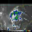
The satellite appearance of 95L continues to improve, with convection trying to wrap around the southeast side of the storm (and, more importantly, persist). QuikSCAT wind fields suggest a rather broad wind field, albeit one with maximum winds relatively close to the center of circulation. Not all of the 00Z model guidance is in, but the available guidance (Canadian and UKMET) show that the system is completing tropical transition now and has had a shallow warm core for some time now. This agrees well with what the other models were showing in terms of forecast evolution earlier today. (Note that this discussion follows from the diagrams at http://moe.met.fsu.edu/cyclonephase/.) I imagine the is waiting for a little bit more separation from the trough to the north of the storm before pulling the trigger on this one; it's likely only a matter of time before they do so. It'll probably start as a subtropical storm before becoming a tropical storm -- Delta -- shortly thereafter. We'll see what actually pans out over the next day or two.
|
HanKFranK
User

Reged:
Posts: 1841
Loc: Graniteville, SC
|
|
the 95L hybrid low is starting to peel back sw as a large high blocks it to the north. it's very much occluded from the frontal trough it has been attached to, but probably not fully detached at this time. ssd has rated it a st2.5, which agrees well with the 40kt/988mb tag that has on it. will of course issue another advisory saying 'it appears to be acquiring tropical characteristics' at 11:30, but if this keeps up, we'll have a post-analysis track starting subtropical today. unless the system has all its convection sheared off or never detaches from the frontal trough still draped around its ne side... the will very likely start issuing advisories on it tomorrow.
almost time for a new thread. whoever puts it up, could you throw in a plug to the forecast challenge 2006? gotta go to class...
HF 1535z22november
|
Margie
Senior Storm Chaser

Reged:
Posts: 1191
Loc: Twin Cities
|
|
Hello all I've been too busy to post the last couple days. Will definitely take the time to review all the information posted about Gamma. I still feel that was a very tenuous call, but you sold me on the circulation; however out of all the storms of this year, the language that was used in the advisories and discussions definitely emphasized its poor organization, more than any other storm I've seen. So I'm assuming that call may have been made in part due to necessity (I prefer to look at it that way rather than to say it was political), since it was just offshore.
Weird to see that the circulation (which essentially was the same one from 93L) rolled back down the coastline of Nicaragua.
I'm seeing low or mid level circulation north of Panama/Columbia (at about 11N77W).
--------------------
Katrina's Surge: http://www.wunderground.com/hurricane/Katrinas_surge_contents.asp
|
|


 Threaded


