neospaceblue
Weather Watcher
.gif)
Reged:
Posts: 28
Loc: Newport News, VA
|
|
Here is my forecast
_11 PM Thursday -- 110 mph
_11 AM Friday -- 120 mph
_11 PM Friday -- 135 mph
_11 AM Saturday -- 145 mph
_11 AM Sunday -- 160 mph
_11 AM Monday -- 140 mph
_11 AM Tuesday -- 125 mph -- INLAND
--------------------
I survived: Hurricane Bonnie (1998), Hurricane Dennis (1999), Hurricane Floyd (1999), Hurricane Isabel (2003), Tropical Storm Ernesto (2006)
|
SeaMule
Weather Hobbyist

Reged:
Posts: 64
Loc: Fairhope, Al...on the coast
|
|
It appears to me to be spending energy getting larger in convective area...and therefore more dangerous. There was talk initially that it was a small cyclone...don't think so now.
I heard a newsman say that the part of the caribbean Dean-0 is headed to is the warmest waters on the planet...as far as oceanic deep heat content. Well, I don't know about that...but perhaps that's the point Dean explodes to it's full potential.
I wouldn't call the GOM bathtub anything but MORE fuel for the fire...
|
rmbjoe1954
Weather Master
Reged:
Posts: 428
Loc: Port Saint Lucie, Florida, USA
|
|
The models are having a heck of a time but kudos to the for being as accurate as it has been.
I hope the islanders have prepared accordingly- but I see no reason to think this storm can go the way of . It does appear that the area of concern down the road has got to be from Mexico to Texas. I mean, the speed of this thing is awesome. I would not have believed that crusing at 23 MPH would allow Dean to whip up to 100MPH winds.

--------------------
________2024 Forecast: 24/14/7________
There is little chance that meteorologists can solve the mysteries of weather until they gain an understanding of the mutual attraction of rain and weekends. ~Arnot Sheppard
Edited by rmbjoe1954 (Thu Aug 16 2007 05:33 PM)
|
native
Weather Guru

Reged:
Posts: 148
Loc: SE Florida
|
|
Quote:
I think there is little question on the importance of the Gulfstream IV upper level wind sampling that will be occurring. This information is going to paint a much better picture of what is going on and should help the future model runs out quite a bit.
I am aware that the Gulfstream IV run is scheduled for 17/00z. What I am curious about is at what point in time will ALL the models/suites have this new information run through them and which advisory tomorrow will reflect this?
|
allan
Weather Master

Reged:
Posts: 468
Loc: Palm Coast, Florida
|
|
Dean is a category 2 Hurricane and getting stronger, could possibly outwit the great Hurricane (2005).. sounds crazy but temperatures in the Gulf Of Mexico are extremely warm. Hurricanes Allen (1980), and Gilbert (1988), and (2004) are similiar to Dean in a way. I still believe the Upper Level Low to the east of Florida will not weaken much and could push Dean more north than it's forecast. tonight as the NOAA aircraft is out there, they will send the information to the computer models and tonight will be the night to finally find out where Dean is headed. Gulf Of Mexico, Mexcio and away from the USA, or could it swing and hit Florida? There is also the possibility that the upcoming High Pressure System that will steer Dean in a few days could weaken a tad and bring Dean to anybody on the Gulf Coast. Those are the scenarios and it's because of the dissagreement of all the models that is making me hold my new 3rd run track. I will make it soon as I find out what these models will agree on.. folks it's very crucial.. Dean could be a category 5 hurricane once it reaches the very warm waters of both the Carribean Sea and Gulf of Mexico... last to note that a situation like is not out of the realm. Everybody needs to moniter this storm, even Florida.. it's still possible that Dean could curve up the west coast of FL, it's still has'nt reached the Islands just yet. Dean will pound them tommorow as a Major Hurricane in my opinion.
--------------------
Allan Reed - 18,9,5
Edited by allan (Thu Aug 16 2007 06:00 PM)
|
WeatherNut
Weather Master
Reged:
Posts: 412
Loc: Atlanta, GA
|
|
It looks to me like the ULL over the Bahamas is elongating SW to NE rather than moving to the west. Looks sort of like a "squeeze play" between the high pressure systems. I would expect the tracking to go slightly right of where they are now. Instead of trying to pinpoint an area (impossible right now), ask yourself these questions if you are on the gulf or atlantic coast...where is the hurricane evacuation route for my area? Where would I evacuate to? (inland hotels fill up very quickly). Do I have supplies necessary set aside if I have to stay put. Be prepared before everyone is scrambling to do the same thing at the last minute.
--------------------
Born into Cleo (64)...been stuck on em ever since
|
stevie
Verified CFHC User

Reged:
Posts: 13
Loc: Clear Lake, Texas
|
|
Well stated Allen, I think Erin was a good wake up call for Houston residents along with other coastal residents. After evacuating from many I feel are not paying much attention to their safety during hurricane season. Today parts of southern and eastern Harris county as well as western counties near Houston recieved 8-9 '' of rain. This minor storm has really slowed Houston down today(with 1 fatality). Maybe this will help officials and local Mets to get the message out about the potential threat of Dean. Most here in Houston have experienced the flooding, but not high winds as Alicia(24 yrs ago) was the last major storm to hit the area.
|
bamffl
Verified CFHC User

Reged:
Posts: 20
Loc: Tampa, FL
|
|
I'll probably get in trouble for this, but from the front page:
..."Erin is spawning weak tornadoes in Texas, along with the rain."
What in the heck is a "weak" tornado? 
Sorry, couldn't resist...
--------------------
You're just jealous because you can't hear the voices...
|
charlottefl
Weather Hobbyist
Reged:
Posts: 94
|
|
Well there's an F0 tornado which will maybe knock down small trees and do minor cosmetic damage.
And then there's a F5 tornado which will successfully relocate your house. An F-0 or an F-1 is a fairly weak
tornado when compared with anything stronger.
Edited by charlottefl (Thu Aug 16 2007 07:03 PM)
|
D3m3NT3DVoRT3X
Weather Watcher

Reged:
Posts: 48
Loc: The Burg < FL
|
|
Good post allan the models have swung from mexico to north carolina over the past 48 hrs i'll feel much better once the data from the gulstream jet gets placed in the models the 00Z runs  btw dean went from 50mph winds yestrerday to 100 right now.... wow btw dean went from 50mph winds yestrerday to 100 right now.... wow
Edited by D3m3NT3DVoRT3X (Thu Aug 16 2007 07:14 PM)
|
Pablo712
Registered User
Reged:
Posts: 2
|
|
Data in this Buoy looks strange....likely riped apart some hours ago...
|
dem05
User
Reged:
Posts: 368
Loc: Port Charlotte, FL
|
|
Additional explanation for why the Upper Level Low over the Bahamas is not moving as much as expected:
In my previous post, I indicated that yes, while the ridge to the north of Dean is nudging at the Upper Level Low over the Bahamas from the east, the high over the Missippi Valley/GA (Which extended southward into the northern half of the Gulf and the Western Guld Coast States) was also pushing back from the west. Inhibiting the Bahamas Cutoff Low and southward extending like feature from retrograding westward as quickly as indicated.
It does look reasonably apparent that Erin may have helped to pump up the intensity of the Missippi Valley Ridge and may be continuing to do so. I would like to revisit a post from Clark that he made yesterday... Also, here is a repost of the Water Vapor Link for the Entire Atlantic Basin: http://www.ssd.noaa.gov/goes/east/tatl/loop-wv.html
Quote from a FL Hurricane Poster:
--------------------------------------------------------------------------------
About the only way that Erin could affect dean is if it weakens the high pressure system developing over the central US that is going to cut Dean off from an east coast hit and help force it into the gulf.
--------------------------------------------------------------------------------
Clark's Answer:
Well, it could also help to strengthen that high pressure ridge (due to the warming at upper levels from its convective outflow), resulting in impacts on the pattern further to the east. It's kinda like the case of a recurving system leaving behind a weakness to cause other systems to recurve days later, except the reverse scenario. Granted, in this case, it's likely to be a very small impact -- but probably still a noticeable one.
(Edit -- on retrospect, I see that this also helps answer the question posted by "tumbleman" in the second post in this thread. If they would like more info on this, please reply and explain.)
|
Hugh
Senior Storm Chaser
Reged:
Posts: 1060
Loc: Okaloosa County, Florida
|
|
Quote:
Additional explanation for why the Upper Level Low over the Bahamas is not moving as much as expected...
So, what's your take on the answer? Are the low and the remnant of Erin going to have an impact, do you think, and if so, what impact?
--------------------
Hugh
Eloise (1975) - Elena and several other near misses (1985) - Erin & Opal (1995) - Ivan (2004)
|
Beaumont, TX
Storm Tracker
Reged:
Posts: 318
|
|
If this was to affect the Gulf Coast states what time frame are we looking at? Know that is still a big "if" since Dean has a long way
to go. Sure is a pretty storm.
Erin sent only cooler temperatures and a little rain our way but flooded parts of Houston.
|
danielw
Moderator

Reged:
Posts: 3527
Loc: Hattiesburg,MS (31.3N 89.3W)
|
|
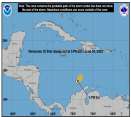
The data on the 41101 buoy looks strange because the Eye of Dean, or very close to the eye passed directly over the buoy.
5pm EDT position was 14.0N/ 56.5W
Buoy is at 14.6 N/ 56.2 W
That's roughly 36 miles from the center of Dean.
Buoy 41101 pressure and windspeed plot.
http://www.ndbc.noaa.gov/show_plot.php?station=41101&meas=wdpr&uom=E
|
MikeC
Admin
Reged:
Posts: 4673
Loc: Orlando, FL
|
|
Just started recording the radar image from Martinique at http://flhurricane.com/imageanimator.php?23
went back west, I noticed, it'll be interesting to see how the GSIV data affects the next model run, if little or not.
|
dem05
User
Reged:
Posts: 368
Loc: Port Charlotte, FL
|
|
Well, I don't have a hard pat answer for your question at this time, and I would really like to give credit to Clark's post forgiving me this theory...so if I happen to go astray/wrong, I hope he sets me straight. 
At this time, Erin is no longer a tropical cyclone. However, the remanants of Erin continue to be that of a warm core low pressure system. Until the remanants of Erin phase out, it will continue to transport warm air and moisture to the upper levels. At this time, Erin's remenants are doing just that. It is this warm air and moisture that I conclude is pumping up the ridge (Keeping it strong enough) to have a blocking effect on the Upper Level Low over the Bahamas. In other words, keeping the ridge strong enough to prevent the Bahamas low from moving westward as quickly as expected by the models.
Itis tough to say when Erin will phase out for sure. In general, I am taking the entire interaction of the Atlantic Ridge, the Bahama's Low, the Gulf States Ridge and other weather features on a 24 hour by 24 hour basis. Now is as good of time as ever to sound like a broken record that we've all heard before.Models are not perfect science here when looking 3,4 or 5 days out folks. However, it is the best tool that the professionals have in making educated decisions. If you all remember correctly, when Dean First developed, the models had a pretty good handleon taking this storm across the NE corner of the Leewards and back into the SW Atlantic. That did not happen and the current 5 day forecast may likely be just as inaccurate, Likewise, it may be very accurate (just as we've seen on many previous storms). For now, do not put all ofyour eggs in one basket on the day 3,4,5 model plots. Dean is far enough away that everyone can be in a monitoring phase (on a 24 by 24 hour basis) and be aware that the upper level low over the Bahama's may have an effect on Dean after all if it continues to retrograde as slowly as it is right now. I know, lot'sof unanswered questions, but this is the best way to approach the future of Dean right now.
|


 Threaded
.gif)


 btw dean went from 50mph winds yestrerday to 100 right now.... wow


