LoisCane
Veteran Storm Chaser

Reged:
Posts: 1237
Loc: South Florida
|
|
Canceling recon just about says it all. I wouldn't say it's dead in the water but definitely not developing any time soon. I've always felt the timing was off with this system. The environment is not very favorable and surprisingly the Atlantic is friendlier suddenly than the caribbean. More on hold if or can wait out the negative conditions it might flare up in the BOC.
--------------------
http://hurricaneharbor.blogspot.com/
|
berrywr
Weather Analyst

Reged:
Posts: 387
Loc: Opelika, AL
|
|
I think as a single tropical entity 92L is not likely going to develop any further; I don't think one can rule out the system splitting but as I posted yesterday on our Facebook page and given the upper air pattern in place over the US; you can't rule out a hybrid; you're right timing matters; take care!
--------------------
Sincerely,
Bill Berry
"Survived Trigonometry and Calculus I"
|
doug
Weather Analyst
Reged:
Posts: 1006
Loc: parrish,fl
|
|
Re: the TO for this morning: it is a puzzle for me to understand the high degree of probability for development of this system based on the current environment. It must be cautionary because there is definitely a low level circulation in the GOM. However, it is under very dry air aloft which should supress otherise norma convective activity...it is a stretch for 50-60% IMO.
--------------------
doug
|
Ed Dunham
Former Meteorologist & CFHC Forum Moderator (Ed Passed Away on May 14, 2017)
Reged:
Posts: 2565
Loc: Melbourne, FL
|
|
I think that it is indeed a small dose of 'cautionary' and a large measure of 'continuity' from the earlier forecasts. The Gulf certainly has its reputation as a breeding ground for hybrid systems - and 92L could quickly fit into that category. Although the circulation is quite weak, convection has started to redevelop to the east of the center. Movement to the west = dry air; to the north, not so much.
ED
|
berrywr
Weather Analyst

Reged:
Posts: 387
Loc: Opelika, AL
|
|
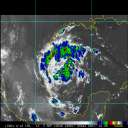
Ed, check out the RAMBIS page and visible imagery - the low level center is completely exposed and moving due west. I looked at the water vapor and as the models have been forecasting the upper level low to fill and be absorbed by the larger longwave trough which its axis is now extended as far south as Houston, TX. Last night, the at 850 millibars took one piece of energy into the Northern Gulf Coast and the other west. There wasn't enough at 500 millibars for me to gauge anything moving west. 92L is likely too shallow for any of us to rely on the global models for the time being. The evolving longwave trough over the southern tier of the United States makes anything tropical approaching the US one unlikely and two, not likely to be pure tropical not with winds aloft in excess of 70 knots. A system moving west still could be absorbed by the main trough if it becomes more vertically deep otherwise, it has a date with the Mexican coast but not likely anything more than a weak storm. I was not aware of the page mentioned in the discussion but I did look it up and here it is: http://rammb.cira.colostate.edu/ramsdis/online/tropical.asp
--------------------
Sincerely,
Bill Berry
"Survived Trigonometry and Calculus I"
|


 Threaded


