MikeC
Admin
Reged:
Posts: 4695
Loc: Orlando, FL
|
|
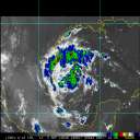
Irma has stalled in the current position, turn likely imminent.
|
rwjaco19
Registered User

Reged:
Posts: 4
Loc: Charlotte Co., FL
|
|
I thought it looked like a stall on radar just off the coast of Cuba? Looks like she's gearing up for the journey north. Still expecting a landfall around Port Charlotte/Manasota Key?
--------------------
// rwjaco19
|
MikeC
Admin
Reged:
Posts: 4695
Loc: Orlando, FL
|
|
Multiple Keys video streams on one page https://zeryl.github.io/irma.html
|
danielw
Moderator

Reged:
Posts: 3527
Loc: Hattiesburg,MS (31.3N 89.3W)
|
|
Just a thought.
Tampa has always feared a storm moving East into Tampa Bay and pushing a storm surge.
Irma on present Track would likely force some of Tampa Bay to the west before a wind reversal would fill it back up after the Storm passes.
|
OrlandoDan
Weather Master

Reged:
Posts: 456
Loc: Longwood, FL
|
|
Any idea on how this stall will effect the future track?
--------------------
Keith (1988), Charley (2004), Frances (2004) , Jeanne (2004), Fay (2008), Mathew (2016), Irma (2017), Dorian (2019)
Personal Weather Station: https://www.wunderground.com/dashboard/pws/KFLLONGW67
|
chance
Weather Watcher
Reged:
Posts: 29
|
|
Quote:
Any idea on how this stall will effect the future track?
It is now moving NNW per radar how that effects it no idea. Praying for everyone in florida there has to be some good news i hope and pray
|
scottsvb
Weather Master
Reged:
Posts: 1184
Loc: fl
|
|
Still WNW.. since 8pm .3W .2N
|
JMII
Weather Master

Reged:
Posts: 546
Loc: Cape Coral & Margate, FL
|
|
Irma's eye is 26 miles from Cudjoe Key, moving NNW.
--------------------
South FL Native... experienced many tropical systems, put up the panels for:
David 79 - Floyd 87 - Andrew 92 - Georges 98 - Frances 04 - Wilma 05 - Matthew 16 - Irma 17
Lost our St James City rental property to Ian 22
|
MikeC
Admin
Reged:
Posts: 4695
Loc: Orlando, FL
|
|
Just got back up, appears it's about to make landfall right now. Middle/Lower keys cell service went out a few minutes ago also. Water being pulled offshore along the west coast of Florida right now.
|
JMII
Weather Master

Reged:
Posts: 546
Loc: Cape Coral & Margate, FL
|
|
Jogged NNE, I'd call land fall at Cudjoe Key, its about dead center of the eye now.
edit the called same thing at 9:10AM... my eyes were glued to the radar and never refreshed the NOAA app 
--------------------
South FL Native... experienced many tropical systems, put up the panels for:
David 79 - Floyd 87 - Andrew 92 - Georges 98 - Frances 04 - Wilma 05 - Matthew 16 - Irma 17
Lost our St James City rental property to Ian 22
Edited by JMII (Sun Sep 10 2017 09:32 AM)
|
MarkFSU
Registered User

Reged:
Posts: 5
Loc: Plant City, FL
|
|
Quote:
Jogged NNE, I'd call land fall at Cudjoe Key, its about dead center of the eye now
NHC had already called landfall there.
"...IRMA MAKES LANDFALL AT CUDJOE KEY IN LOWER FLORIDA KEYS...
The center of Hurricane Irma made landfall at Cudjoe Key in the
lower Florida Keys at 9:10 am EDT. A gust to 106 mph (171 km/h)
was just reported at the National Key Deer Refuge in Big Pine Key.
SUMMARY OF 910 AM EDT...1310 UTC...INFORMATION
----------------------------------------------
LOCATION...24.7N 81.5W
ABOUT 20 MI...30 KM ENE OF KEY WEST FLORIDA
MAXIMUM SUSTAINED WINDS...130 MPH...215 KM/H
PRESENT MOVEMENT...NNW OR 330 DEGREES AT 8 MPH...13 KM/H
MINIMUM CENTRAL PRESSURE...929 MB...27.43 INCHES"
|
MikeC
Admin
Reged:
Posts: 4695
Loc: Orlando, FL
|
|
Went from a near 12 year major hurricane drought to 2 within a few weeks.
|
JMII
Weather Master

Reged:
Posts: 546
Loc: Cape Coral & Margate, FL
|
|
Irma getting really close to Marco Island, 25 miles south.
--------------------
South FL Native... experienced many tropical systems, put up the panels for:
David 79 - Floyd 87 - Andrew 92 - Georges 98 - Frances 04 - Wilma 05 - Matthew 16 - Irma 17
Lost our St James City rental property to Ian 22
|
JMII
Weather Master

Reged:
Posts: 546
Loc: Cape Coral & Margate, FL
|
|
Marco Island is in the eyewall, mobile homes are failing via Jeff's periscope feed.
--------------------
South FL Native... experienced many tropical systems, put up the panels for:
David 79 - Floyd 87 - Andrew 92 - Georges 98 - Frances 04 - Wilma 05 - Matthew 16 - Irma 17
Lost our St James City rental property to Ian 22
|
cieldumort
Moderator

Reged:
Posts: 2529
Loc: Austin, Tx
|
|
Report of 130 MPH gust on Marco.
From NWS - EXTREME WIND WARNING
Quote:
Extreme Wind Warning
National Weather Service Miami FL
327 PM EDT SUN SEP 10 2017
The National Weather Service in Miami has issued a
* Extreme Wind Warning for...
Western Collier County in southwestern Florida...
West central Hendry County in southern Florida...
* Until 530 PM EDT
* At 326 PM EDT, surface observations indicated extreme winds of
over 120 mph, associated with the eyewall of Hurricane Irma, were
moving onshore over Marco Island, or near Naples, moving north at
15 mph.
This is an extremely dangerous and life-threatening situation!
* Locations impacted include...
Naples, Marco Island, Chokoloskee, Ave Maria and Golden Gate
Estates.
|
cieldumort
Moderator

Reged:
Posts: 2529
Loc: Austin, Tx
|
|
|
MikeC
Admin
Reged:
Posts: 4695
Loc: Orlando, FL
|
|
The St. Johns river in Jacksonville is seeing record surge levels, 2ft above the record so far.
|
cieldumort
Moderator

Reged:
Posts: 2529
Loc: Austin, Tx
|
|
|


 Threaded


