F
Current Radar or Satellite Image

Flhurricane.com - Central Florida Hurricane Center - Tracking Storms since 1995Hurricanes Without the Hype! Since 1995


Gulf area (91L) now up to 90% chance for Development, Texas and Louisiana should watch it closely. Two other areas in the Atlantic away from land 50/60% chances respectively.
Days since last H. Landfall - US: Any 34 (Debby) , Major: 375 (Idalia) Florida - Any: 34 (Debby) Major: 375 (Idalia)


General Discussion >> The Tropics Today

Pages: 1
WesnWylie
Weather Guru


Reged:
Posts: 155
Loc:
Low Off of the Louisiana Coast
      #89110 - Fri Aug 27 2010 02:15 PM

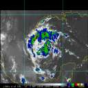
There appears to be a low spinning westward near the South Central Louisiana coastline. It looks like it formed out of all the convection in the Gulf of Mexico. Any thoughts on whether it may be something to keep an eye on?

--------------------
2011 Season Forecast: 16/09/04
2011 Systems: 10/01/01


Post Extras: Print Post   Remind Me!   Notify Moderator  
Wingman51
Weather Guru


Reged:
Posts: 126
Loc: Orlando, FL
Re: Low Off of the Louisiana Coast [Re: WesnWylie]
      #89113 - Fri Aug 27 2010 02:26 PM

appears to just be extended convection from interaction of the stalled front and the Gulf - - no real tropical indicators

Post Extras: Print Post   Remind Me!   Notify Moderator  
visitor
Unregistered


Re: Low Off of the Louisiana Coast [Re: WesnWylie]
      #89125 - Sat Aug 28 2010 10:41 AM

It sure does have that tropical weather feel in south LA today.

Post Extras: Print Post   Remind Me!   Notify Moderator  
Ed DunhamAdministrator
Former Meteorologist & CFHC Forum Moderator (Ed Passed Away on May 14, 2017)


Reged:
Posts: 2565
Loc: Melbourne, FL
Features From Louisiana to Panama [Re: visitor]
      #89126 - Sat Aug 28 2010 11:06 AM

As noted by NHC at 8AM, it is a non-tropical system located at the end of an old front. This Saturday morning the system was located just off the central Louisiana coast and it is expected to move generally north to northeast into inland Louisiana today.

An active tropical wave with a small low pressure center is located just north of Panama in the extreme southwestern Caribbean Sea near 9.7N 81.0W at 28/15Z. Convection currently displaced to the north. The low is drifting north and a track to the north northwest and eventually northwest is probable. At the moment its just an interesting feature to watch.
ED


Post Extras: Print Post   Remind Me!   Notify Moderator  
Jasonch
Weather Watcher


Reged:
Posts: 42
Loc: Texas
Re: Features From Louisiana to Panama [Re: Ed Dunham]
      #89183 - Mon Aug 30 2010 09:11 AM

Has the current wave train off africa stopped? Does it still look to be very active for the month of september?

Edited by Jasonch (Mon Aug 30 2010 09:32 AM)


Post Extras: Print Post   Remind Me!   Notify Moderator  
Pages: 1


Extra information
0 registered and 4 anonymous users are browsing this forum.

Moderator:  

Print Topic

Forum Permissions
      You cannot start new topics
      You cannot reply to topics
      HTML is disabled
      UBBCode is enabled

Rating:
Topic views: 6531

Rate this topic

Jump to

Note: This is NOT an official page. It is run by weather hobbyists and should not be used as a replacement for official sources. 
CFHC's main servers are currently located at
Hostdime.com in Orlando, FL.
Image Server Network thanks to Mike Potts and Amazon Web Services. If you have static file hosting space that allows dns aliasing contact us to help out! Some Maps Provided by:
Great thanks to all who donated and everyone who uses the site as well. Site designed for 800x600+ resolution
When in doubt, take the word of the National Hurricane Center