Current Radar or Satellite Image

Flhurricane.com - Central Florida Hurricane Center - Tracking Storms since 199531 Years of Hurricanes Without the Hype - Since 1995


POLO HEADS FOR BAJA, NW MX, SW US. LARGEST MODERATE RISK FOR FLOODING EVER ISSUED IN SW US THIS WEEK. NOLO HEADS FOR NW HAWAII. HANNA FORMS, GOIN FISHING..
Days since last Hurricane Landfall — US Any: 718 (Milton), US Major: 718 (Milton), FL Any: 718 (Milton), FL Major: 718 (Milton)
FlHurricane Atlantic Tropical Cyclone Tracking 🌀 Since 1995
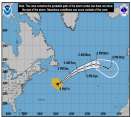
27.1N -44.6W
Wind: 35MPH
Pres: 1011mb
Moving:
Present movement...ssw or 210 degrees at 9 mph...15 km/h
Click for Storm Spotlight
36.6N -50.4W
Wind: 45MPH
Pres: 1006mb
Moving:
Present movement...e or 100 degrees at 17 mph...28 km/h
Click for Storm Spotlight
HypeScale:
5.00
0510
Communication
Storm Data
Content
Follow & Connect


General Discussion >> The Tropics Today

Jump to first unread post. Pages: 1
Robert
Weather Analyst


Reged:
Posts: 371
Loc: Southeast, FL
Central atlantic wave
      #100046 - Fri Aug 23 2019 07:15 AM Attachment (836 downloads)

There is a wave in the middle atlantic that has also gained some organization, and is wetting the atmosphere as it goes fighting the dry air.
18Z GFS yesterday has it tracking all the way to the off bahamas around the 4th, shows azores high building strong, 1034 and at end has a high 1024 coming off New Jersey, florida to main need to watch.


Post Extras: Print Post   Remind Me!   Notify Moderator  
Pages: 1


Extra information
0 registered and 0 anonymous users are browsing this forum.

Moderator:  CFHC, MikeC, Ed Dunham, Colleen A., danielw, Clark, RedingtonBeachGuy, SkeetoBite, Bloodstar, tpratch, typhoon_tip, cieldumort 

Print Topic

Forum Permissions
      You cannot start new topics
      You cannot reply to topics
      HTML is disabled
      UBBCode is enabled

Rating:
Topic views: 6279

Rate this topic

Jump to