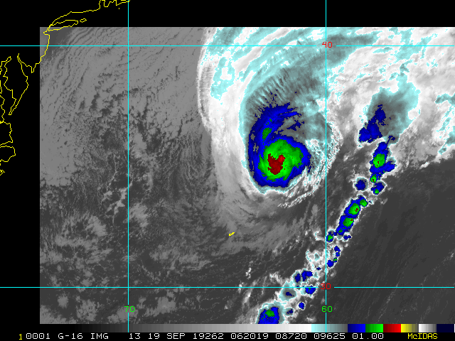
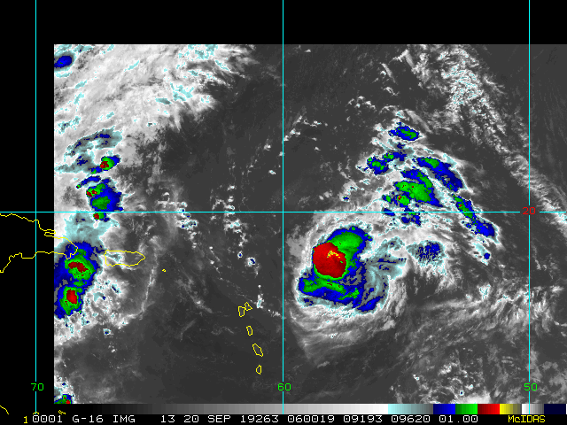
11PM EDT 13 September 2019 Update
The system has been upgraded to Tropical Storm Humberto, and with it a clearer picture of where the center is and where it may go, and it's good news for Florida and the US, but does bring Bermuda into the question later on. Tropical Storm watches have been dropped for Florida, only warnings remain for the Bahamas, but it appears the storm will stay east of the islands, so only the weaker fringe effects will be felt there, but enough to keep tropical storm warnings up there.
This does mean Bermuda is potentially in the path down the road, so folks there should pay attention to the progress of the storm as it likely will be a hurricane by the time it nears there later in the week.
11PM EDT 12 September 2019 Update
Tropical Storm watches are now up from Jupiter north the the Volusia/Brevard county line (Between Cape Canaveral and New Smyrna Beach) for a storm that has not yet developed, referred to as Potential Tropical Cyclone 9. If it gets named (which is forecast by Saturday), it would be called Humberto. The forecast has landfall around Saturday night along the east central Florida coastline. Expect heavy rain and some winds, along with short lived tornadoes if the system track remains as forecast. There is a possibility that the storm could slow down and rain for a while in parts of Florida or Georgia.
Based on the official forecast, Shear should keep any development in check for 36 hours, but there likely will be enough time for it to develop into a moderate level tropical storm before landfall.
Since this storm has not fully developed things may change, so keep watch on it *very* closely tomorrow.
8:00AM 12 September 2019 Update
The area near the southern Bahamas, tracked as Invest 95L, is slowly becoming more organized and now has an 80% chance to develop or the next 5 days (70% in the next 48 hours). It'll bring rainfall and winds to the Bahamas, including the areas affected by Dorian. Therefore it is likely that Potential Tropical Cyclone advisories may be issued later in the day so that tropical storm watches/warnings may be issued for parts of the Bahamas or Florida. Direct impacts to Florida are not guaranteed, as the models are varied on what happens with this area (And don't do well with forming storms). So it will have to be monitored. Areas getting some wind and rain is very likely, although there is very little to suggest that it would strengthen rapidly -- watch it closely over the next day or so to see.
Another area off Africa has a 40% chance to develop over the next 5 days, it gets more likely a little beyond that. But plenty of time to watch that one.
9:30AM 11 September 2019 Update
There is a wide area over the Southeast Bahamas now that has a 60% chance to develop over the next 5 days, and only 20% before then. Those in the Gulf should watch it closely. Those in the Bahamas and south Florida can expect some squally weather later this week, but the shear is strong enough to likely keep anything from intensifying quickly, at least before Florida. Back side rain bands will likely expand into Central Florida also as it moves into the Gulf in the weekend.
Once in the Gulf there is a better chance for it to form into a tropical storm or depression, but right now anything stronger seems unlikely--caveat it is September so it could change-- So the northern Gulf coast from about the Florida Panhandle west toward Louisiana should be monitoring this for late this weekend or early next week.
Two other areas have a low chance to develop, 10% near the lesser Antilles, and 20% further east. The later likely will have to be watched beyond the 5 day timeframe more closely.
Original Update
Hurricane Dorian has moved away and become extra-tropical after leaving its wake in the northwest Bahamas which were devastated. Beyond that flooding and damage to the Outer Banks, and Nova Scotia and Newfoundland. And causing quite a bit of a stir in other areas of the southeast US and Florida.
Beyond that we have several areas to watch, Tropical Storm Gabrielle, which likely will become extra-tropical and eventually impact the north parts of Ireland or Scotland, and a few areas in the open Atlantic. Only one of which is an invest currently.
The closest area to the US is north of Haiti this morning and has a low chance of 20% to develop, it's currently in an area of high shear which is keeping development low, but that could change as it moves over Florida into the Gulf of the Mexico later this week. Florida and the Gulf coasts should keep an eye on it to see if anything changes.
94L east of the Caribbean is in a marginal spot for development, with about 30% chance over the next 5 days/48 hours. This probably won't develop, but could.
Off Africa is the most interesting of the waves on the various models, but likely won't develop until much further west, but currently has a 20% chance to develop over the next 5 days. Development seems more likely after 5 days.


 Threaded


