
Flhurricane.com - Central Florida Hurricane Center - Tracking Storms since 199531 Years of Hurricanes Without the Hype - Since 1995
Nothing on the horizon for Atlantic development at the start of July.
|
|
MichaelA
|
Weather Analyst 
Reged: Posts: 956 Loc: Pinellas Park, FL
|
|
The FSU model page has all current model runs indicating development this coming weekend/early next week. Whether it is sub-tropical or purely tropical will remain to be seen. I did see an article that stated that the East Pacific sea surface ENSO was beginning to cool which, if I recall correctly, could mean an above normal Atlantic season. -------------------- Michael PWS
JMII
|
Weather Master 
Reged: Posts: 547 Loc: Cape Coral & Margate, FL
|
|
Down here in S FL we need the rain, so no complaints with a tropical wave moving thru. Would just prefer it do this during the week and not the weekend however. -------------------- South FL Native... experienced many tropical systems, put up the panels for: David 79 - Floyd 87 - Andrew 92 - Georges 98 - Frances 04 - Wilma 05 - Matthew 16 - Irma 17 Lost our St James City rental property to Ian 22
Bloodstar
|
Moderator 
Reged: Posts: 468 Loc: Tucson, AZ
|
|
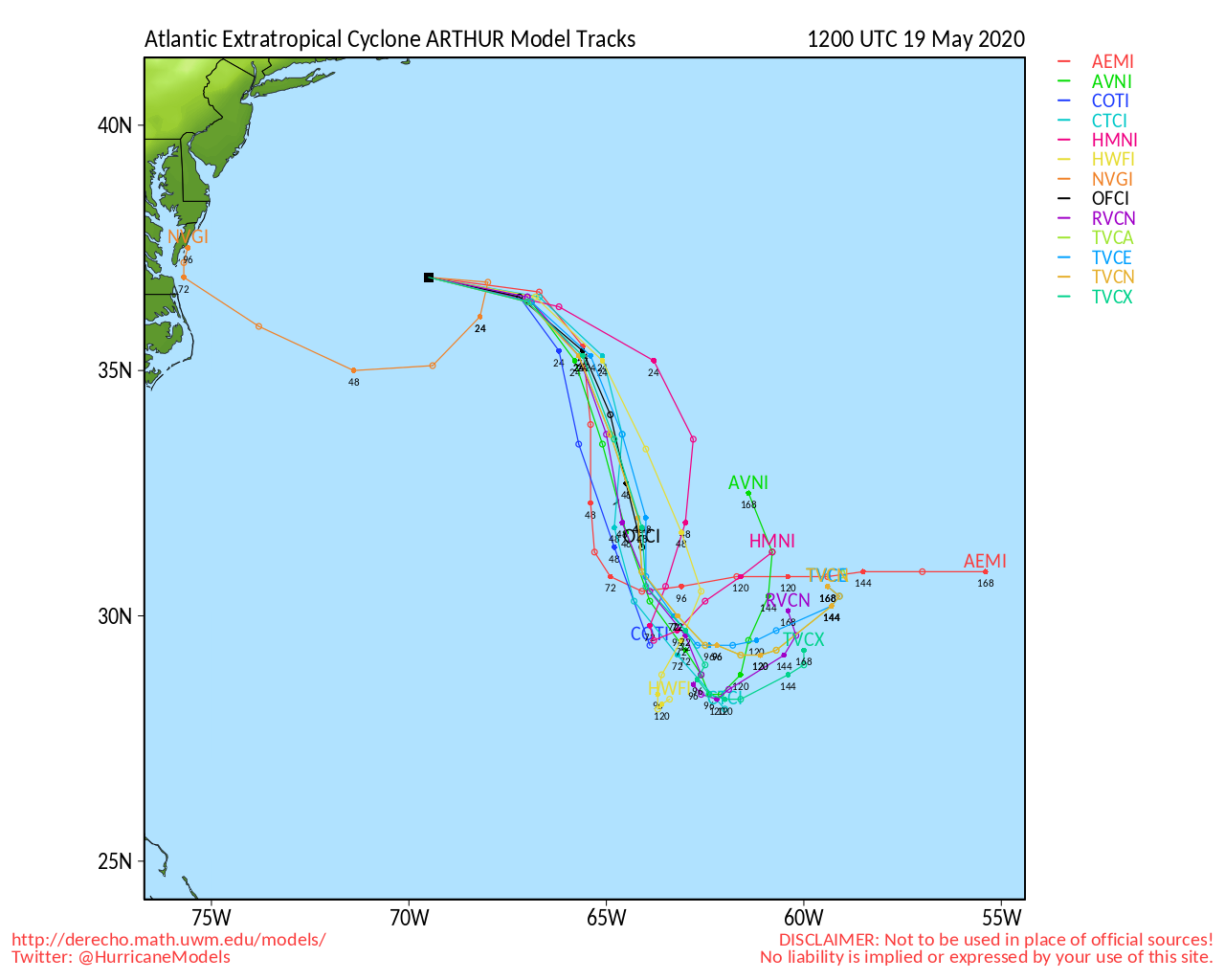
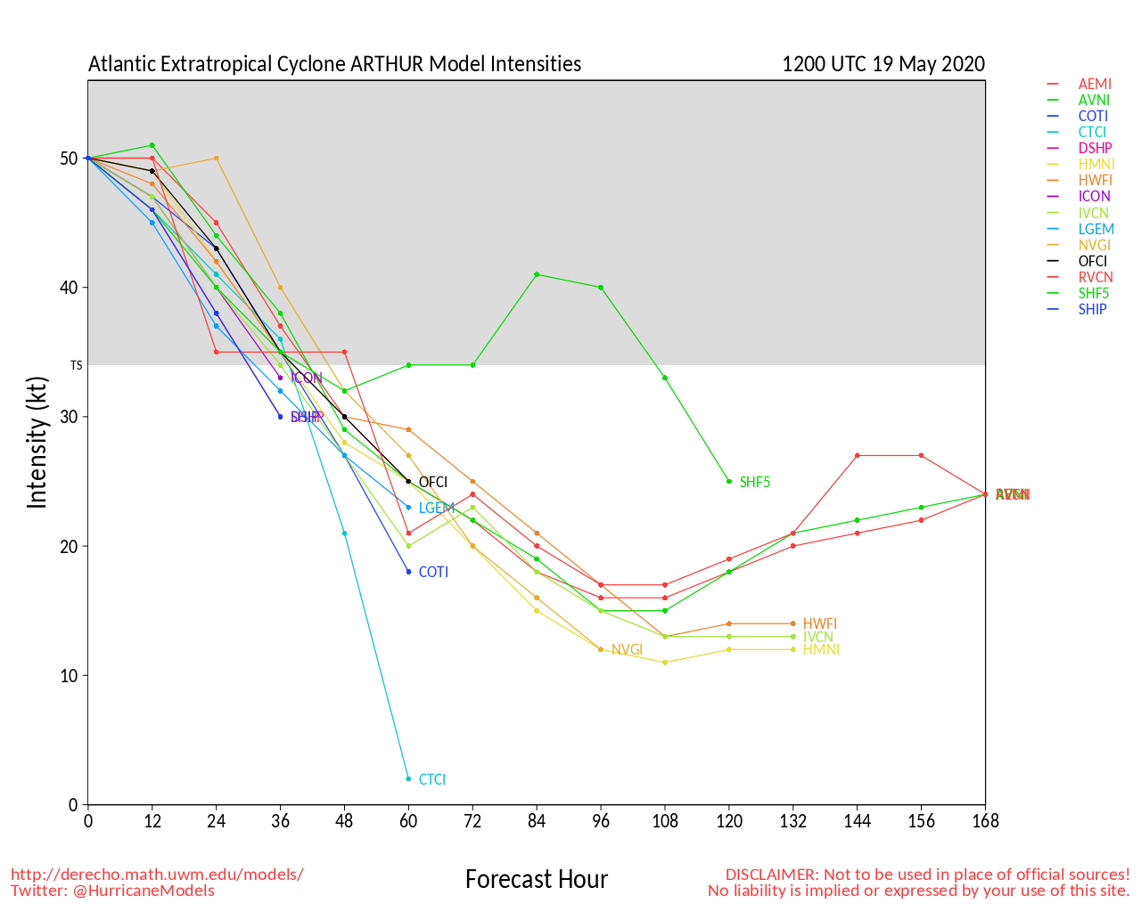
Looks like first advisory will be at 5pm EDT. Trivia: this will be the sixth year in a row that the Atlantic will have had a tropical system form before June first. -------------------- M. S. Earth and Atmospheric Sciences, Georgia Tech - May 2020 U. Arizona PhD Student
IsoFlame
|
Weather Analyst 
Reged: Posts: 413 Loc: One block off the Atlantic Oce...
|
|
Looking beyond Invest 91-L for any areas with "upstream" potential for development to our south early in the season, NWS Melbourne mentioned in extended discussion: GFS guid continues to indicate modest onshore winds from the ATLC with a deepening Caribbean gyre centered near the Yucatan. EC is not quite into the height fall trend to the south. -------------------- CoCoRaHS Weather Observer (FL-VL-42) & Surf Forecaster: https://www.surf-station.com/north-florida-surf-forecast-3/
Pages: 1
|
|
||||||||||||||||||||||||||||
|
|
||||||||||||||


 Threaded


