MikeC
Admin
Reged:
Posts: 4811
Loc: Orlando, FL
|
|
2:30AM CT Update 21 May 2021
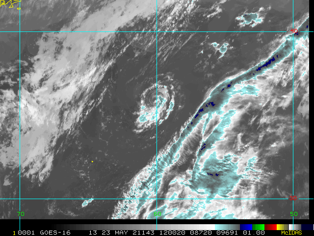
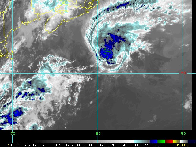
Six of the last nine years have seen preseason named cyclones (tropical and/or subtropical) form in the Atlantic basin, and 2021 may be no exception. As of Friday May 21, we are now closely monitoring two features increasingly looking to develop into numbered cyclones, with one (Invest 91L) likely approaching the Texas coast later today, and the other (90L) already prompting the Bermuda Weather Service to issue a Tropical Storm WatchQuote:
Tropical Storm Watch
Updated: 11:30 pm Thursday, May 20, 2021
A potential tropical or subtropical disturbance is developing approximately 600 nm east-northeast of Bermuda, but has not formed yet. A Tropical Storm Watch remains in effect to cover the potential for sustained winds reaching 35 knots and seas exceeding 12 feet offshore on Friday. For more detail, please review the Marine Forecast. Once formal advisories begin, BWS will start issuing Tropical Update Bulletins with more details about track and intensity.
Invest 91L does not appear to have enough time over water given moderate shear to develop into a hurricane, but a mid-range Tropical Storm might not be out of the question. Regardless of development, blustery showers and thunderstorms starting later today and heading into the weekend could result in more flooding for parts of Texas and Louisiana.
-Ciel
Original Post
After the record number of named systems in 2020, This next year will likely also be active, but probably not as much as 2020.
We'll be partnering more with Mark Sudduth and Hurricanetrack.com over the new year, but all the old data and image recordings will remain here. The Atlantic hurricane Season starts on June 1st, and we'll be watching both here, and our twitter and facebook feeds.
|
bob3d
Weather Hobbyist

Reged:
Posts: 65
Loc: Pasco County, Florida
|
|
"Mrak"? That's an interesting first name.
--------------------
bob
Time in West Central Florida: 52 years
|
kspkap
Weather Watcher
Reged:
Posts: 35
|
|
Hurricane Zeta reclassified as Category 3 storm! I recall Jim Cantore of The Weather Channel stating he couldn’t wrap his head around Zeta. It was to be about a 74 mph landfall storm, the water was cold, it was cold on top, but it intensified to almost a Cat 3. Now we know Zeta was a Cat 3 at landfall!
I’m a transplant from St. Cloud to the MS coast across the street from the Gulf. I was in Florida, my daughter was here with my Yorkie. Zeta peeled part of my metal roof back like a tuna can! I had just paid to have my front porch re-screened from Cristobal which hit in June. I left for Florida. Zeta came to visit! Shredded the new screening...spun & tilted the ceiling fans so strong they cut into my ceiling before breaking into pieces. MS folks North of me said it was their ...so many tornadoes, also. The area became a sea of blue roofs akin to the result of our 3 storms in 2004.
Rain poured through my front door glass and side lights as if there wasn’t a door! My house is on 16†concrete piers. I received a frantic call from my daughter telling me objects were hitting the house and the house was shaking. The neighbors took both my daughter & dog in for 6 days due to no power. They have a whole house generator. The gulf water was half way up the driveway while U.S. 90 and the beach disappeared!
Being from Florida my family have been through many hurricanes, but my daughter said she had never been so frightened and prays she is never in another one.
--------------------
Donna-1960, Charley-2004, Frances-2004, Jeanne-2004, Issac-2012, Zeta-2020
|
Lamar-Plant City
Storm Tracker

Reged:
Posts: 392
Loc: Plant City, Florida
|
|
Mark is a good resource...I have followed him and Hurricane Track on Twitter for several years. A merging of the minds will be a great addition to this site!
--------------------
If you don't like the weather, wait 5 minutes...
2023 Season Prediction: 17/6/2
|
|


 Threaded


