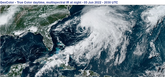
Above: Tropical Storm Alex and Invest 92L June 5, 2022 2030z
5:00PM EDT 05 June 2022 Updated
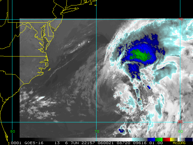
Alex is now a strong western Atlantic Tropical Storm with maximum sustained winds at the surface estimated to be 65MPH. Recon continues flights into the cyclone on its approach to Bermuda tonight to get a closer look.
12:00PM EDT 05 June 2022 Update
PTC1 sufficiently organized overnight and became Tropical Storm Alex. The cyclone has so far continued to intensify today, with maximum sustained surface winds as of this update estimated to be a possibly conservative 60 MPH.
Alex is headed towards Bermuda first, before becoming Post-Tropical further out at sea, and Tropical Storm Warnings are up for Bermuda, where the greatest impact should be felt later tonight into Monday. Hurricane-force gusts on the island are very possible.
3:30PM EDT 03 June 2022 Update
The center of sprawling PTC One appears to be leaping a bit as it chases the deeper convection that is being sheared to the northeast. The number one threat from One will continue to be from moderate to very heavy rain, much of it falling over the same locations, leading to flooding.
Elsewhere, we are also tracking newly Invest-tagged 92L, located west-southeast of Bermuda.
5AM EDT 03 June 2022 Update
Recon overnight found that PTC One has become better organized, with lower pressure, and slightly stronger wind, but was unable to conclusively determine that a more stable and closed low level circulation center has formed.
Because of the sprawling nature of this system and the finding of tropical storm winds at the surface, has issued additional Tropical Storm Warnings, now including the east coast of Florida, western Cuba, and the northwestern Bahamas.
Daylight visible satellite imagery and another recon pass will help determine if a Tropical Cyclone has formed.
Original Entry
Invest 91L does not yet meet the criteria for designation as a Tropical Cyclone. However, as it is organized enough and highly likely to become a bona fide TC, is starting Advisories on Potential Tropical Cyclone One, with tropical storm conditions anticipated within 48 hours along its path.
PTC One is expected to be a prolific rainmaker, and flooding could become serious especially where there is training. In addition, there looks to be a good risk of waterspouts and tornadoes, some moving very fast, some others also at night. Warning lead times on such tornadoes can be brief, and within heavy precip can be especially difficult to see coming. Flood Watches/Warnings and Tornado Watches/Warnings will likely also be forthcoming.
Join us for more analysis and model talk on ALEX in the Tropical Storm Alex Forecast Lounge
Edited by MikeC (Tue Jun 14 2022 01:35 PM)


 Threaded


