Might as well start this thread now that Debby's lopsided east-loaded circulation is or will shortly be impacting the entire Florida peninsula with some sort of weather...
In Daytona Beach Shores, one block from the Atlantic Ocean in central coastal Volusia County, it became overcast mid-afternoon after a partly sunny first half of the day with a high of 91F after a morning low of 81F. Currently the temperature is 85F with wind 15-18 mph from the SE. Surf temperature is 81F, breaking waves are a choppy 2-3 feet with a moderate current running south to north; Dry today (so far), it is the 13th consecutive day without measurable precipitation. Hopeful for at least an inch or two over the next day from Debby's outer bands.
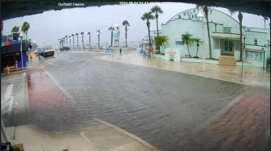
Here in Gulfport which is in Pinellas County, Florida, we are getting hammered right now by a respectable Tropical Storm band. Looking around at SailFlow measurements the area has had gusts from 40 to 60 mph. The rain was sideways, and downtown Gulfport is flooded with rain water right now. The storm surge won't be till morning...
Daytona Beach Shores @ 7am: 82F, light rain (0.25" past 12 hrs), wind SSE 17mph/gust 28. First measurable rainfall in 14 days received overnight. Hopeful that a long "tail" of Debby's banding circulation sets up along the east coast north of the Cape today as the area is abnormally dry following 2 weeks without rain and only 50% of normal wet season rainfall so far this summer.